Category:Chapin-Quadrangle
County Coal Data
Mines that Appear in Chapin-Quadrangle
- 9998 & 9999 = Unknown dates
Unlocated Mines in Chapin-Quadrangle
Mine that have known coal production but no known location
Historical Mined Out Area Maps
WPA
These maps were constructed as part of the nationwide Works Projects Administration (WPA), generally between 1934 and 1937 with some later updates or revisions,
Disclaimer
Maps for some locations might have multiple versions/seams, please inspected these areas closely for differences.
Notes and corrections were made by ISGS staff.
These maps are reproductions from microfilm, they may be of poor quality with text difficult to read.
There are no WPA Maps for this county
Federal Land Bank of St. Louis, Preliminary Reports on Subsidence Investigations
Federal Land Bank of St. Louis, Preliminary Reports on Subsidence Investigations (refered by Coal Section Staff as "Quade Maps")
Mining engineers working for the Federal Land Bank of St. Louis mapped areas of subsidence due to coal mining in the early 1930s. These reports often include county maps of mine properties with mined-out areas including shaft locations, as well as subsidence areas.
Disclaimer
Maps for some locations might have multiple versions/seams, please inspected these areas closely for differences.
These maps are accompanied by a report, please download and inspect this document.
Notes and corrections were made by ISGS staff.
There are no Quade Maps for this county
Photographs
Pages in category "Chapin-Quadrangle"
The following 38 pages are in this category, out of 38 total.
Media in category "Chapin-Quadrangle"
The following 30 files are in this category, out of 30 total.
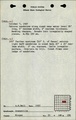
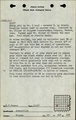
 M6353 fieldnotes.pdf 752 × 1,185, 2 pages; 7.26 MB
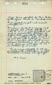
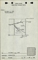
 M6353 minenotes.pdf 733 × 1,193, 2 pages; 572 KB
 M6356 fieldnotes.pdf 752 × 1,185, 4 pages; 782 KB
 M6357 fieldnotes.pdf 745 × 1,183, 3 pages; 637 KB
 M6359 fieldnotes.pdf 752 × 1,187; 199 KB
 M6360 fieldnotes.pdf 752 × 1,185; 263 KB
 M6360 minenotes.pdf 733 × 1,193; 322 KB
 M6361 fieldnotes.pdf 752 × 1,185, 4 pages; 6.6 MB
 M6361 minenotes.pdf 733 × 1,193; 273 KB
 M6362 fieldnotes.pdf 752 × 1,185, 2 pages; 6.26 MB
 M6362 minenotes.pdf 733 × 1,193; 327 KB
 M6363 fieldnotes.pdf 752 × 1,185; 207 KB
 M6364 Worthen Vol IV.pdf 1,275 × 1,650; 218 KB
 M6365 Worthen Vol IV.pdf 1,275 × 1,650; 196 KB
 M6456 fieldnotes.pdf 747 × 1,195, 4 pages; 762 KB
 M6662 fieldnotes.pdf 747 × 1,195; 209 KB
 M7733 coalreport1885.pdf 602 × 975; 91 KB
 M7733 fieldnotes.pdf 747 × 1,195, 2 pages; 426 KB
 M7733 minenotes.pdf 733 × 1,193, 2 pages; 7.65 MB
 M7734 fieldnotes.pdf 756 × 1,187, 3 pages; 613 KB
 M7736 fieldnotes.pdf 752 × 1,185, 2 pages; 6.21 MB
 M7739 fieldnotes.pdf 756 × 1,189; 223 KB
 M7739 Worthen Vol IV.pdf 1,275 × 1,650; 199 KB
 M7740 fieldnotes.pdf 756 × 1,189; 214 KB
 M7741 fieldnotes.pdf 756 × 1,187; 204 KB
 M7742 fieldnotes.pdf 754 × 1,187; 248 KB
 M7743 fieldnotes.pdf 754 × 1,187, 2 pages; 459 KB
 M7744 fieldnotes.pdf 754 × 1,187; 244 KB
 M7757 fieldnotes.pdf 754 × 1,187, 2 pages; 5.26 MB
 M7840 minenotes.pdf 733 × 1,193; 264 KB