Raymond Quadrangle
Mining in the Raymond Quadrangle
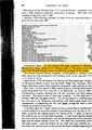
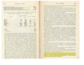
The Raymond Mine (mine index 3003) operated from 1897 to 1910. No maps have been found, but the size estimated from production is approximately 10 acres. The coal was thin, just over 3 feet thick, and at over 400 feet deep, required a substantial capital investment to access.
Map and Directory PDF Download
Coal Mines In Illinois Raymond Quadrangle
Mines that Appear on the Raymond Quadrangle
Unlocated Mines
Montgomery County
Christian County
Media in category "Raymond Quadrangle"
The following 3 files are in this category, out of 3 total.
 M3003 coalreport1897.pdf 839 × 1,185; 132 KB
 M3003 coalreport1898.pdf 1,577 × 1,177; 312 KB
 M3003 minenotes.pdf 737 × 1,193, 6 pages; 1.2 MB