Wood River Quadrangle
Mining in the Wood River Quadrangle
The topography of the Wood River Quadrangle is dominated by the American Bottoms, where the coal has been eroded. Consequently, the mining that has taken place here is a westward extension of the mining around Edwardsville. The Herrin Coal was mined in the southeast corner of the quad, where the coal is 82 to 108 feet deep, and averages 5.5 to 6 feet thick. These mines were active from the mid-1930s to the early 1950s. The geologic problems reported were not extensive, mostly concerning the roof materials. The thick shale required more support than other areas, and contained coal balls.
Map and Directory PDF Download
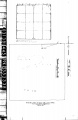
Coal Mines In Illinois Wood River Quadrangle
Mines that Appear on the Wood River Quadrangle
Unlocated Mines
Madison County
Pages in category "Wood River Quadrangle"
The following 4 pages are in this category, out of 4 total.
Media in category "Wood River Quadrangle"
This category contains only the following file.
 352338.jpg 2,726 × 4,200; 905 KB
