Alexander
Coal Mines
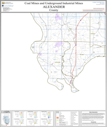
This county map displays coal mines and/or underground industrial mineral mines. If coal mining has occurred in this county, a directory of additional information about these coal mines is included with the map. Buffer regions for industrial mineral mines were incorporated into this map due to limited information regarding these mines. The size of the buffer region is dependent on the uncertainty or inaccuracy of the mine location. For more information regarding industrial mineral mines please contact the ISGS Industrial Minerals Section. The county maps also display quadrangle boundaries for which the ISGS has completed studies. Scale 1:100,000. PDF file.
The accompanying coal mine directory provides basic information about the coal mines. PDF file.
|
| Alexander County Mine Map |
|---|
ILMINES WIKI
The links below contain much of the same information as the downloadable directories above. But has links to additional information such as mine map downloads, additional Mine Notes downloads, and other data.
Alexander County
On demand plots available for these maps! If you are unable to make your own large size plots from these PDF's we also offer an on demand plot for individual maps from our publication and sales office—for cost of the plot and handling. Please contact the ISGS at (217) 244-2414, or email at sales@prairie.illinois.edu(link sends e-mail) for more information on purchasing plots and other details.
Coal Resources
There are no coal resources maps for Alexander County.
Coal Logs
There are no coal logs for Alexander County.