Coal Mines
This county map displays coal mines and/or underground industrial mines. If coal mining has occurred in this county, a directory of additional information about these coal mines is included with the map. Buffer regions for industrial mineral underground mines were incorporated into this map due to limited information regarding these mines. The size of the buffer region is dependent on the uncertainty or inaccuracy of the mine location. For more information regarding industrial mines please contact the ISGS Industrial Minerals Section. The county maps also display quadrangle boundaries for which the ISGS has completed studies. Scale 1:100,000. PDF file.
The accompanying coal mine directory provides basic information about the coal mines. PDF file.
Quadrangle Coal Mine Maps and Directories located in Calhoun County
These selected 7.5-minute quadrangle maps are available online as PDF versions and show active and abandoned mines and their known extent on a topographic map base which includes township, range, and section lines and surface features such as roads, towns, lakes, and rivers. The mines are color-coded by mining method and the relative precision and completeness of the source map used for the mine boundary are indicated. Scale 1:24,000. Accompanying each map is a directory that gives a brief history of mining on the quadrangle and lists for each mine the location of mine opening and tipples; the name, thickness, and depth of seams mined; production history; geologic problems reported; company names; mine names and numbers; type of mine; years operated; coal seam mined; and mine location.
Brussels Quadrangle Map and Directory
ILMINES WIKI
The links below contain much of the same information as the downloadable directories above. But has links to additional information such as mine map downloads, additional Mine Notes downloads, and other data.
Calhoun County
Brussels Quadrangle
Coal Resources
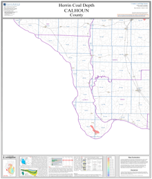
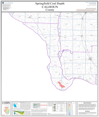
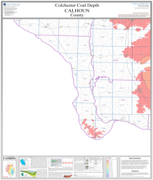
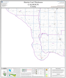
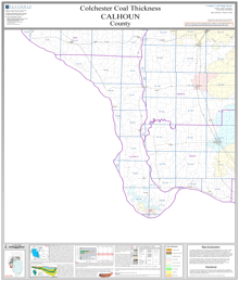
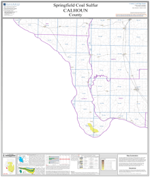
County structural elevation, depth, and thickness maps. Scale 1:100,000. PDF files.
Elevation
Depth
Thickness
Sulfur
Chlorine
On demand plots available for these maps! If you are unable to make your own large size plots from these PDF's we also offer an on demand plot for individual maps from our publication and sales office—for cost of the plot and handling. Please contact the ISGS at (217) 244-2414, or email at sales@prairie.illinois.edu(link sends e-mail) for more information on purchasing plots and other details.
Coal Logs
There are no coal logs for Calhoun County.