File:M0682a 35101801.jpg

Size of this preview: 800 × 535 pixels. Other resolutions: 2,560 × 1,713 pixels | 3,390 × 2,269 pixels.
Original file (3,390 × 2,269 pixels, file size: 1,002 KB, MIME type: image/jpeg)
CLICK HERE TO DOWNLOAD THE HIGH RESOLUTION IMAGE. FILE SIZE MAY BE LARGE(Note:this file is usually better quality than "original file" linked above)
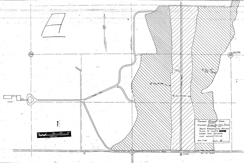
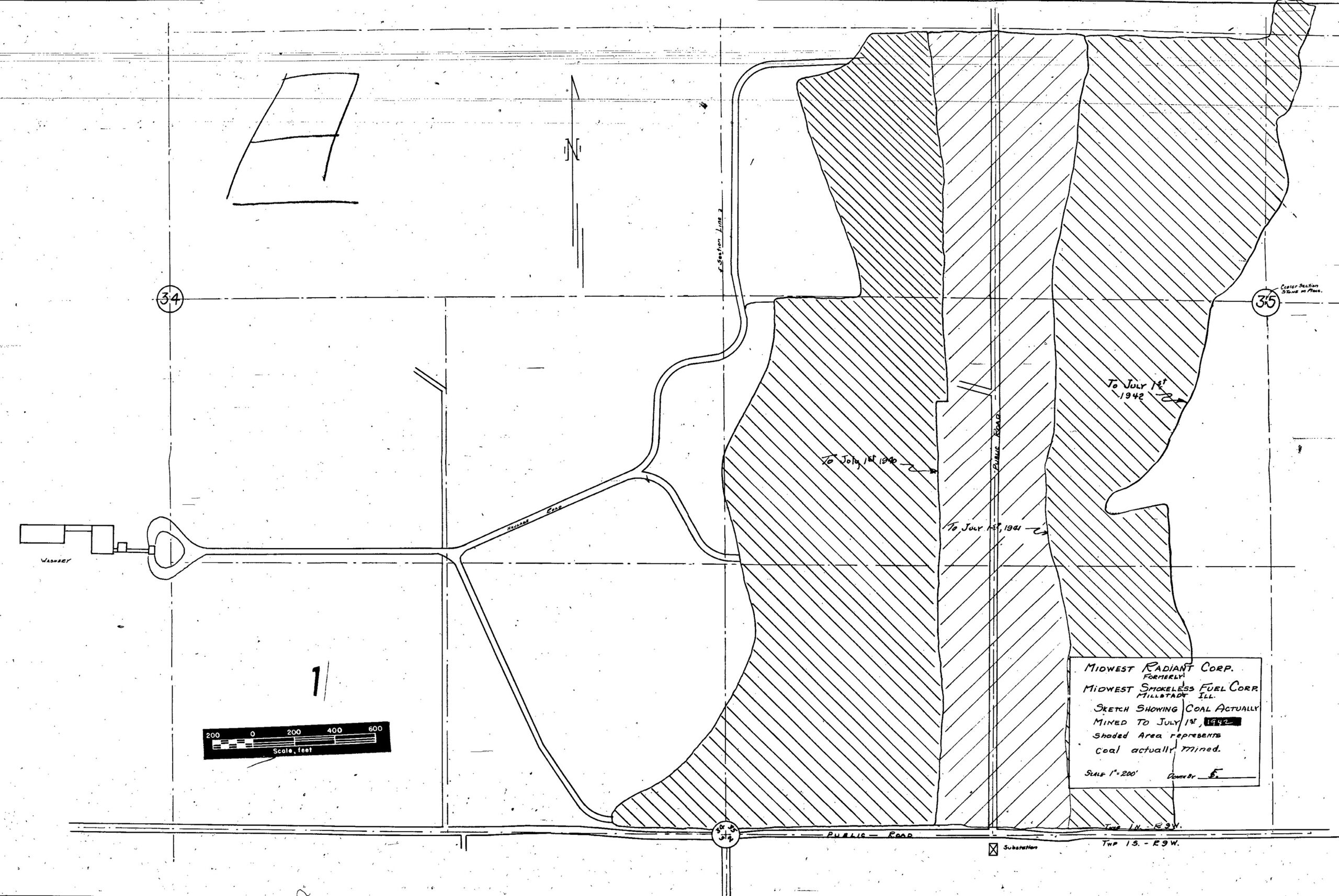
| Mine Index(s): | 0682 |
| Mine Company: | Midwest Radiant Fuel Corporation |
| Mine Name | Midwest Radiant No. 1 Mine |
| Map Date | 7-1-1942 |
| Map Scale | 1:2400 |
| Map Type microfilm/company/wpa/quade | Microfilm |
| Map Status final,not final, secondary | Not final |
| ID Number | 351018 |
| Used For | mine outline (SW 35-T1N-R9W) |
| Notes | microfilm map, document 351018, reel 03134, frame 93; later maps show an un-mined area along Peabody Road, while this map shows that in 1942 the road was only along the south section line. Later construction connected the section line road with a road to the tipple in a long, gentle curve, in an area that was previously strip mined. |
| Image Credit | |
| Hi-Res Download | Click to download |
File history
Click on a date/time to view the file as it appeared at that time.
| Date/Time | Thumbnail | Dimensions | User | Comment | |
|---|---|---|---|---|---|
| current | 11:19, October 1, 2021 | | 3,390 × 2,269 (1,002 KB) | Cheri (talk | contribs) |
You cannot overwrite this file.
File usage
There are no pages that use this file.