File:M0782.jpg

Size of this preview: 603 × 599 pixels. Other resolutions: 2,061 × 2,048 pixels | 3,390 × 3,369 pixels.
Original file (3,390 × 3,369 pixels, file size: 1.57 MB, MIME type: image/jpeg)
CLICK HERE TO DOWNLOAD THE HIGH RESOLUTION IMAGE. FILE SIZE MAY BE LARGE(Note:this file is usually better quality than "original file" linked above)
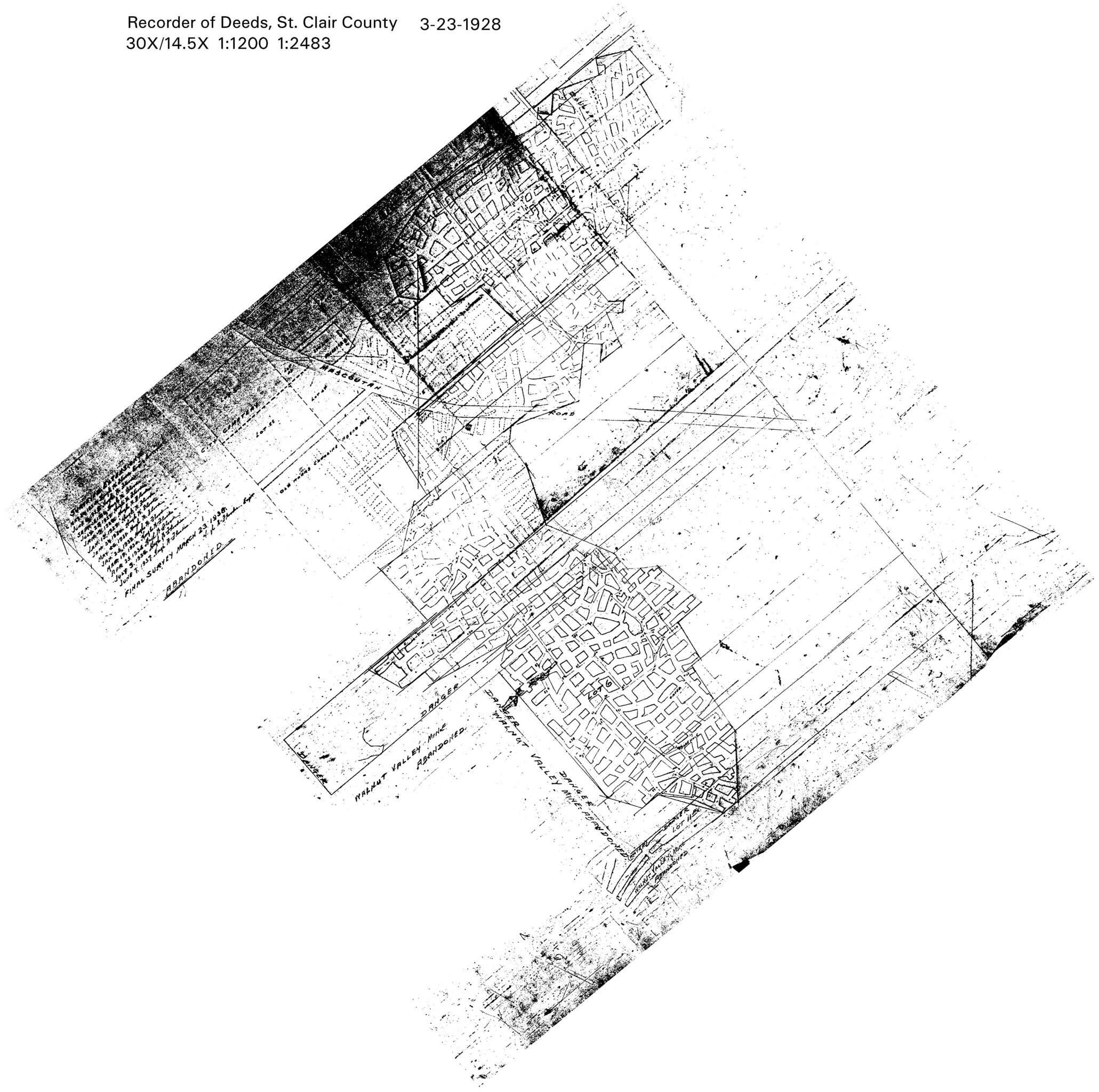
| Mine Index(s): | 4297, 0782,4297 |
| Mine Company: | Patterson and Harding |
| Mine Name | Patterson and Harding |
| Map Date | 3-23-1938 |
| Map Scale | 1:2483 |
| Map Type microfilm/company/wpa/quade | Microfilm |
| Map Status final,not final, secondary | Final |
| ID Number | |
| Used For | shaft locations, mine outline, mining method, geologic problems |
| Notes | microfilm map from the St. Clair County Recorder of Deeds |
| Image Credit | |
| Hi-Res Download | Click to download |
File history
Click on a date/time to view the file as it appeared at that time.
| Date/Time | Thumbnail | Dimensions | User | Comment | |
|---|---|---|---|---|---|
| current | 10:59, October 13, 2020 | | 3,390 × 3,369 (1.57 MB) | Cheri (talk | contribs) |
You cannot overwrite this file.
File usage
The following page uses this file: