Mine Index Number: 0782
| Company Name:
|
Patterson and Harding
|
| Mine Name:
|
Patterson and Harding Mine
|
| Start Date:
|
1889
|
End Date:
|
1938
|
| Type of Mine:
|
Underground
|
| Total acres shown:
|
81
|
| Acres after map date:
|
|
General Area of mining acres shown:
|
|
|
|
Shaft, Slope, Drift or Tipple Location(s)
| Type
|
County
|
Township-Range
|
Section
|
Part Section
|
| Main shaft
|
St. Clair
|
1N 8W
|
27
|
NW NE SE
|
| Air shaft
|
St. Clair
|
1N 8W
|
27
|
NE NE SE
|
Geology
Geological Problems Reported
Some problems were designated on source map, areas labeled "squeeze" and "caved", mostly in the southeastern part of the mine. The source map for the older part of the mine shows the western area was abandoned due to bad top. (There is a stream shown on the topographic map, and the bedrock was probably thin here.)
Production
| Company
|
Mine Name
|
Date
|
Production (tons)
|
| Frank Sargent Source map indicates the mine name is "Car. Abend". Production was not reported under this name.
|
Abend No. 1
|
1900-1910
|
153,588
|
|
|
|
|
|
|
|
| Total Production: 499,453
|
Production Notes
Coal Report production (if available)
Sources of Data
| Microfilm, Recorder of Deeds
|
3-23-1938
|
1:1200
|
1:2483
|
Final
|
| Microfilm, document 351151
|
7-1-1910
|
1:1200
|
1:1572
|
Not final Source map for the older part of the mine; final for the older Abend portion of the mine (abandoned 1910).
|
Annotated Bibliography (Data source - brief description of information)
| Coal Reports - Production, ownership, years of operation.
|
| Directory of Illinois Coal Mines (St. Clair County) - Mine names, mine index, ownership, years of operation.
|
| Mine notes (St. Clair County) - Shaft location, mine type, seam, depth, thickness.
|
| Microfilm map from Recorder of Deeds, St. Clair County - Shaft locations, mine outline, mining method, geologic problems.
|
| Microfilm map, document 351151, reel 03134, frame 291 - Shaft locations, mine outline (western), mining method, geologic problems.
|
Mine Notes
Mine Images
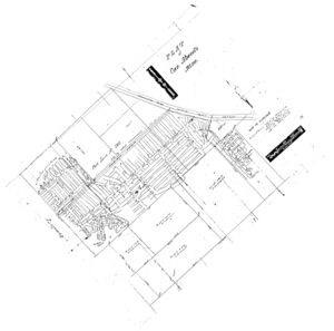
Microfilm: 351151
Map Date: 7-1-1910
Coal Co.: Patterson and Harding
Mine Name: Patterson and Harding
Full Res Download
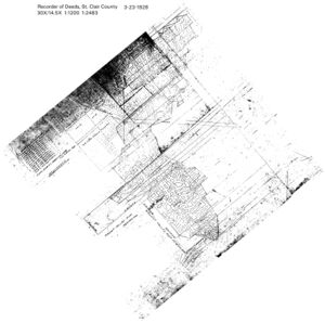
Microfilm:
Map Date: 3-23-1938
Coal Co.: Patterson and Harding
Mine Name: Patterson and Harding
Full Res Download
Photographs


