File:M2773 1892.jpg
Size of this preview: 437 × 600 pixels. Other resolution: 1,275 × 1,750 pixels.
Original file (1,275 × 1,750 pixels, file size: 568 KB, MIME type: image/jpeg)
CLICK HERE TO DOWNLOAD THE HIGH RESOLUTION IMAGE. FILE SIZE MAY BE LARGE(Note:this file is usually better quality than "original file" linked above)
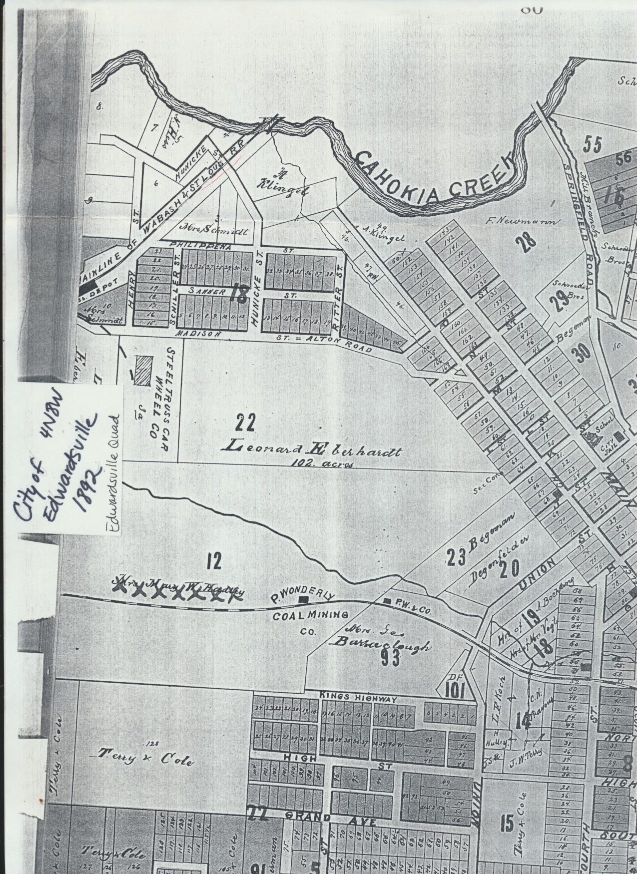
| Mine Index(s): | 2773 |
| Mine Company: | P. Wonderly Coal Company |
| Mine Name | Wonderly Mine |
| Map Date | 1892 |
| Map Scale | |
| Map Type microfilm/company/wpa/quade | Atlas |
| Map Status final,not final, secondary | Secondary |
| ID Number | |
| Used For | |
| Notes | |
| Image Credit | |
| Hi-Res Download | Click to download |
Notes
New Atlas of Madison County, State of Illinois, compiled and published by H. Riniker, Robert Hagnauer & George K. Dickson 1892
Used For
Shaft Locations
File history
Click on a date/time to view the file as it appeared at that time.
| Date/Time | Thumbnail | Dimensions | User | Comment | |
|---|---|---|---|---|---|
| current | 09:57, April 21, 2017 | | 1,275 × 1,750 (568 KB) | Alan.Myers (talk | contribs) | {{#default_form:Image Info}} |
You cannot overwrite this file.
File usage
The following page uses this file: