File:M3508 atlas1874.jpg

Size of this preview: 507 × 600 pixels. Other resolution: 1,704 × 2,016 pixels.
Original file (1,704 × 2,016 pixels, file size: 477 KB, MIME type: image/jpeg)
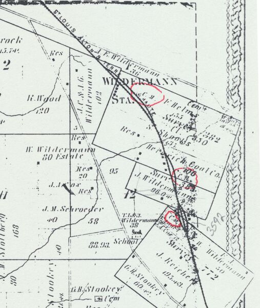
| Mine Index(s): | 3508, 3571, 3592,3592 ,3571 |
| Mine Company: | Consolidated Coal Company of St. Louis |
| Mine Name | Heinrich Mine |
| Map Date | 1874 |
| Map Scale | 1:62500 |
| Map Type microfilm/company/wpa/quade | Atlas |
| Map Status final,not final, secondary | Secondary source |
| ID Number | |
| Used For | years of operation, shaft location |
| Notes | Warner & Beers, 1874, An Illustrated Historical Atlas of St. Clair County, IL, Warner & Beers Publishers, Chicago, Illinois, 115p. |
| Image Credit | |
File history
Click on a date/time to view the file as it appeared at that time.
| Date/Time | Thumbnail | Dimensions | User | Comment | |
|---|---|---|---|---|---|
| current | 16:22, September 21, 2021 | | 1,704 × 2,016 (477 KB) | Cheri (talk | contribs) |
You cannot overwrite this file.