File:M3662 pb363.jpg
Size of this preview: 678 × 600 pixels. Other resolutions: 2,315 × 2,048 pixels | 3,390 × 2,999 pixels.
Original file (3,390 × 2,999 pixels, file size: 1.77 MB, MIME type: image/jpeg)
CLICK HERE TO DOWNLOAD THE HIGH RESOLUTION IMAGE. FILE SIZE MAY BE LARGE(Note:this file is usually better quality than "original file" linked above)
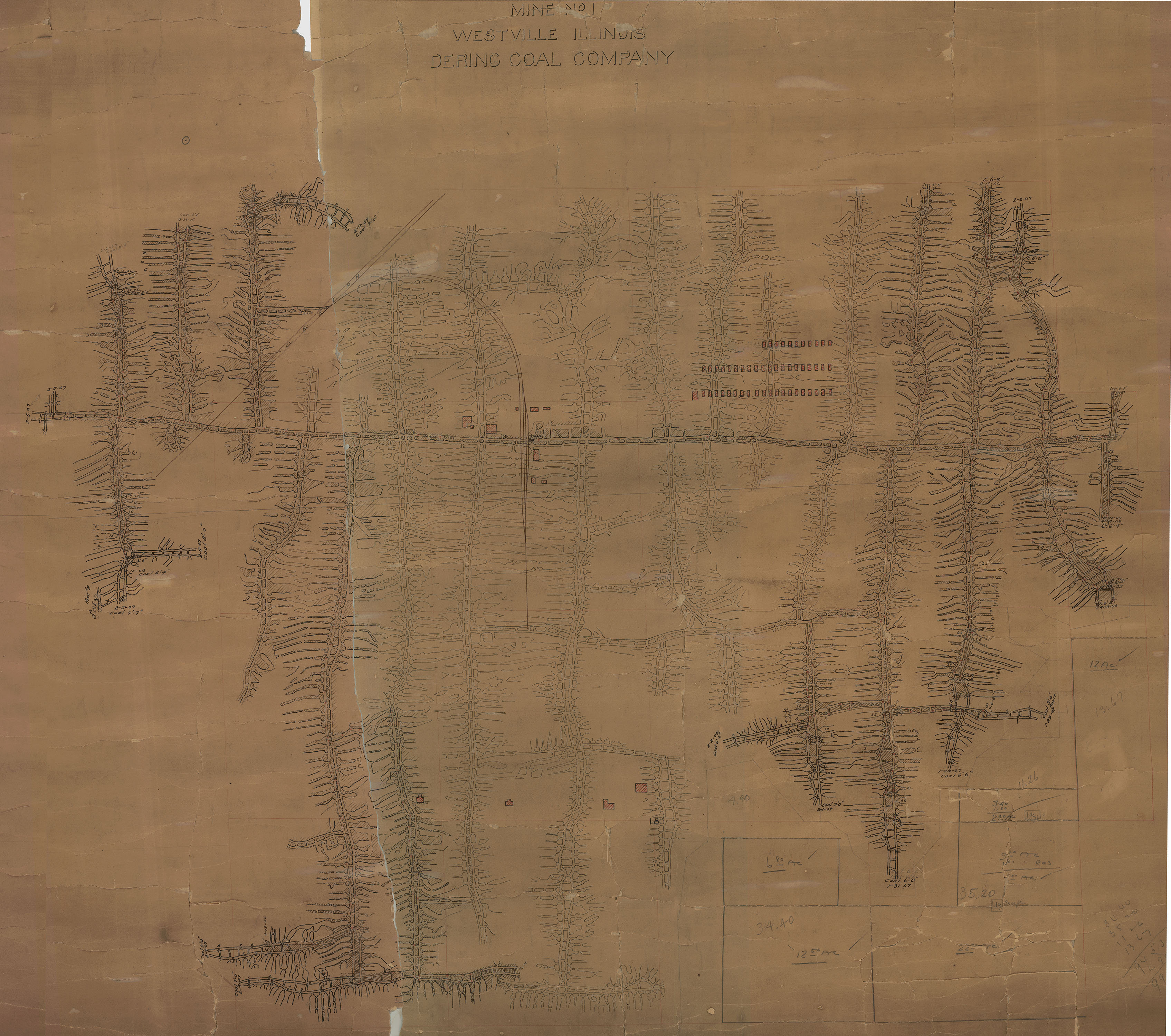
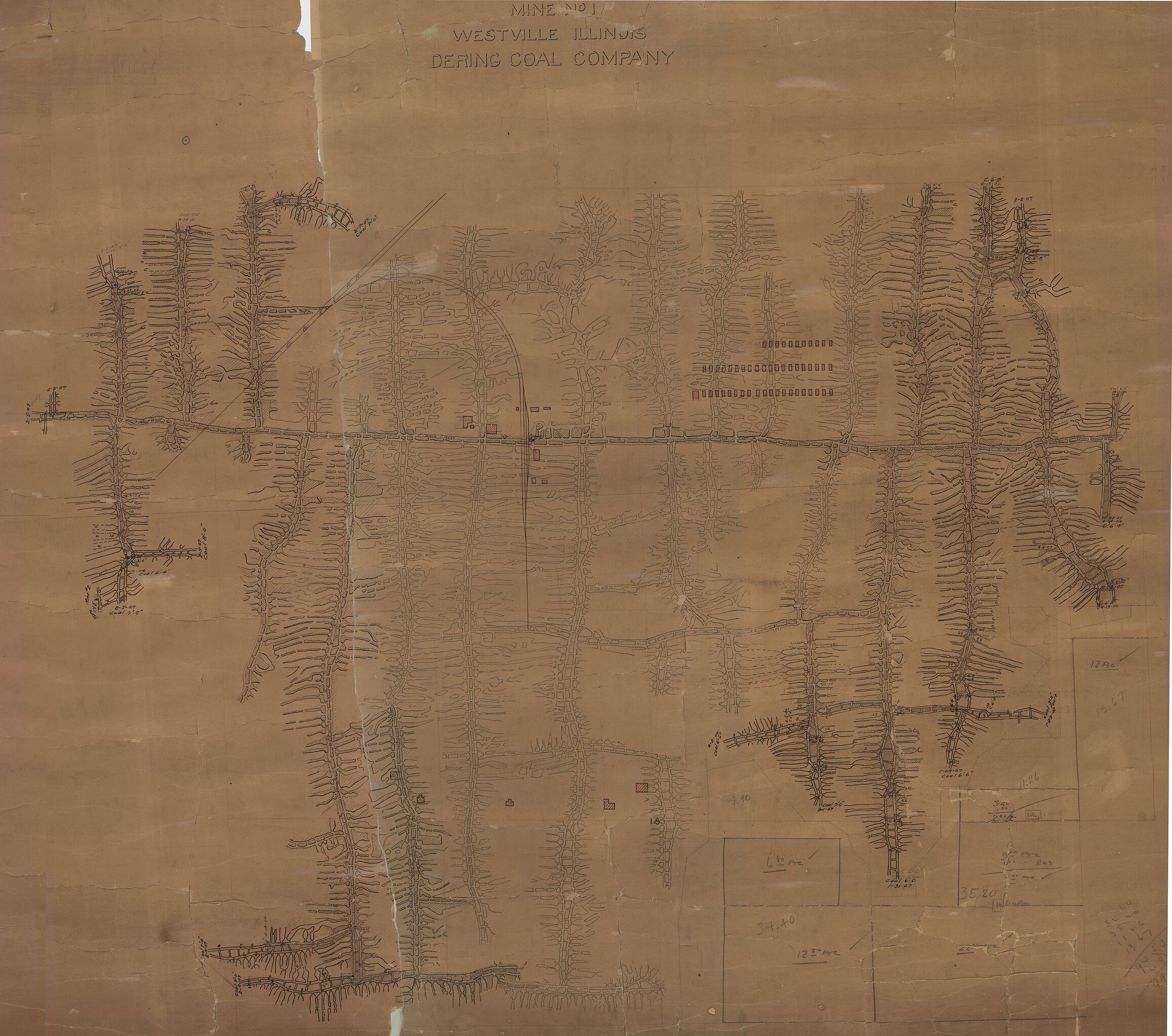
| Mine Index(s): | 3662 |
| Mine Company: | Dering Coal Company |
| Mine Name | Dering No. 2 Mine |
| Map Date | 2-5-1907 |
| Map Scale | 1:2400 |
| Map Type microfilm/company/wpa/quade | Company |
| Map Status final,not final, secondary | Final |
| ID Number | PB_363 |
| Used For | mine outline, shaft, mining method |
| Notes | The georegistered image is not that which was used to create the mine outline. The 2013 update version has been lost. |
| Image Credit | Illinois Department of Natural Resources - Office of Mines and Minerals |
| Hi-Res Download | Click to download |
File history
Click on a date/time to view the file as it appeared at that time.
| Date/Time | Thumbnail | Dimensions | User | Comment | |
|---|---|---|---|---|---|
| current | 13:24, March 24, 2021 | | 3,390 × 2,999 (1.77 MB) | Cheri (talk | contribs) |
You cannot overwrite this file.
File usage
The following page uses this file: