File:M3692 mf352930.jpg
Size of this preview: 646 × 600 pixels. Other resolutions: 2,206 × 2,048 pixels | 3,136 × 2,912 pixels.
Original file (3,136 × 2,912 pixels, file size: 994 KB, MIME type: image/jpeg)
CLICK HERE TO DOWNLOAD THE HIGH RESOLUTION IMAGE. FILE SIZE MAY BE LARGE(Note:this file is usually better quality than "original file" linked above)
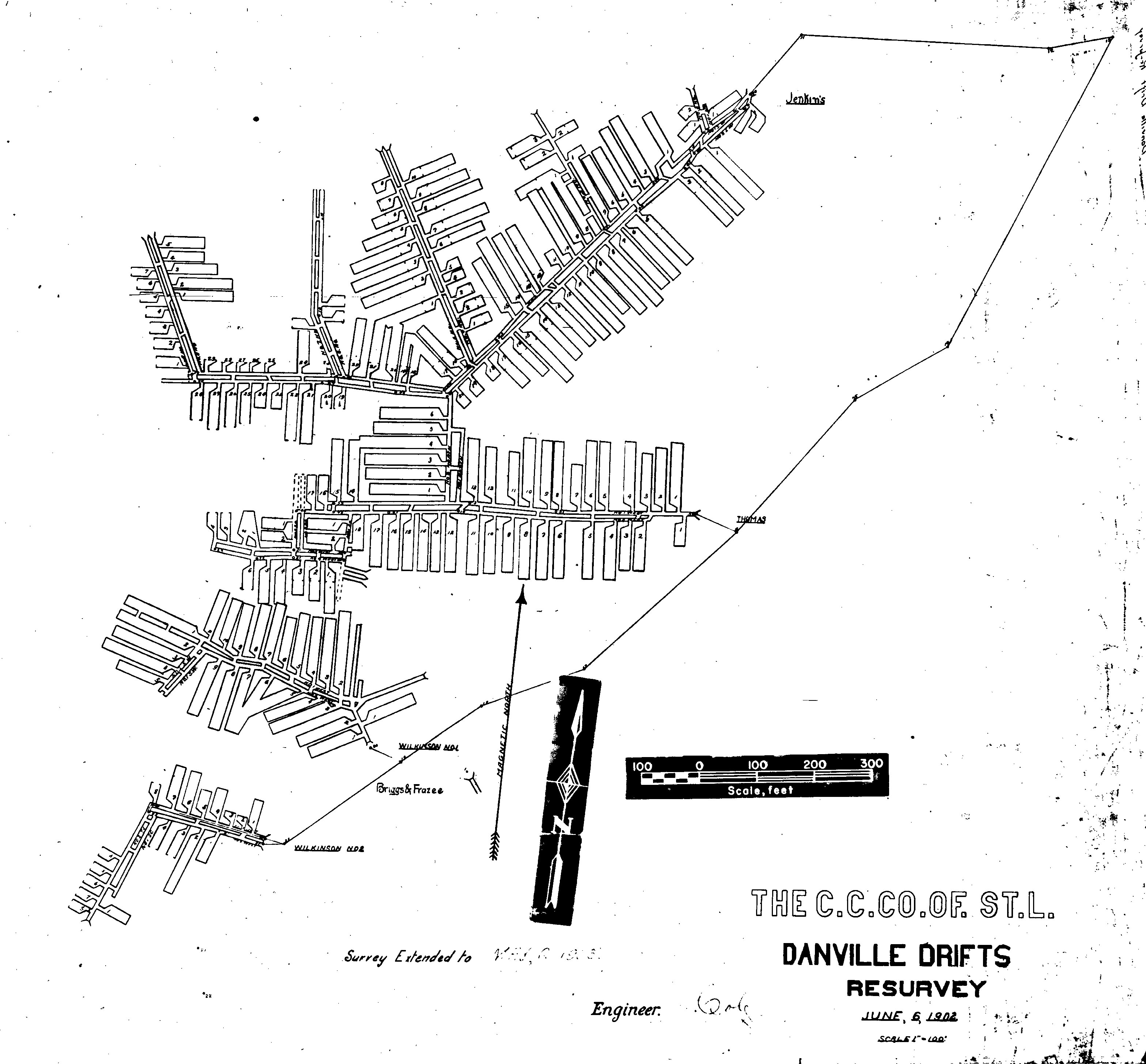
| Mine Index(s): | 3687, 3692, 3706, 6541,3706 ,6541 |
| Mine Company: | M. C. Wilkinson |
| Mine Name | Wilkinson No. 2 Mine |
| Map Date | 5-6-1903 |
| Map Scale | 1:1200 |
| Map Type microfilm/company/wpa/quade | Microfilm |
| Map Status final,not final, secondary | Secondary source |
| ID Number | 352930 |
| Used For | drift locations, mine outlines, mining method |
| Notes | Microfilm map, document 352930, reel 03141, frame 70; the WPA map was required to georegister this microfilm as the starting point for the survey appears to be a random survey station northeast of the mines. |
| Image Credit | |
| Hi-Res Download | Click to download |
File history
Click on a date/time to view the file as it appeared at that time.
| Date/Time | Thumbnail | Dimensions | User | Comment | |
|---|---|---|---|---|---|
| current | 11:36, March 29, 2021 | | 3,136 × 2,912 (994 KB) | Cheri (talk | contribs) |
You cannot overwrite this file.