File:M3692 wpa 17 19n11w.jpg
No higher resolution available.
M3692_wpa_17_19n11w.jpg (540 × 441 pixels, file size: 59 KB, MIME type: image/jpeg)
CLICK HERE TO DOWNLOAD THE HIGH RESOLUTION IMAGE. FILE SIZE MAY BE LARGE(Note:this file is usually better quality than "original file" linked above)
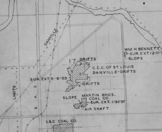
| Mine Index(s): | 3687, 3692, 3706, 6541,3687 ,3706 |
| Mine Company: | M. C. Wilkinson |
| Mine Name | Wilkinson No. 2 Mine |
| Map Date | 5-6-1903 |
| Map Scale | 1:12000 |
| Map Type microfilm/company/wpa/quade | WPA |
| Map Status final,not final, secondary | Secondary source |
| ID Number | T19N-R11W |
| Used For | Positioning microfilm map |
| Notes | The original georegistered version of the map was lost. The newly georegistered map does not match the original exactly but illustrates why the WPA was necessary for placement of the microfilm. |
| Image Credit | |
| Hi-Res Download | Click to download |
File history
Click on a date/time to view the file as it appeared at that time.
| Date/Time | Thumbnail | Dimensions | User | Comment | |
|---|---|---|---|---|---|
| current | 11:40, March 29, 2021 | | 540 × 441 (59 KB) | Cheri (talk | contribs) |
You cannot overwrite this file.