File:M3709.jpg

Size of this preview: 760 × 600 pixels. Other resolutions: 2,560 × 2,021 pixels | 3,390 × 2,676 pixels.
Original file (3,390 × 2,676 pixels, file size: 1.13 MB, MIME type: image/jpeg)
CLICK HERE TO DOWNLOAD THE HIGH RESOLUTION IMAGE. FILE SIZE MAY BE LARGE(Note:this file is usually better quality than "original file" linked above)
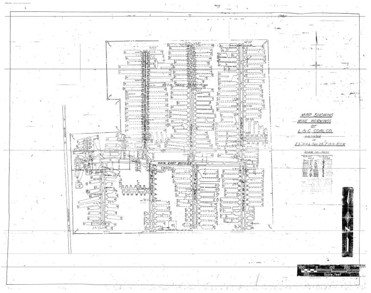
| Mine Index(s): | 3709 |
| Mine Company: | L. and C. Coal Company |
| Mine Name | L. and C. Mine |
| Map Date | 11-9-1929 |
| Map Scale | 1:1200 |
| Map Type microfilm/company/wpa/quade | Microfilm |
| Map Status final,not final, secondary | Not final |
| ID Number | 352900 |
| Used For | slope location, air shaft location (identified via a different map), mine outline, mining method |
| Notes | microfilm map, document 352900, reel 03141, frame 35; the map contains few georegistration points in common with the topographic map. Georegistration is mainly from the title block (E 1/2 NW 1/4), and assuming they did not undermine the school, so georegistration is considered poor. |
| Image Credit | |
| Hi-Res Download | Click to download |
File history
Click on a date/time to view the file as it appeared at that time.
| Date/Time | Thumbnail | Dimensions | User | Comment | |
|---|---|---|---|---|---|
| current | 10:10, March 31, 2021 | | 3,390 × 2,676 (1.13 MB) | Cheri (talk | contribs) |
You cannot overwrite this file.
File usage
The following page uses this file: