File:M3709b.jpg
Size of this preview: 708 × 599 pixels. Other resolutions: 2,419 × 2,048 pixels | 3,390 × 2,870 pixels.
Original file (3,390 × 2,870 pixels, file size: 501 KB, MIME type: image/jpeg)
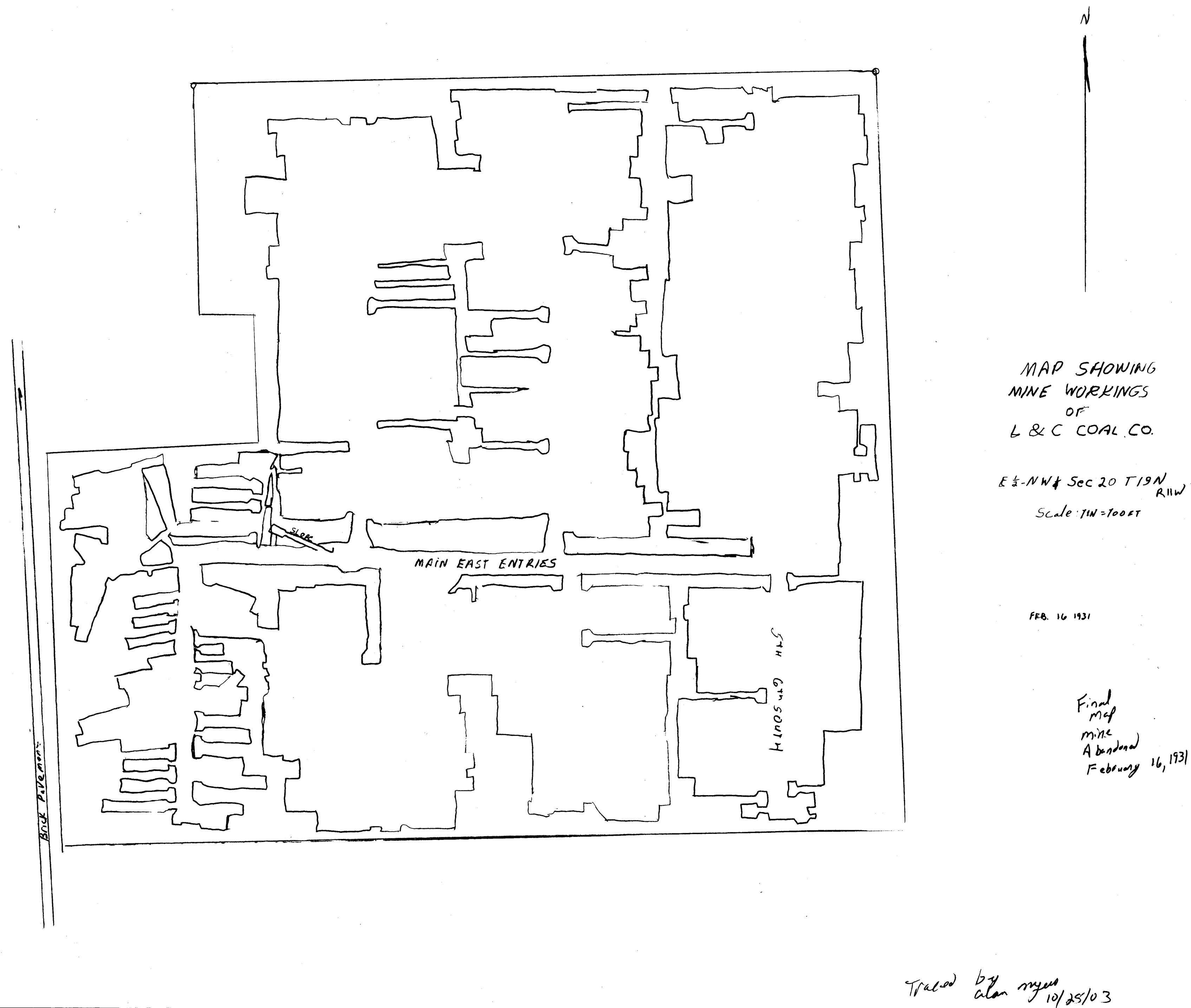
| Mine Index(s): | 3709 |
| Mine Company: | L. and C. Coal Company |
| Mine Name | L. and C. Mine |
| Map Date | 2-16-1931 |
| Map Scale | 1:1200 |
| Map Type microfilm/company/wpa/quade | Coal Section files |
| Map Status final,not final, secondary | Final |
| ID Number | 10-7-8 |
| Used For | mine outline status |
| Notes | The company map at the Vermilion County Recorder's Office was traced and incorporated into the Coal Section files as 10-7-8. The tracing was not scanned or georegistered, although it is a final map because the only changes to the mine outline are in the southern portion, which has been stripped out by the Mary Moore No. 25 Mine (mine index 3707). |
| Image Credit | |
File history
Click on a date/time to view the file as it appeared at that time.
| Date/Time | Thumbnail | Dimensions | User | Comment | |
|---|---|---|---|---|---|
| current | 10:16, March 31, 2021 | | 3,390 × 2,870 (501 KB) | Cheri (talk | contribs) |
You cannot overwrite this file.
File usage
The following page uses this file: