File:M3817.jpg
Size of this preview: 727 × 599 pixels. Other resolutions: 2,485 × 2,048 pixels | 3,390 × 2,794 pixels.
Original file (3,390 × 2,794 pixels, file size: 998 KB, MIME type: image/jpeg)
CLICK HERE TO DOWNLOAD THE HIGH RESOLUTION IMAGE. FILE SIZE MAY BE LARGE(Note:this file is usually better quality than "original file" linked above)
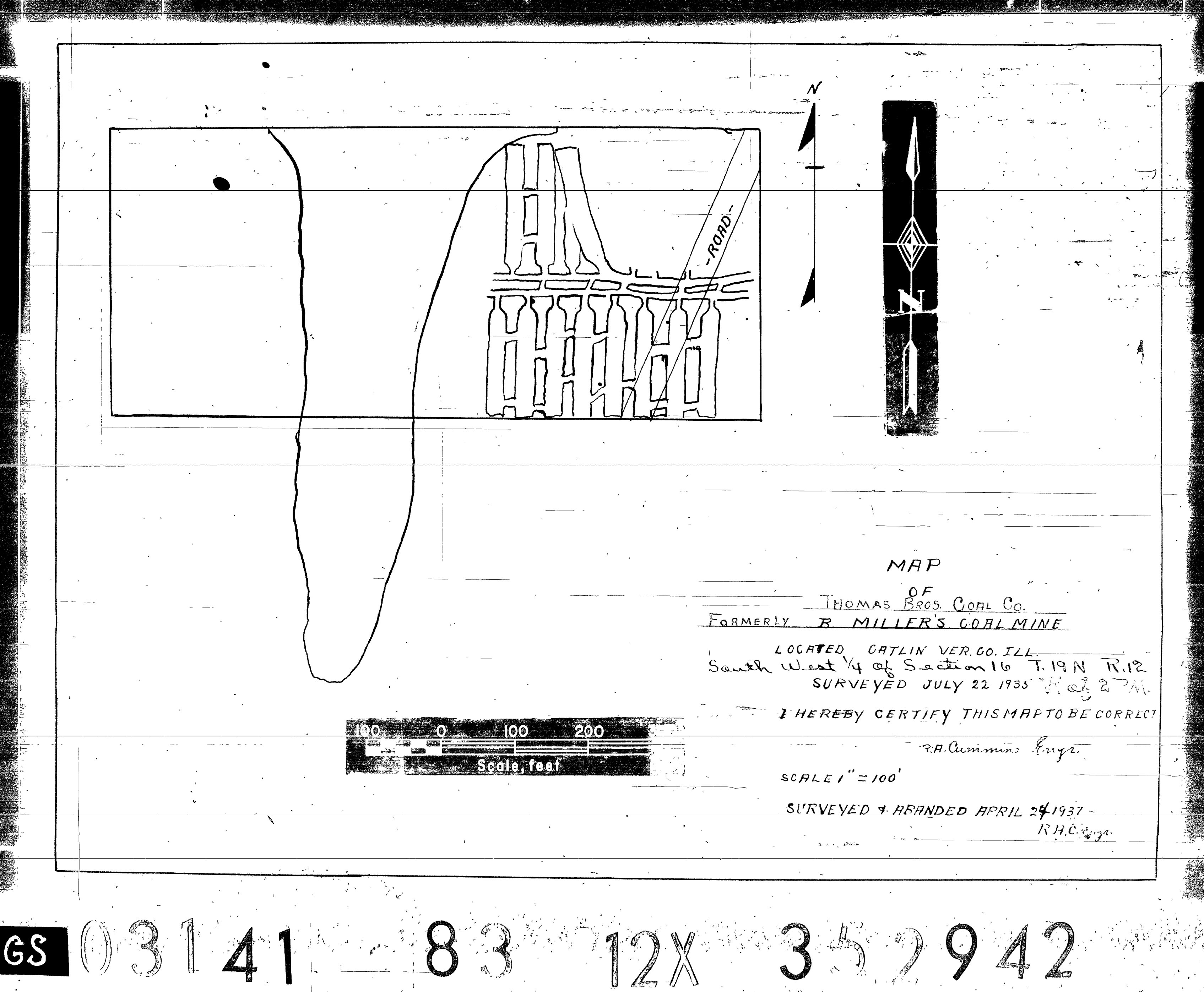
| Mine Index(s): | 3817 |
| Mine Company: | Thomas Brothers Coal Company |
| Mine Name | Thomas Mine |
| Map Date | 4-24-1937 |
| Map Scale | 1:1200 |
| Map Type microfilm/company/wpa/quade | Microfilm |
| Map Status final,not final, secondary | Final |
| ID Number | 352942 |
| Used For | mine outline, mining method |
| Notes | microfilm map, document 352942, reel 03141, frame 83; the title block indicates the mine was formerly operated by B. Miller. Miller most likely operated the mine in the 1930-1933 time period when mines producing less than 1,000 tons per year were not reported. The map shows a SW-NE trending road that is not on the topographic maps, but was seen on the 1938 atlas. |
| Image Credit | |
| Hi-Res Download | Click to download |
File history
Click on a date/time to view the file as it appeared at that time.
| Date/Time | Thumbnail | Dimensions | User | Comment | |
|---|---|---|---|---|---|
| current | 09:16, April 20, 2021 | | 3,390 × 2,794 (998 KB) | Cheri (talk | contribs) |
You cannot overwrite this file.
File usage
The following page uses this file: