File:M3834.jpg

Size of this preview: 732 × 600 pixels. Other resolutions: 2,500 × 2,048 pixels | 3,390 × 2,777 pixels.
Original file (3,390 × 2,777 pixels, file size: 856 KB, MIME type: image/jpeg)
CLICK HERE TO DOWNLOAD THE HIGH RESOLUTION IMAGE. FILE SIZE MAY BE LARGE(Note:this file is usually better quality than "original file" linked above)
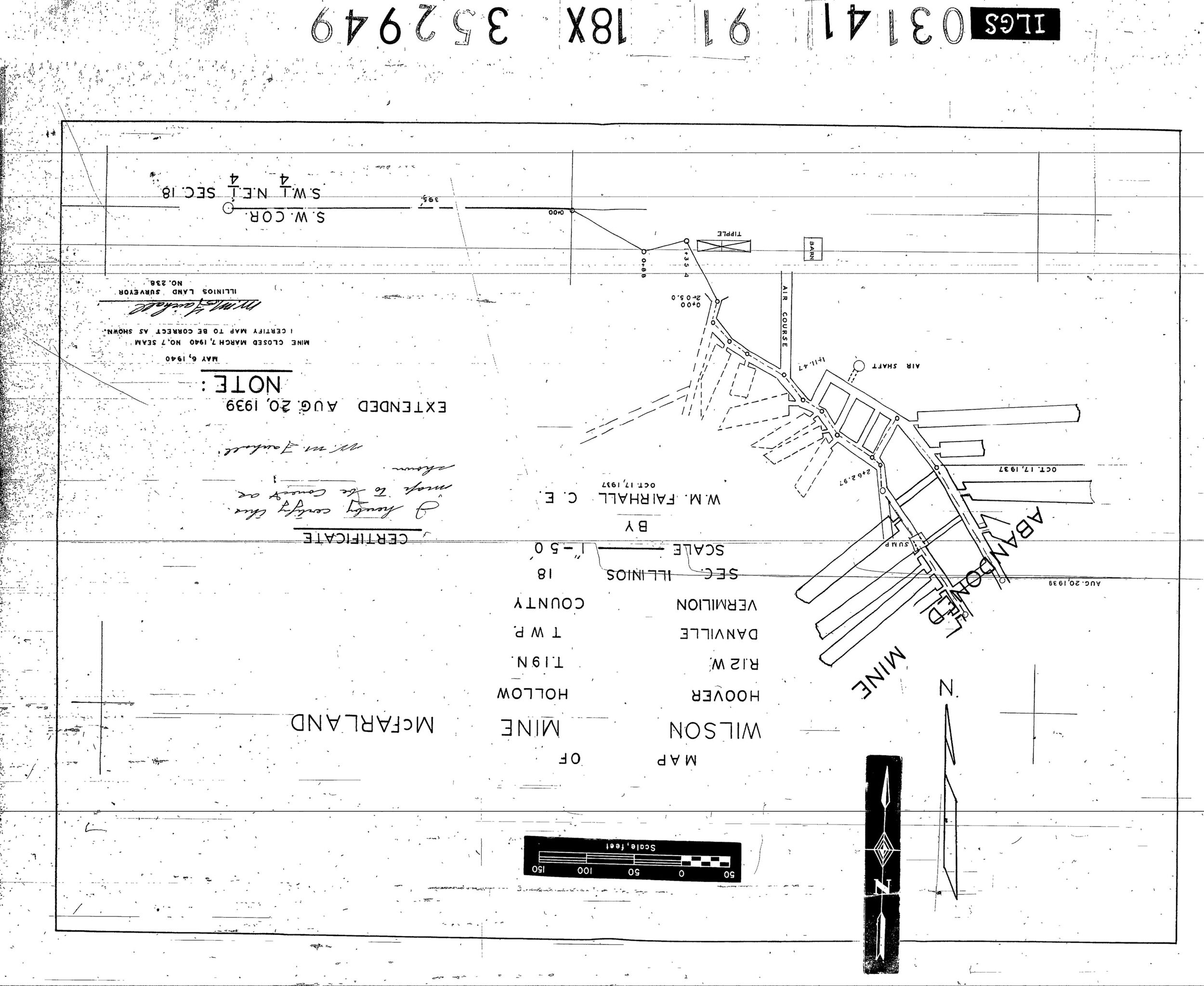
| Mine Index(s): | 3834 |
| Mine Company: | McFarland Coal Company |
| Mine Name | Wilson Mine |
| Map Date | 5-6-1940 |
| Map Scale | 1:600 |
| Map Type microfilm/company/wpa/quade | Microfilm |
| Map Status final,not final, secondary | Final |
| ID Number | 352949 |
| Used For | drift locations, mine outline, mining method |
| Notes | microfilm map, document 352949, reel 03141, frame 91; the location as stated on the map is incorrect. Hoover Hollow is in 11W (not 12W, as stated on the map). 18-19n-11w is in Oakwood Township; 18-19n-12w is in Danville Township, which the title block of the mine map indicates the mine is in. |
| Image Credit | |
| Hi-Res Download | Click to download |
File history
Click on a date/time to view the file as it appeared at that time.
| Date/Time | Thumbnail | Dimensions | User | Comment | |
|---|---|---|---|---|---|
| current | 10:26, March 26, 2021 | | 3,390 × 2,777 (856 KB) | Cheri (talk | contribs) |
You cannot overwrite this file.
File usage
There are no pages that use this file.