File:M4290 atlas1874.jpg
Size of this preview: 346 × 598 pixels. Other resolution: 1,143 × 1,977 pixels.
Original file (1,143 × 1,977 pixels, file size: 624 KB, MIME type: image/jpeg)
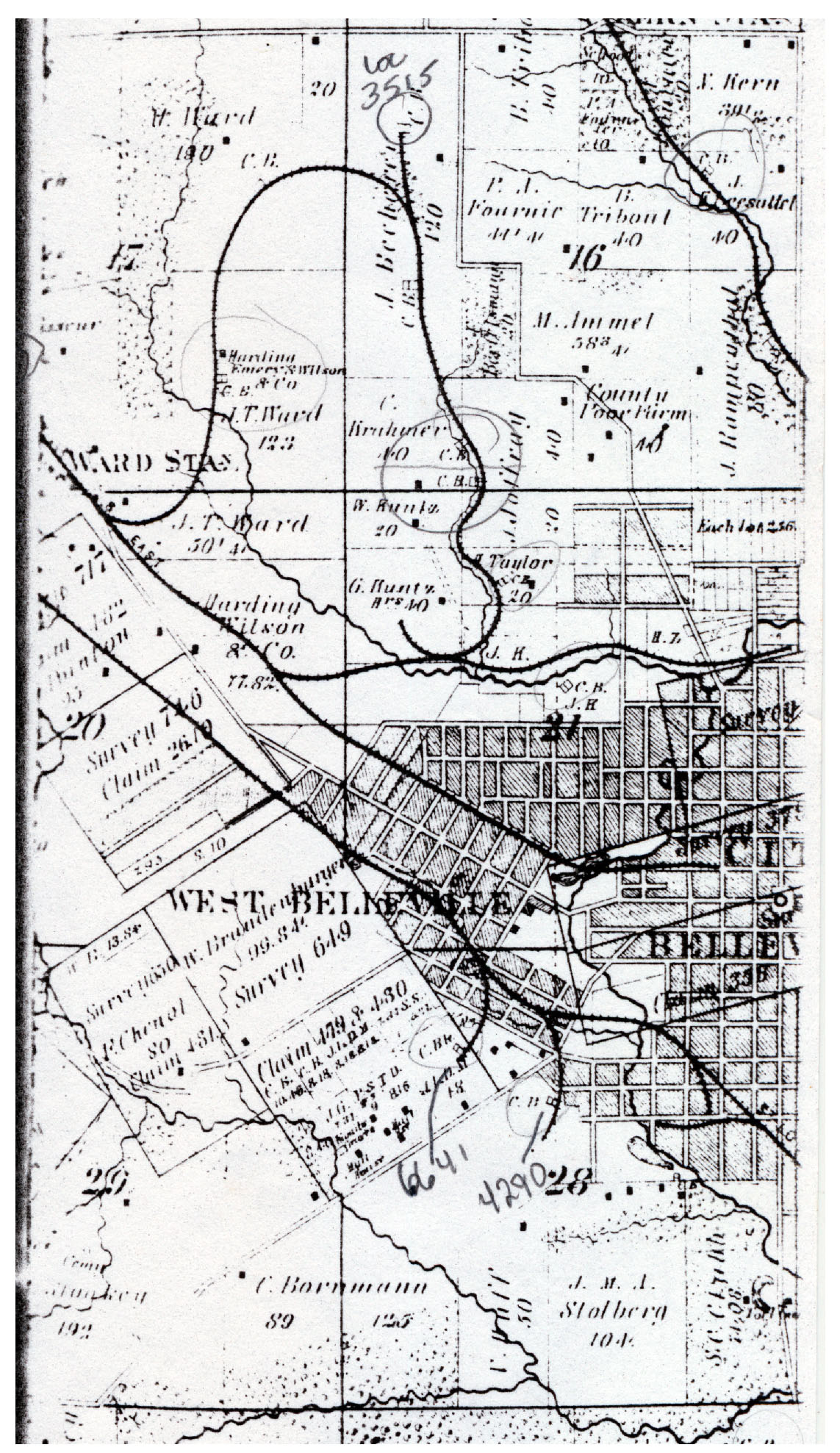
| Mine Index(s): | 4290, 6641, 6897,6641 ,6897 |
| Mine Company: | German Mining Company |
| Mine Name | German |
| Map Date | 1874 |
| Map Scale | 1:3840 |
| Map Type microfilm/company/wpa/quade | Atlas |
| Map Status final,not final, secondary | Secondary source |
| ID Number | |
| Used For | years of operation |
| Notes | Atlas of St. Clair County, Illinois, 1874, Warner and Beers, Chicago, Illinois |
| Image Credit | |
File history
Click on a date/time to view the file as it appeared at that time.
| Date/Time | Thumbnail | Dimensions | User | Comment | |
|---|---|---|---|---|---|
| current | 16:55, October 13, 2020 | | 1,143 × 1,977 (624 KB) | Cheri (talk | contribs) |
You cannot overwrite this file.
File usage
The following 2 files are duplicates of this file (more details):