Mine Index Number: 6641
| Company Name:
|
Nicholas Reeb
|
| Mine Name:
|
Reeb Mine
|
| Start Date:
|
Pre 1874
|
End Date:
|
1883
|
| Type of Mine:
|
Underground
|
| Total acres shown:
|
None
|
| Production Indicated Acres:
|
Less than 1
|
General Area of mining acres shown:
|
|
|
The Coal Report indicates 35 acres were mined prior to 1883.
|
Shaft, Slope, Drift or Tipple Location(s)
| Type
|
County
|
Township-Range
|
Section
|
Part Section
|
| Main shaft
|
St. Clair
|
1N 8W
|
28
|
SW NE NW
|
Geology
Geological Problems Reported
Production
| Company
|
Mine Name
|
Date
|
Production (tons)
|
| Nicholas Reeb
|
Reeb, Murphy
|
pre1874-1883
|
3,400 Ownership and production prior to 1883 are not known. The Coal Report of 1883 indicates 35 acres were mined. The 1874 Atlas of St. Clair County shows a shaft with a railroad spur at this location, indicating that mining was taking place in the early 1870s.
|
|
|
Production Notes
Coal Report production (if available)
Sources of Data
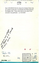
| Microfilm, document 351098
|
undated
|
1:1200
|
1:1986
|
Undated
|
Annotated Bibliography (Data source - brief description of information)
| Coal Reports - Production, ownership, years of operation, mine type, seam, depth, thickness.
|
| Directory of Illinois Coal Mines (St. Clair County) - Mine names, mine index, ownership, years of operation.
|
| Microfilm map, document 351098, reel 03134, frame 212 - Shaft location, mine outline.
|
| Atlas of St. Clair County, 1874, Warner & Beers, Chicago, Illinois - Years of operation.
|
Mine Notes
Mine Images
Atlas:
Map Date: 1874
Coal Co.: German Mining Company
Mine Name: German
Microfilm: 351098
Map Date: Undated
Coal Co.: Nicholas Reeb
Mine Name: Reeb
Full Res Download
Photographs