File:M4849 atlas 1874.jpg

Size of this preview: 474 × 599 pixels. Other resolutions: 1,621 × 2,048 pixels | 2,683 × 3,390 pixels.
Original file (2,683 × 3,390 pixels, file size: 1.38 MB, MIME type: image/jpeg)
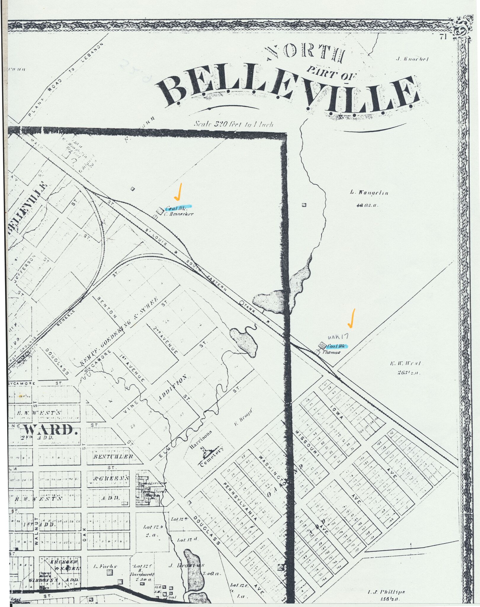
| Mine Index(s): | 4849 |
| Mine Company: | Thomas and Company |
| Mine Name | Thomas |
| Map Date | 1874 |
| Map Scale | 1:3840 |
| Map Type microfilm/company/wpa/quade | Atlas |
| Map Status final,not final, secondary | Secondary source |
| ID Number | |
| Used For | mine location, years of operation |
| Notes | An Illustrated Historical Atlas of St. Clair County, Illinois, 1874, Warner and Beers, Chicago, Illinois, reproduced by Marissa Historical and Genealogical Society, 1984 |
| Image Credit | |
File history
Click on a date/time to view the file as it appeared at that time.
| Date/Time | Thumbnail | Dimensions | User | Comment | |
|---|---|---|---|---|---|
| current | 09:28, October 14, 2020 | | 2,683 × 3,390 (1.38 MB) | Cheri (talk | contribs) |
You cannot overwrite this file.
File usage
The following page uses this file: