Search results
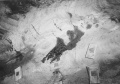
File:Mn 45 017.jpg |caption=Oil seep in [https://isgs.illinois.edu/ilstrat/index.php/2450 Piasa Limestone] roof, |cat1=Oil Seep(2,628 × 1,843 (783 KB)) - 14:41, November 26, 2019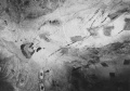
File:Mn 45 016.jpg |caption=Oil seep in [https://isgs.illinois.edu/ilstrat/index.php/2450 Piasa Limestone] roof, |cat1=Oil Seep(2,646 × 1,849 (838 KB)) - 14:41, November 26, 2019- ...80 feet. The source map indicated “bad top” near the faulted areas. An oil seep was noted, and water and gas also entered along the fault planes. Many of t4 KB (489 words) - 16:12, June 2, 2022
- ...ick, and in some places, exceed 200 feet (Hopkins, 1958). Electric logs of oil-test holes have provided most of the data for this channel. Only one underg ...Rock Sandstone frequently contains copious amounts of water, which flow or seep into the mine as the face advances. Since the seepage is likely to be dispe30 KB (4,712 words) - 09:32, February 26, 2024

