File:QUADE VERMILION LOAN AREA MAP.jpg: Difference between revisions
Alan.Myers (talk | contribs) No edit summary |
Alan.Myers (talk | contribs) No edit summary |
||
| Line 1: | Line 1: | ||
{{Image | |||
|File name=QUADE VERMILION LOAN AREA MAP.jpg | |||
|Map Type=Quade | |||
|Map ID=Vermilion, Quade - Loan Area Map | |||
|Map hires=https://wikiimage.isgs.illinois.edu/ilmines/quade/QUADE_VERMILION_LOAN AREA MAP.tif | |||
|county1=Vermilion | |||
}} | |||
==Quade Report== | |||
[https://wikiimage.isgs.illinois.edu/ilmines/quade/reports/quade_report_vermilion.pdf Quade Report Download (pdf)] | |||
==See also== | |||
[[:File:QUADE BUREAU.jpg|QUADE MAP]] | |||
[[Category:Quade]] | |||
{{#set:Quade_Report=https://wikiimage.isgs.illinois.edu/ilmines/quade/reports/quade_report_vermilion.pdf}} | |||
Revision as of 10:10, July 4, 2020
AREA MAP.tif CLICK HERE TO DOWNLOAD THE HIGH RESOLUTION IMAGE. FILE SIZE MAY BE LARGE(Note:this file is usually better quality than "original file" linked above)
| Mine Index(s): | |
| Mine Company: | |
| Mine Name | |
| Map Date | |
| Map Scale | |
| Map Type microfilm/company/wpa/quade | Quade |
| Map Status final,not final, secondary | |
| ID Number | Vermilion, Quade - Loan Area Map |
| Used For | |
| Notes | |
| Image Credit | |
| Hi-Res Download | AREA MAP.tif Click to download |
Quade Report
See also
File history
Click on a date/time to view the file as it appeared at that time.
| Date/Time | Thumbnail | Dimensions | User | Comment | |
|---|---|---|---|---|---|
| current | 10:08, July 4, 2020 | 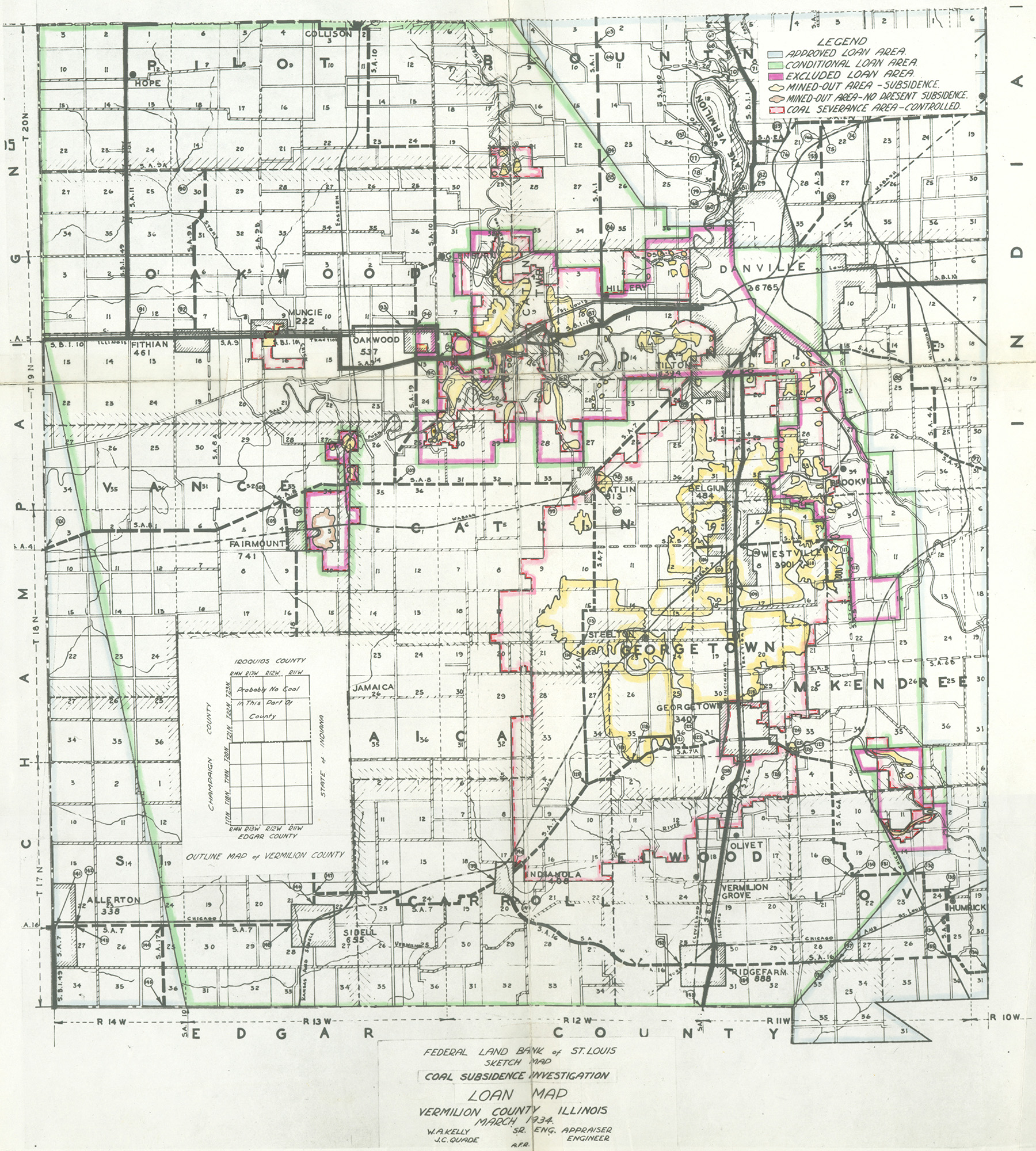 | 1,800 × 2,000 (1.36 MB) | Alan.Myers (talk | contribs) |
You cannot overwrite this file.
File usage
The following 4 pages use this file: