File:Folio67d.jpg: Difference between revisions
Alan.Myers (talk | contribs) m (Text replacement - "Danville SE" to "Danville Southeast") |
Alan.Myers (talk | contribs) m (Text replacement - "Danville Southeast" to "Danville SE") |
||
| (One intermediate revision by the same user not shown) | |||
| Line 9: | Line 9: | ||
|Map Scale=1:62500 | |Map Scale=1:62500 | ||
|Map Status=Secondary source | |Map Status=Secondary source | ||
|Map hires=https://wikiimage.isgs.illinois.edu/ilmines/vermilion/folio67d.zip | |||
|county1=Vermilion | |county1=Vermilion | ||
|quad1=Danville | |quad1=Danville SE | ||
}} | }} | ||
Latest revision as of 16:09, August 31, 2020
CLICK HERE TO DOWNLOAD THE HIGH RESOLUTION IMAGE. FILE SIZE MAY BE LARGE(Note:this file is usually better quality than "original file" linked above)
| Mine Index(s): | 3737, 3739,3739 |
| Mine Company: | Brookside Coal Mining Company |
| Mine Name | Brookside No. 1 Mine |
| Map Date | 12-1900 |
| Map Scale | 1:62500 |
| Map Type microfilm/company/wpa/quade | USGS Folio 67 |
| Map Status final,not final, secondary | Secondary source |
| ID Number | |
| Used For | |
| Notes | |
| Image Credit | |
| Hi-Res Download | Click to download |
File history
Click on a date/time to view the file as it appeared at that time.
| Date/Time | Thumbnail | Dimensions | User | Comment | |
|---|---|---|---|---|---|
| current | 08:58, April 2, 2020 | 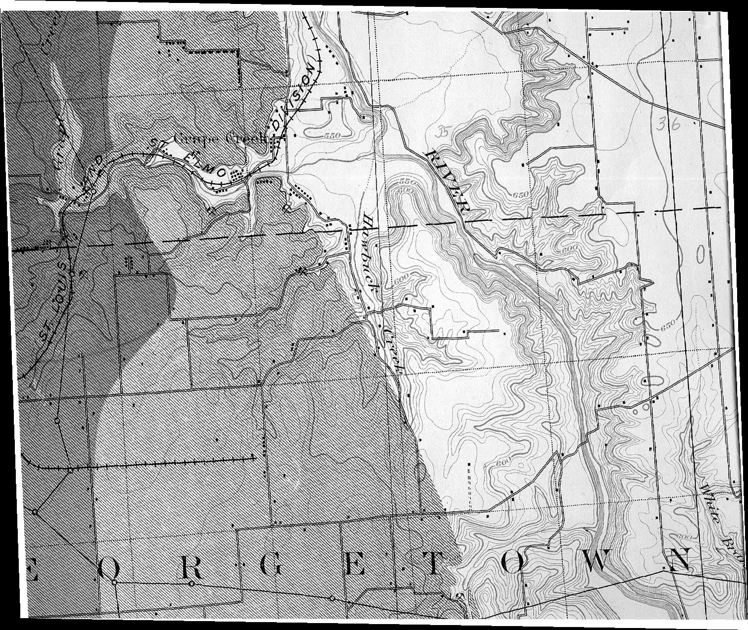 | 1,511 × 1,273 (806 KB) | Cheri (talk | contribs) |
You cannot overwrite this file.
File usage
The following file is a duplicate of this file (more details):