File:M3650.jpg: Difference between revisions
Alan.Myers (talk | contribs) No edit summary |
Alan.Myers (talk | contribs) m (Text replacement - "Danville Southeast" to "Danville SE") |
||
| Line 11: | Line 11: | ||
|Map hires=https://wikiimage.isgs.illinois.edu/ilmines/vermilion/m3650.zip | |Map hires=https://wikiimage.isgs.illinois.edu/ilmines/vermilion/m3650.zip | ||
|county1=Vermilion | |county1=Vermilion | ||
|quad1=Danville | |quad1=Danville SE | ||
|Image Notes=Microfilm map, document 352011, reel 03141, frame 157 | |Image Notes=Microfilm map, document 352011, reel 03141, frame 157 | ||
|Image Used For=Slope & shaft locations, mine outline, mining method | |Image Used For=Slope & shaft locations, mine outline, mining method | ||
}} | }} | ||
Latest revision as of 16:10, August 31, 2020
CLICK HERE TO DOWNLOAD THE HIGH RESOLUTION IMAGE. FILE SIZE MAY BE LARGE(Note:this file is usually better quality than "original file" linked above)
| Mine Index(s): | 3650 |
| Mine Company: | P. J. Dowiatt and Sons Coal Company |
| Mine Name | Dowaitt No. 2 Mine |
| Map Date | 2-20-1939 |
| Map Scale | 1:1200 |
| Map Type microfilm/company/wpa/quade | Microfilm |
| Map Status final,not final, secondary | Not final |
| ID Number | 352011 |
| Used For | Slope & shaft locations, mine outline, mining method |
| Notes | Microfilm map, document 352011, reel 03141, frame 157 |
| Image Credit | |
| Hi-Res Download | Click to download |
File history
Click on a date/time to view the file as it appeared at that time.
| Date/Time | Thumbnail | Dimensions | User | Comment | |
|---|---|---|---|---|---|
| current | 11:23, February 25, 2020 | 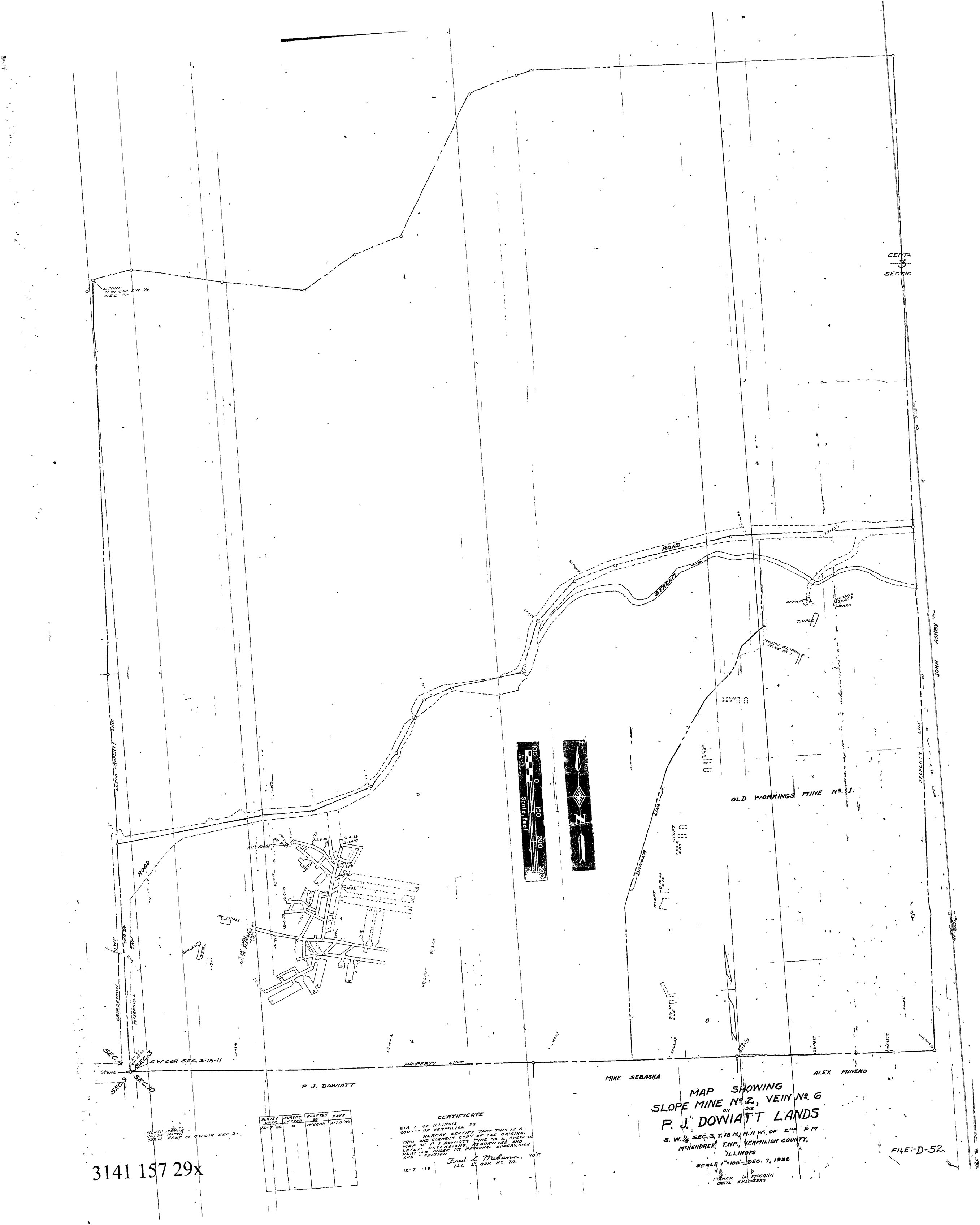 | 2,714 × 3,390 (589 KB) | Cheri (talk | contribs) |
You cannot overwrite this file.
File usage
There are no pages that use this file.