|
|
| Line 14: |
Line 14: |
| |Latitude=38.6773952660001 | | |Latitude=38.6773952660001 |
| |Longitude=-89.953037449 | | |Longitude=-89.953037449 |
| |Zoom=13 | | |Zoom=14 |
| }} | | }} |
| ==Shaft, Slope, Drift or Tipple Location(s)== | | ==Shaft, Slope, Drift or Tipple Location(s)== |
Revision as of 12:10, December 10, 2020
Mine Index Number: 2760
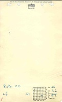
| Company Name:
|
Buxton Coal Company
|
| Mine Name:
|
Buxton Mine
|
| Start Date:
|
1898
|
End Date:
|
1937
|
| Type of Mine:
|
Underground
|
| Total acres shown:
|
63
|
| Acres after map date:
|
|
General Area of mining acres shown:
|
|
|
|
Shaft, Slope, Drift or Tipple Location(s)
| Type
|
County
|
Township-Range
|
Section
|
Part Section
|
| Main shaft
|
Madison
|
3N 8W
|
26
|
SE NW SE
|
| Air shaft
|
Madison
|
3N 8W
|
26
|
SE NW SE
|
Geology
| Herrin
|
180
|
|
|
7.5-7.6
|
MRP, RPB
|
Geological Problems Reported
Production
| Company
|
Mine Name
|
Date
|
Production (tons)
|
Production Notes
Coal Report production (if available)
Sources of Data
| Microfilm, document 352359
|
2-2-1937
|
1:1200
|
1:1655
|
Final
|
Annotated Bibliography (Data source - brief description of information)
| Coal Reports - Production, ownership, years of operation.
|
| Directory of Illinois Coal Mines (Madison County) - Mine names, mine index, ownership, years of operation.
|
| Microfilm map, document 352359, reel 03138, frame 474 - Shaft locations, mine outline, mining method.
|
| Mine notes (Madison County) - Mine type, shaft location, seam, depth, thickness.
|
Mine Notes
Mine Images
Microfilm: 352359
Map Date: 2-2-1937
Coal Co.: Hydraulic Press Brick Company
Mine Name: Hyrdraulic Press Brick Mine
Full Res Download
Photographs