0501: Difference between revisions
Alan.Myers (talk | contribs) No edit summary |
Alan.Myers (talk | contribs) No edit summary |
||
| Line 14: | Line 14: | ||
|Latitude=38.624945095 | |Latitude=38.624945095 | ||
|Longitude=-90.0318920139999 | |Longitude=-90.0318920139999 | ||
|Zoom= | |Zoom=12 | ||
}} | }} | ||
==Shaft, Slope, Drift or Tipple Location(s)== | ==Shaft, Slope, Drift or Tipple Location(s)== | ||
Revision as of 08:29, April 19, 2021
Mine Index Number: 0501
| Company Name: | Pyramid Coal Company | ||
|---|---|---|---|
| Mine Name: | Pyramid No. 4 Mine | ||
| Start Date: | 1914 | End Date: | 1944 |
| Type of Mine: | Underground | ||
| Total acres shown: | 535 Connected underground to Dove Mine (mine index 3606) | ||
| Acres after map date: | General Area of mining acres shown: | ||
Shaft, Slope, Drift or Tipple Location(s)
| Type | County | Township-Range | Section | Part Section |
|---|
| Drift | St. Clair | 2N 9W | 24 | NW NE NE |
| Air drift | St. Clair | 2N 9W | 24 | NW NE NE |
Geology
| Thickness (ft) | |||||
|---|---|---|---|---|---|
| Seam | Depth (ft) | Min | Max | Ave | Mining Method |
| Herrin | 6.0 | MRP |
Geological Problems Reported
Production
| Company | Mine Name | Date | Production (tons) |
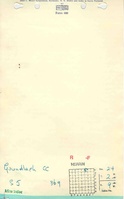
| Aloys Gundlach Coal Company | Gundlach | 1914-1942 | 2,334,718 |
| Pyramid Coal Company | Pyramid No. 4 | 1942-1944 | 247,429 |
Production Notes
Coal Report production (if available)
Sources of Data
| Source Map | Map Date | Original Scale | Digitized Scale | Map Type |
| Microfilm, document 351024 | 3-3-1944 | 1:2400 | 1:4966 | Final |
Annotated Bibliography (Data source - brief description of information)
| Coal Reports - Production, ownership, years of operation. |
| Directory of Illinois Coal Mines (St. Clair County) - Mine names, mine index, ownership, years of operation. |
| Microfilm map, document 351024, reel 03134, frames 103,104 - Drift locations, mine outline, mining method. |
| Mine notes (St. Clair County) - Thickness, seam, mine type, drift location. |
Mine Notes
Mine Images

Photographs