3266: Difference between revisions
(Created page with "{{Sidebar Info Query}} {{Header |checked=1st Entry |unlocated=No |shown_on_map=Yes |Mine-index=3266 |Coal_co=Russell Coal Company |Mine Name Header=Russell No. 1 Mine |mine_ty...") |
Kate.O'Brien (talk | contribs) No edit summary |
||
| Line 8: | Line 8: | ||
|Mine Name Header=Russell No. 1 Mine | |Mine Name Header=Russell No. 1 Mine | ||
|mine_type=Underground | |mine_type=Underground | ||
|mined-out-area=None | |mined-out-area=None{{#info:Production indicates approximately 1 acre was mined.|note}} | ||
| | |||
|county1=Saline | |county1=Saline | ||
|quad1=Carrier Mills | |quad1=Carrier Mills | ||
| Line 22: | Line 21: | ||
{{Shaft locations header}} | {{Shaft locations header}} | ||
{{Shaft locations | {{Shaft locations | ||
|shaft_type= | |shaft_type=Main slope | ||
|County=Saline | |County=Saline | ||
|Town-Range=9S 5E | |Town-Range=9S 5E | ||
| Line 57: | Line 56: | ||
|Source Map=Mine notes | |Source Map=Mine notes | ||
|Map Date=Undated | |Map Date=Undated | ||
|Original Scale= | |Original Scale=(text only) | ||
|Digitized Scale=1:24000 | |Digitized Scale=1:24000{{#info:Point plotted onto 1:24,000 USGS quadrangle and digitized.|note}} | ||
|Map Type=Secondary source | |Map Type=Secondary source | ||
}} | }} | ||
Revision as of 18:03, January 20, 2022
Mine Index Number: 3266
| Company Name: | Russell Coal Company | ||
|---|---|---|---|
| Mine Name: | Russell No. 1 Mine | ||
| Start Date: | 1946 | End Date: | December 1947 |
| Type of Mine: | Underground | ||
| Total acres shown: | NoneProduction indicates approximately 1 acre was mined. | ||
| Acres after map date: | General Area of mining acres shown: | ||
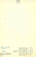
Shaft, Slope, Drift or Tipple Location(s)
| Type | County | Township-Range | Section | Part Section |
|---|
| Main slope | Saline | 9S 5E | 33 | NE NW SE |
Geology
| Thickness (ft) | |||||
|---|---|---|---|---|---|
| Seam | Depth (ft) | Min | Max | Ave | Mining Method |
| Herrin | 35 | 4.67 | RP |
Geological Problems Reported
Production
| Company | Mine Name | Date | Production (tons) |
| Russell Coal Company | Russell No. 1 | 1946-1947 | 3,428 |
Production Notes
Coal Report production (if available)
Sources of Data
| Source Map | Map Date | Original Scale | Digitized Scale | Map Type |
| Mine notes | Undated | (text only) | 1:24000Point plotted onto 1:24,000 USGS quadrangle and digitized. | Secondary source |
Annotated Bibliography (Data source - brief description of information)
| Coal Reports - Production, ownership, years of operation, depth, thickness, mining method. |
| Directory of Illinois Coal Mines (Saline County) - Mine names, mine index, ownership, years of operation. |
| Mine notes (Saline County) - Mine type, slope location, seam. |
Mine Notes
Mine Images
Photographs