Category:Saline-County
(Redirected from Saline-County)
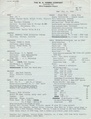
County Coal Data
Mines that Appear in Saline-County
- 9998 & 9999 = Unknown dates
Unlocated Mines in Saline-County
Mine that have known coal production but no known location
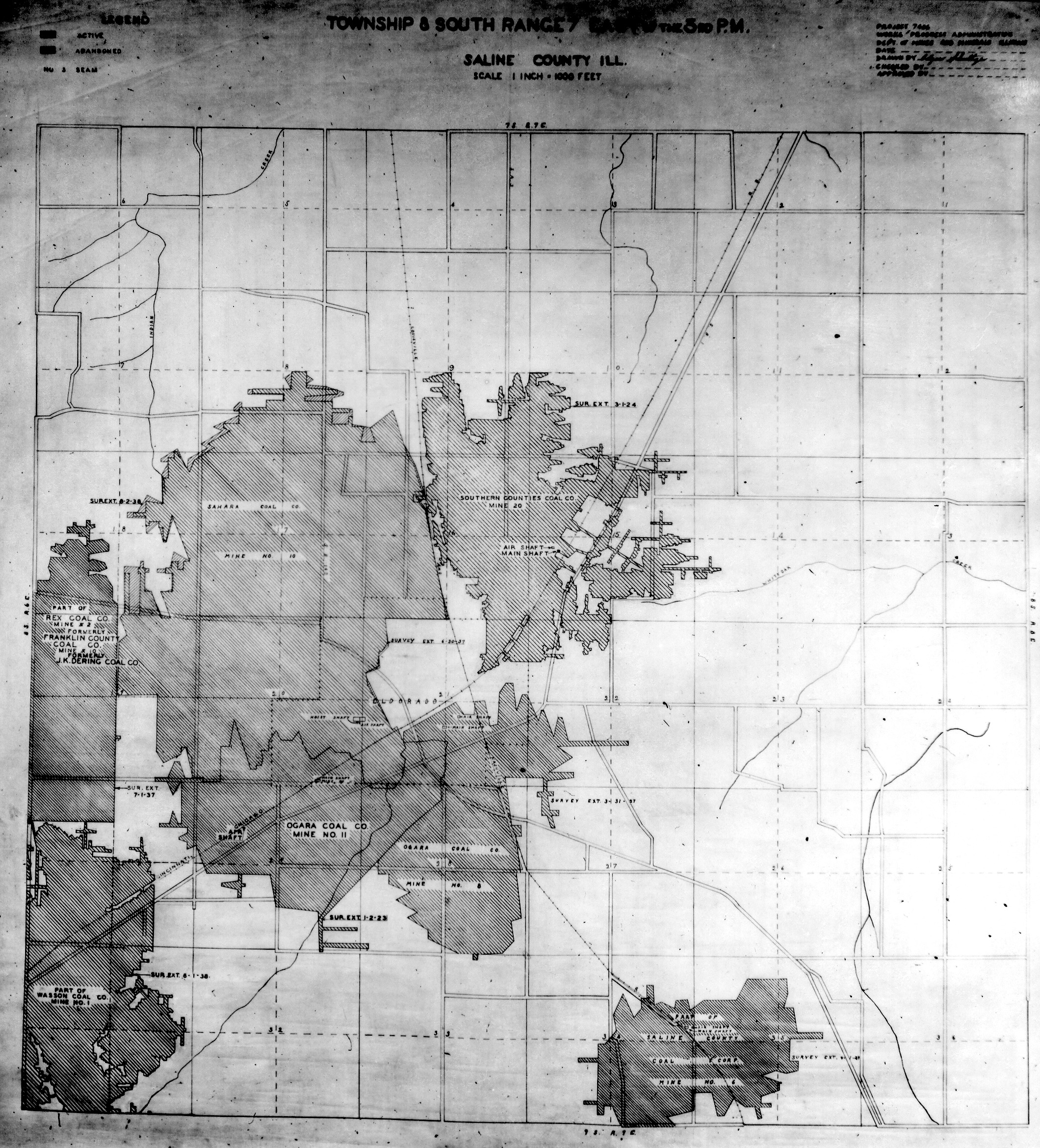
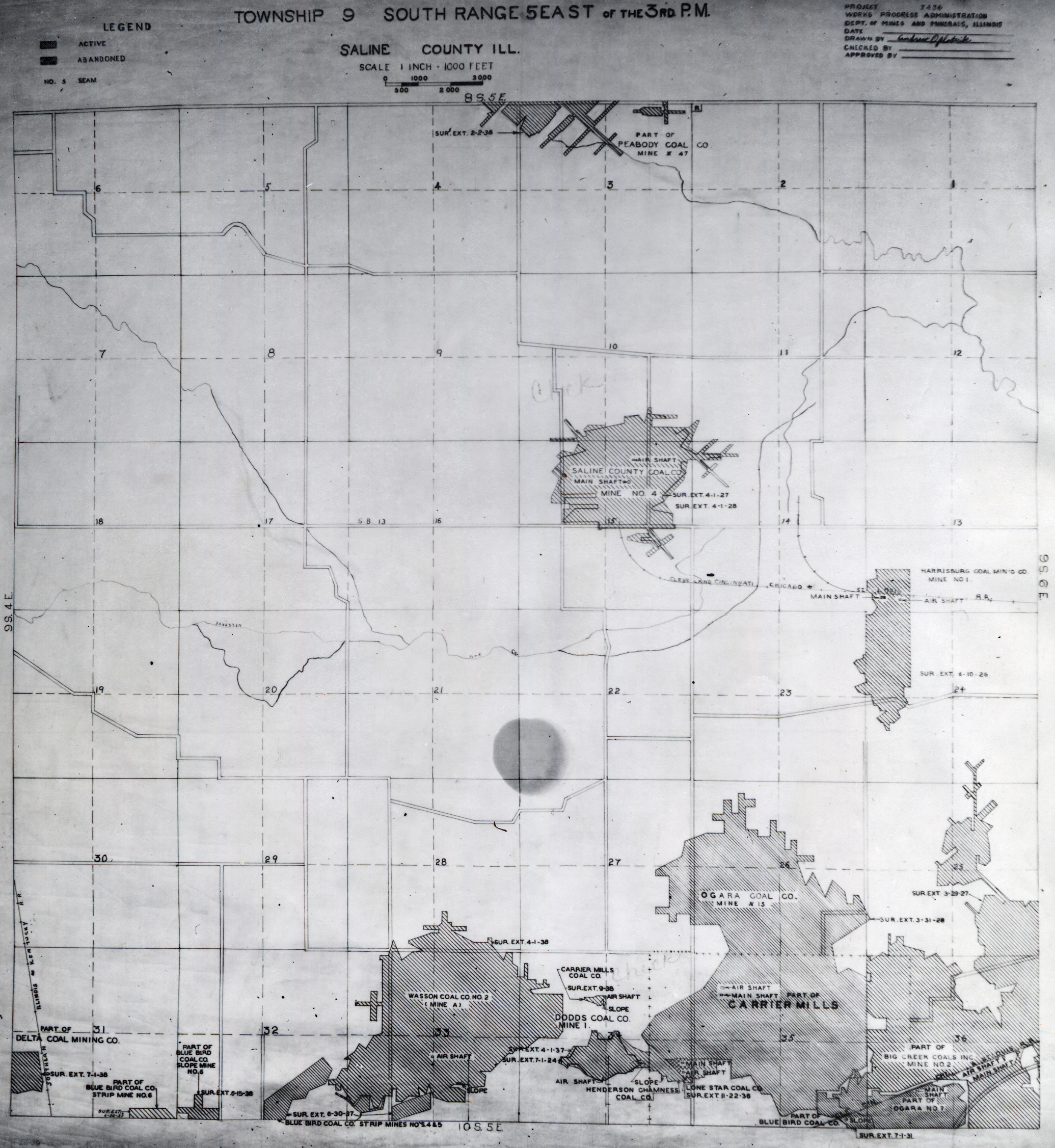
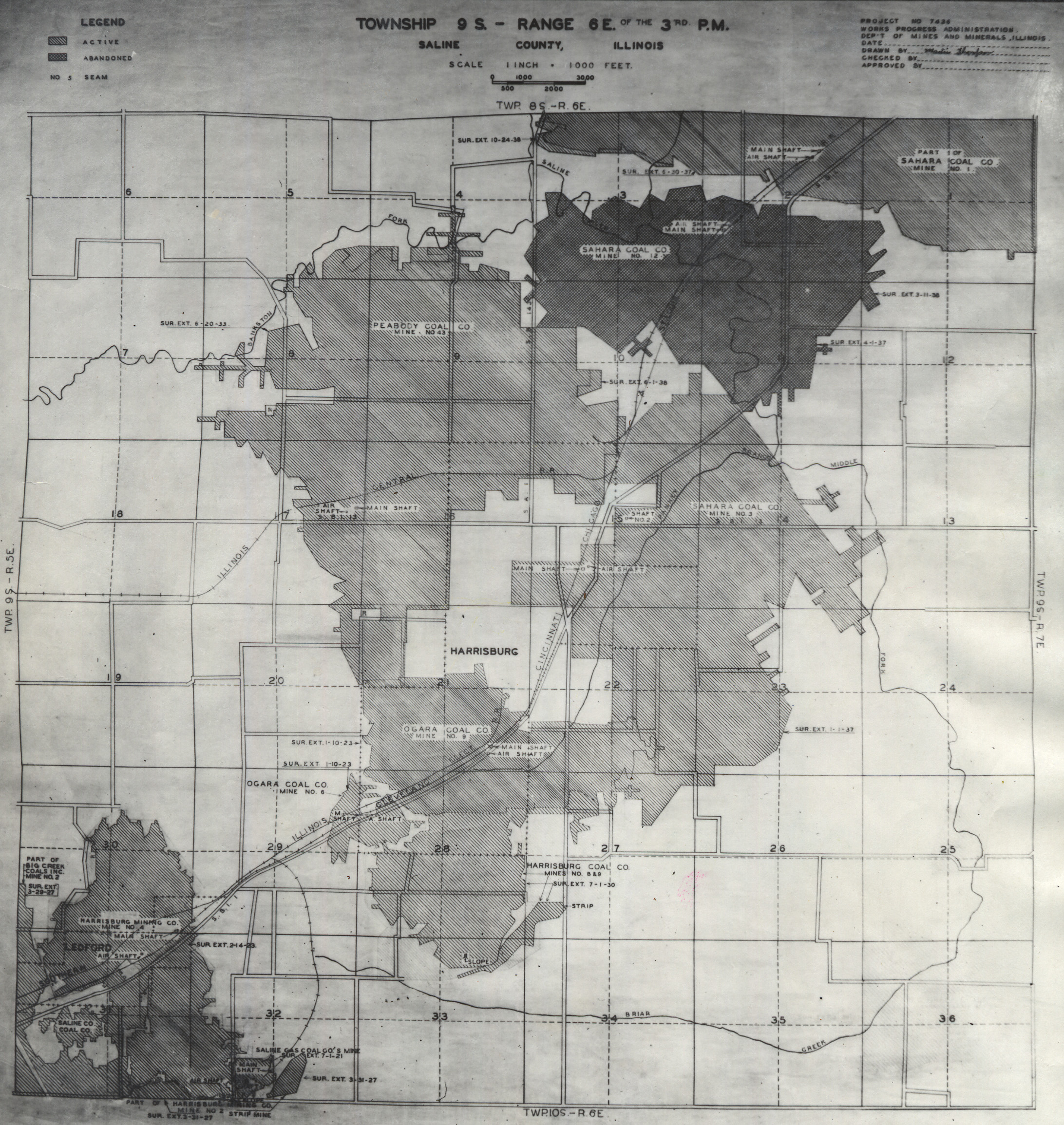
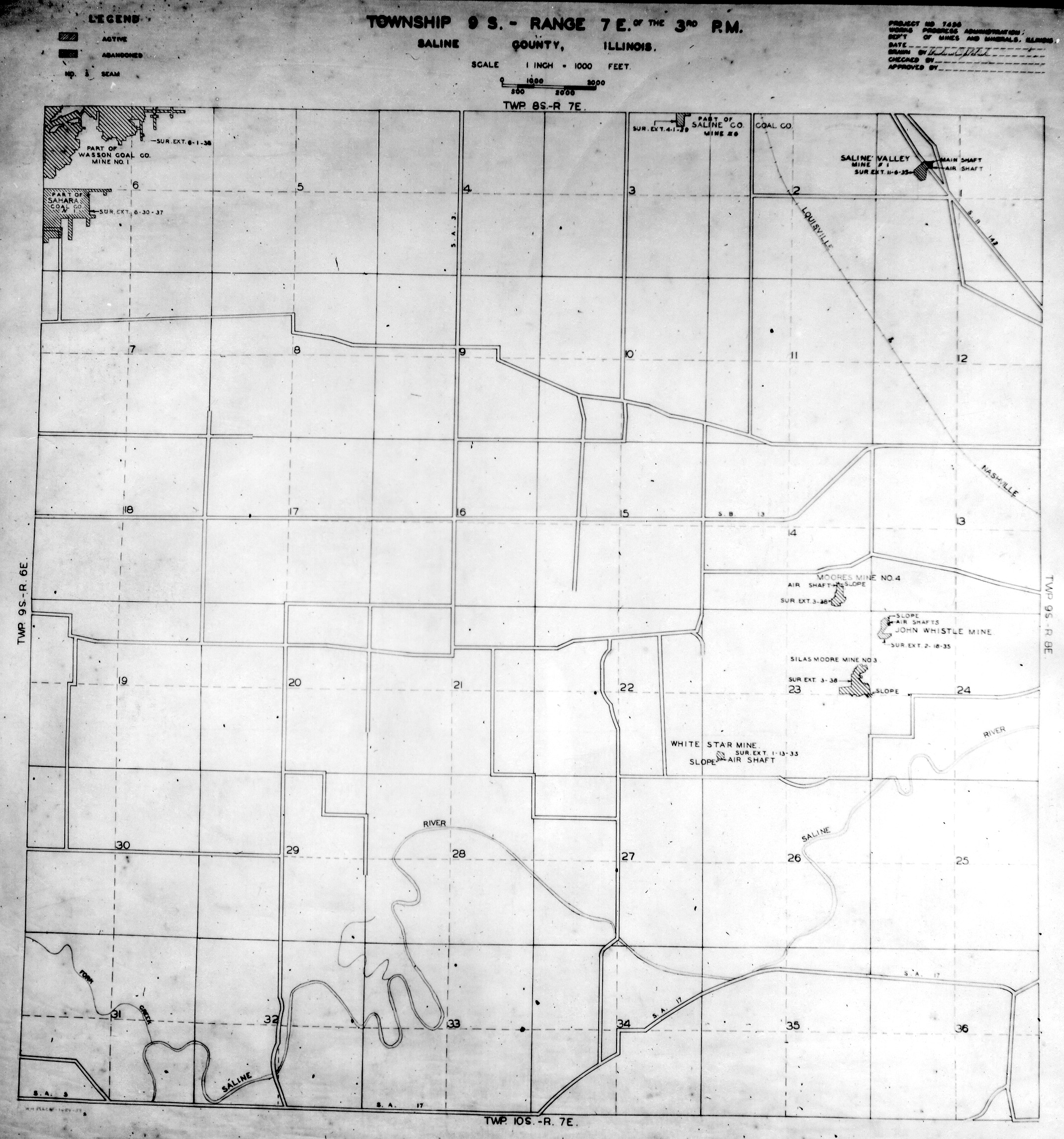
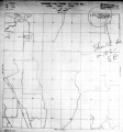
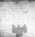
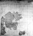
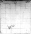
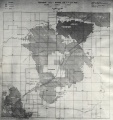
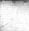
Historical Mined Out Area Maps
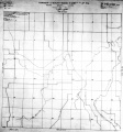
WPA
These maps were constructed as part of the nationwide Works Projects Administration (WPA), generally between 1934 and 1937 with some later updates or revisions,
Disclaimer
Maps for some locations might have multiple versions/seams, please inspected these areas closely for differences.
Notes and corrections were made by ISGS staff.
These maps are reproductions from microfilm, they may be of poor quality with text difficult to read.


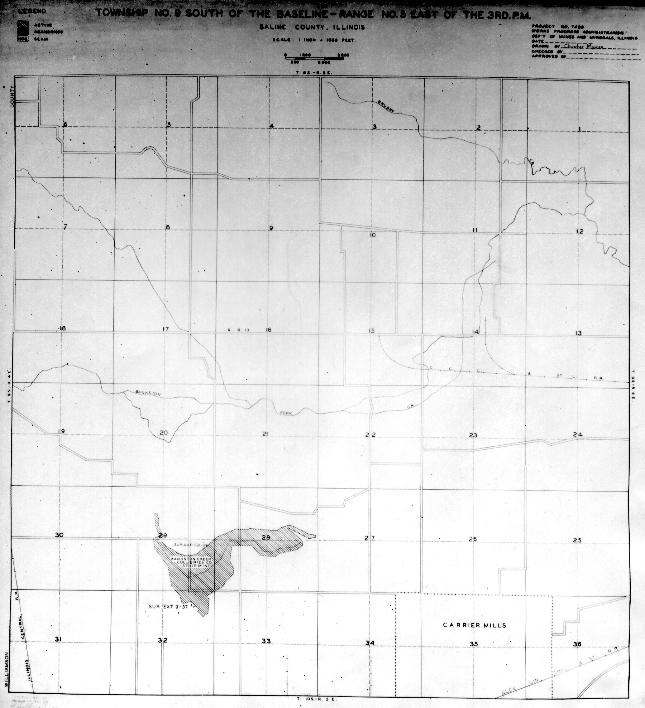
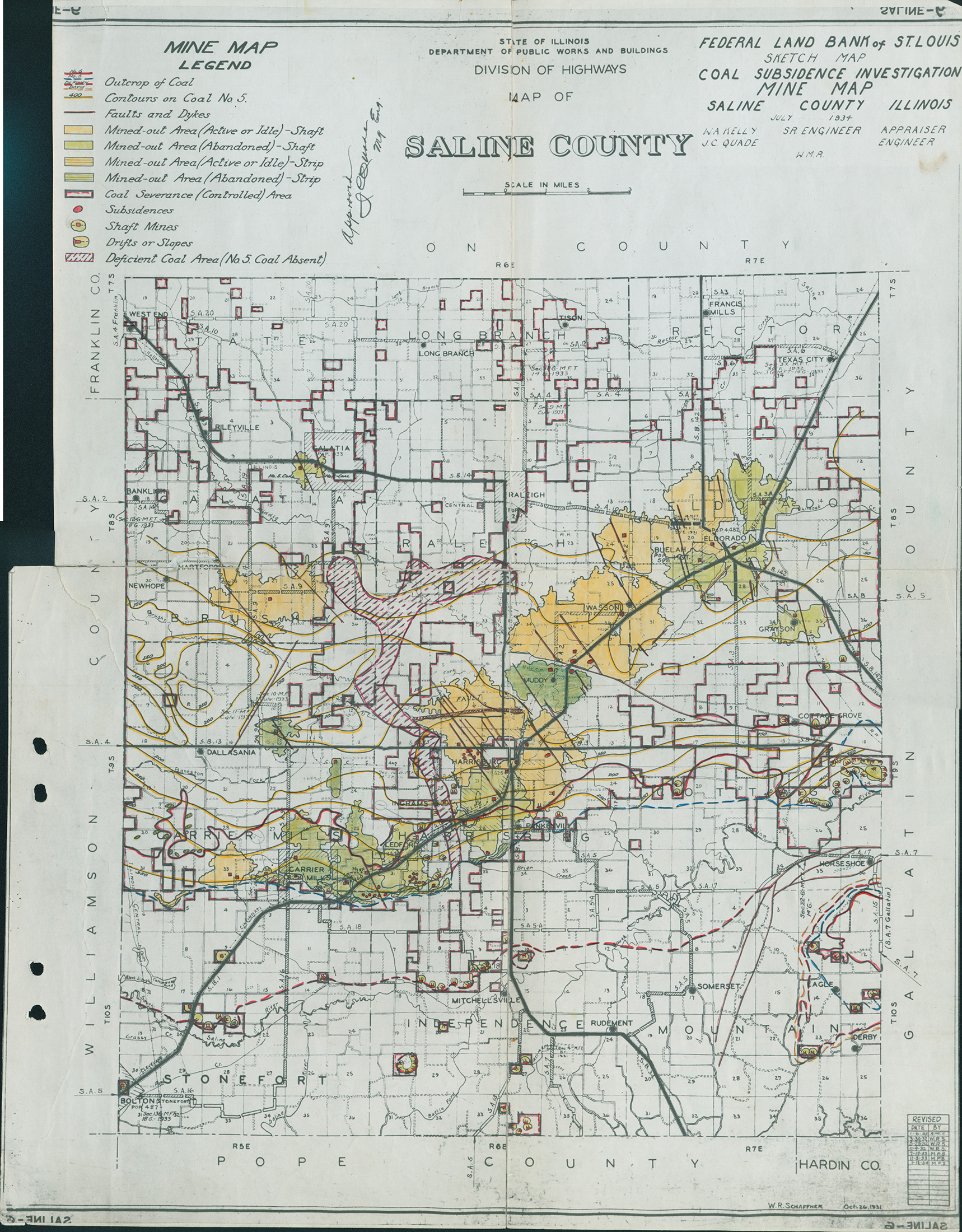
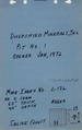
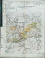
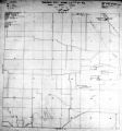
Federal Land Bank of St. Louis, Preliminary Reports on Subsidence Investigations
Federal Land Bank of St. Louis, Preliminary Reports on Subsidence Investigations (refered by Coal Section Staff as "Quade Maps")
Mining engineers working for the Federal Land Bank of St. Louis mapped areas of subsidence due to coal mining in the early 1930s. These reports often include county maps of mine properties with mined-out areas including shaft locations, as well as subsidence areas.
Disclaimer
Maps for some locations might have multiple versions/seams, please inspected these areas closely for differences.
These maps are accompanied by a report, please download and inspect this document.
Notes and corrections were made by ISGS staff.

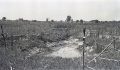
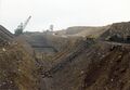
Photographs


Pages in category "Saline-County"
The following 200 pages are in this category, out of 304 total.
(previous page) (next page)0
1
3
- 3257
- 3258
- 3259
- 3261
- 3262
- 3263
- 3264
- 3265
- 3266
- 3267
- 3268
- 3269
- 3270
- 3271
- 3272
- 3273
- 3275
- 3276
- 3277
- 3278
- 3279
- 3280
- 3281
- 3282
- 3283
- 3284
- 3285
- 3286
- 3287
- 3288
- 3289
- 3290
- 3291
- 3292
- 3293
- 3294
- 3296
- 3297
- 3298
- 3299
- 3300
- 3301
- 3302
- 3303
- 3304
- 3305
- 3306
- 3307
- 3308
- 3309
- 3310
- 3311
- 3312
- 3313
- 3314
- 3315
- 3316
- 3317
- 3318
- 3319
- 3320
- 3321
- 3322
- 3323
- 3324
- 3325
- 3326
- 3327
- 3328
- 3329
- 3330
- 3332
- 3333
- 3334
- 3335
- 3344
- 3353
- 3487
- 3495
- 3519
- 3520
- 3540
- 3548
- 3552
- 3564
- 3607
- 3693
Media in category "Saline-County"
The following 182 files are in this category, out of 182 total.
 M-968 OGara CC no 7 Coop 17 Fig 13 7ft coal 80ft deep.jpg 2,500 × 1,457; 622 KB
 M-969 Breaks in field S of OGara Co No 7 Harrisburg.jpg 4,376 × 2,548; 1.39 MB
 M0043 minenotes.pdf 731 × 1,172, 27 pages; 5.87 MB
 M0044 minenotes.pdf 731 × 1,172, 27 pages; 5.61 MB
 M0045 minenotes.pdf 745 × 1,183, 23 pages; 4.93 MB
 M0046 minenotes.pdf 745 × 1,183, 18 pages; 3.59 MB
 M0048 minenotes.pdf 731 × 1,172, 20 pages; 3.56 MB
 M0049 minenotes.pdf 745 × 1,183, 21 pages; 2.09 MB
 M0124 fieldnotes.pdf 750 × 1,191, 3 pages; 610 KB
 M0124 minenotes.pdf 743 × 1,183, 27 pages; 5.96 MB
 M0125 minenotes.pdf 745 × 1,183, 52 pages; 11.13 MB
 M0126 minenotes.pdf 745 × 1,183, 10 pages; 2.21 MB
 M0127 minenotes.pdf 731 × 1,172, 31 pages; 6.94 MB
 M0128 minenotes.pdf 731 × 1,172, 12 pages; 8.8 MB
 M0129 coalreport1917 p250.pdf 602 × 991; 82 KB
 M0129 fieldnotes.pdf 747 × 1,191; 196 KB
 M0129 minenotes.pdf 733 × 1,181, 16 pages; 3.58 MB
 M0130 coalreport1914 p239-240.pdf 1,756 × 1,331, 2 pages; 485 KB
 M0130 coalreport1916 p244.pdf 654 × 1,016; 72 KB
 M0130 coalreport1917 p250.pdf 602 × 991; 80 KB
 M0130 minenotes.pdf 731 × 1,168, 12 pages; 2.67 MB
 M0131 minenotes.pdf 739 × 1,172, 6 pages; 1.22 MB
 M0132 minenotes.pdf 739 × 1,172, 4 pages; 798 KB
 M0133 minenotes.pdf 731 × 1,160, 3 pages; 445 KB
 M0330 minenotes.pdf 731 × 1,172, 11 pages; 2.23 MB
 M0427 minenotes.pdf 718 × 1,160, 10 pages; 1.58 MB
 M0450 minenotes.pdf 731 × 1,172, 17 pages; 3.32 MB
 M0535 minenotes.pdf 731 × 1,172, 13 pages; 2.81 MB
 M0608 minenotes.pdf 731 × 1,172, 3 pages; 415 KB
 M0610 minenotes.pdf 733 × 1,172, 12 pages; 3.97 MB
 M0638 fieldnotes.pdf 745 × 1,191; 232 KB
 M0638 minenotes Cady.pdf 1,245 × 1,635, 2 pages; 16.97 MB
 M0638 minenotes.pdf 737 × 1,172, 88 pages; 11.68 MB
 M0646 minenotes.pdf 733 × 1,172, 7 pages; 1.39 MB
 M0647 minenotes.pdf 733 × 1,172, 10 pages; 1.13 MB
 M0664 minenotes.pdf 731 × 1,168, 15 pages; 3.26 MB
 M0672 minenotes.pdf 718 × 1,160, 4 pages; 721 KB
 M0697 fieldnotes Saline.pdf 750 × 1,200, 3 pages; 619 KB
 M0697 fieldnotes Williamson.pdf 747 × 1,197, 6 pages; 831 KB
 M0697 minenotes Saline.pdf 718 × 1,160, 5 pages; 699 KB
 M0697 minenotes Williamson.pdf 727 × 1,166, 73 pages; 19.23 MB
 M0698 minenotes.pdf 718 × 1,160, 24 pages; 5 MB
 M0751 minenotes.pdf 745 × 1,183, 6 pages; 1.29 MB
 M0798 fieldnotes.pdf 756 × 1,189; 257 KB
 M0798 minenotes.pdf 700 × 1,160, 18 pages; 4 MB
 M0799 minenotes.pdf 745 × 1,183, 5 pages; 1.04 MB
 M0800 minenotes.pdf 745 × 1,183, 10 pages; 2.12 MB
 M0801 minenotes.pdf 706 × 1,162, 35 pages; 7.9 MB
 M0802 minenotes.pdf 733 × 1,181, 32 pages; 10.65 MB
 M0803 minenotes.pdf 731 × 1,172, 2 pages; 331 KB
 M0804 minenotes.pdf 731 × 1,172, 8 pages; 1.75 MB
 M0840 minenotes.pdf 718 × 1,160, 41 pages; 8.27 MB
 M0888 minenotes.pdf 731 × 1,168, 2 pages; 412 KB
 M0909 minenotes.pdf 739 × 1,183, 80 pages; 7.89 MB
 M0911 minenotes.pdf 733 × 1,181, 39 pages; 7.64 MB
 M0915 minenotes.pdf 731 × 1,172, 17 pages; 3.37 MB
 M0919 minenotes.pdf 718 × 1,160, 62 pages; 11.43 MB
 M0931 minenotes.pdf 718 × 1,160, 13 pages; 2.08 MB
 M0983 minenotes.pdf 718 × 1,154, 29 pages; 5.78 MB
 M0989 minenotes.pdf 731 × 1,172, 9 pages; 1.43 MB
 M0992 minenotes.pdf 745 × 1,183, 51 pages; 17.62 MB
 M0993 minenotes.pdf 733 × 1,195, 31 pages; 6.72 MB
 M1001 minenotes.pdf 743 × 1,175, 150 pages; 40.92 MB
 M1003 minenotes.pdf 739 × 1,172, 8 pages; 1.51 MB
 M1004 minenotes.pdf 750 × 1,250, 17 pages; 3.39 MB
 M1009 minenotes.pdf 739 × 1,172, 10 pages; 2.21 MB
 M1011 minenotes.pdf 745 × 1,183, 2 pages; 406 KB
 M1015 minenotes.pdf 731 × 1,172, 25 pages; 6 MB
 M1028 minenotes.pdf 556 × 241, 5 pages; 979 KB
 M1029 minenotes.pdf 506 × 314, 8 pages; 1.67 MB
 M1032 minenotes.pdf 535 × 293, 6 pages; 1.01 MB
 M1033 minenotes.pdf 756 × 1,208, 5 pages; 1.95 MB
 M1038 minenotes.pdf 1,275 × 1,650, 5 pages; 4.22 MB
 M1044 minenotes.pdf 560 × 302, 11 pages; 4.43 MB
 M2286 minenotes.pdf 731 × 1,172, 4 pages; 786 KB
 M3257 minenotes.pdf 731 × 1,172, 3 pages; 621 KB
 M3258 minenotes.pdf 745 × 1,183, 4 pages; 792 KB
 M3259 minenotes.pdf 745 × 1,183, 3 pages; 567 KB
 M3261 minenotes.pdf 731 × 1,168, 4 pages; 771 KB
 M3262 minenotes.pdf 737 × 1,172, 2 pages; 336 KB
 M3263 minenotes.pdf 731 × 1,168, 8 pages; 1.83 MB
 M3264 minenotes.pdf 731 × 1,168, 5 pages; 1.04 MB
 M3265 minenotes.pdf 731 × 1,168, 6 pages; 1.44 MB
 M3266 minenotes.pdf 731 × 1,168, 3 pages; 542 KB
 M3267 minenotes.pdf 731 × 1,168, 2 pages; 426 KB
 M3268 minenotes.pdf 731 × 1,168, 3 pages; 529 KB
 M3269 minenotes.pdf 731 × 1,168, 2 pages; 365 KB
 M3270 minenotes.pdf 731 × 1,168, 5 pages; 1.01 MB
 M3271 fieldnotes.pdf 745 × 1,183; 199 KB
 M3271 minenotes.pdf 731 × 1,168, 2 pages; 413 KB
 M3273 minenotes.pdf 731 × 1,168, 6 pages; 3.77 MB
 M3276 minenotes.pdf 731 × 1,172, 3 pages; 619 KB
 M3277 minenotes.pdf 731 × 1,172, 4 pages; 711 KB
 M3278 minenotes.pdf 731 × 1,172, 3 pages; 524 KB
 M3279 minenotes.pdf 731 × 1,172; 103 KB
 M3280 minenotes.pdf 731 × 1,172, 4 pages; 748 KB
 M3281 minenotes.pdf 731 × 1,172, 27 pages; 5.5 MB
 M3282 minenotes.pdf 731 × 1,172, 2 pages; 323 KB
 M3283 minenotes.pdf 731 × 1,172, 4 pages; 804 KB
 M3284 minenotes.pdf 731 × 1,172, 5 pages; 1.02 MB
 M3285 minenotes.pdf 731 × 1,172, 2 pages; 340 KB
 M3286 minenotes.pdf 731 × 1,172, 4 pages; 819 KB
 M3287 minenotes.pdf 731 × 1,172, 3 pages; 570 KB
 M3288 minenotes.pdf 731 × 1,172, 2 pages; 282 KB
 M3289 minenotes.pdf 731 × 1,172, 4 pages; 815 KB
 M3290 minenotes.pdf 731 × 1,172, 3 pages; 508 KB
 M3291 minenotes.pdf 731 × 1,172, 2 pages; 341 KB
 M3292 minenotes.pdf 731 × 1,172, 16 pages; 3.39 MB
 M3293 minenotes.pdf 731 × 1,172, 5 pages; 1.09 MB
 M3294 minenotes.pdf 731 × 1,172, 2 pages; 492 KB
 M3296 minenotes.pdf 731 × 1,172, 5 pages; 1.01 MB
 M3297 minenotes.pdf 733 × 1,172, 3 pages; 392 KB
 M3298 minenotes.pdf 733 × 1,172, 3 pages; 360 KB
 M3299 minenotes.pdf 731 × 1,172, 3 pages; 535 KB
 M3300 minenotes.pdf 731 × 1,172, 3 pages; 531 KB
 M3301 minenotes.pdf 731 × 1,172, 3 pages; 551 KB
 M3302 minenotes.pdf 731 × 1,172, 4 pages; 618 KB
 M3303 minenotes.pdf 731 × 1,172, 5 pages; 1.01 MB
 M3305 minenotes.pdf 704 × 1,166, 7 pages; 1.6 MB
 M3306 minenotes.pdf 733 × 1,172, 9 pages; 1.66 MB
 M3307 minenotes.pdf 733 × 1,172, 2 pages; 342 KB
 M3308 minenotes.pdf 733 × 1,172, 3 pages; 551 KB
 M3309 minenotes.pdf 733 × 1,172, 3 pages; 538 KB
 M3310 minenotes.pdf 733 × 1,172, 2 pages; 327 KB
 M3312 minenotes.pdf 733 × 1,172, 2 pages; 336 KB
 M3313 minenotes.pdf 733 × 1,172, 3 pages; 539 KB
 M3314 minenotes.pdf 718 × 1,160, 4 pages; 662 KB
 M3315 minenotes.pdf 733 × 1,172, 2 pages; 333 KB
 M3316 minenotes.pdf 731 × 1,168, 3 pages; 546 KB
 M3317 coalreport1908 p372.pdf 629 × 970; 94 KB
 M3317 fieldnotes.pdf 745 × 1,193; 272 KB
 M3317 minenotes.pdf 718 × 1,160, 2 pages; 290 KB
 M3318 minenotes.pdf 718 × 1,160, 4 pages; 689 KB
 M3319 minenotes.pdf 718 × 1,160, 7 pages; 1.16 MB
 M3320 minenotes.pdf 718 × 1,160, 3 pages; 527 KB
 M3321 minenotes.pdf 718 × 1,160, 5 pages; 768 KB
 M3323 minenotes.pdf 718 × 1,160, 3 pages; 492 KB
 M3324 minenotes.pdf 718 × 1,160, 4 pages; 699 KB
 M3325 minenotes.pdf 718 × 1,160, 3 pages; 494 KB
 M3326 minenotes.pdf 718 × 1,160, 3 pages; 497 KB
 M3327 minenotes.pdf 739 × 1,172, 3 pages; 512 KB
 M3328 minenotes.pdf 739 × 1,172, 4 pages; 784 KB
 M3329 minenotes.pdf 739 × 1,172, 3 pages; 608 KB
 M3330 minenotes.pdf 739 × 1,172, 25 pages; 4.85 MB
 M3332 minenotes.pdf 739 × 1,172, 5 pages; 1.05 MB
 M3333 minenotes.pdf 731 × 1,160, 3 pages; 474 KB
 M3334 minenotes.pdf 731 × 1,160, 3 pages; 500 KB
 M3335 minenotes.pdf 731 × 1,160, 3 pages; 503 KB
 M3353 minenotes.pdf 743 × 1,183, 6 pages; 1.28 MB
 M4179 minenotes.pdf 733 × 1,172, 3 pages; 577 KB
 M4180 minenotes.pdf 733 × 1,172, 4 pages; 773 KB
 M4184 minenotes.pdf 739 × 1,172, 6 pages; 1.22 MB
 M4193 minenotes.pdf 718 × 1,160, 3 pages; 537 KB
 M4197 minenotes.pdf 741 × 1,202, 2 pages; 463 KB
 M4199 minenotes.pdf 750 × 1,183, 4 pages; 716 KB
 M4203 minenotes.pdf 718 × 1,160, 3 pages; 625 KB
 M4205 minenotes.pdf 737 × 1,172, 3 pages; 605 KB
 M4206 fieldnotes.pdf 747 × 1,193; 316 KB
 M4241 minenotes.pdf 731 × 1,172, 3 pages; 591 KB
 M4494 fieldnotes.pdf 758 × 1,197; 278 KB
 M4581 minenotes.pdf 731 × 1,168, 3 pages; 540 KB
 M4595 minenotes.pdf 739 × 1,172, 4 pages; 796 KB
 M4597 minenotes.pdf 739 × 1,172, 6 pages; 1.21 MB
 M4598 minenotes.pdf 739 × 1,172, 4 pages; 826 KB
 M4700 minenotes.pdf 745 × 1,183, 3 pages; 569 KB
 M4702 minenotes.pdf 741 × 1,197, 2 pages; 581 KB
 M4728 minenotes.pdf 733 × 1,172, 2 pages; 315 KB
 M4734 minenotes.pdf 733 × 1,172, 3 pages; 589 KB
 M4764 minenotes.pdf 731 × 1,172, 3 pages; 614 KB
 Mn act gallatin 01.jpg 2,956 × 2,056; 528 KB
 QUADE SALINE.jpg 1,718 × 2,200; 1.45 MB
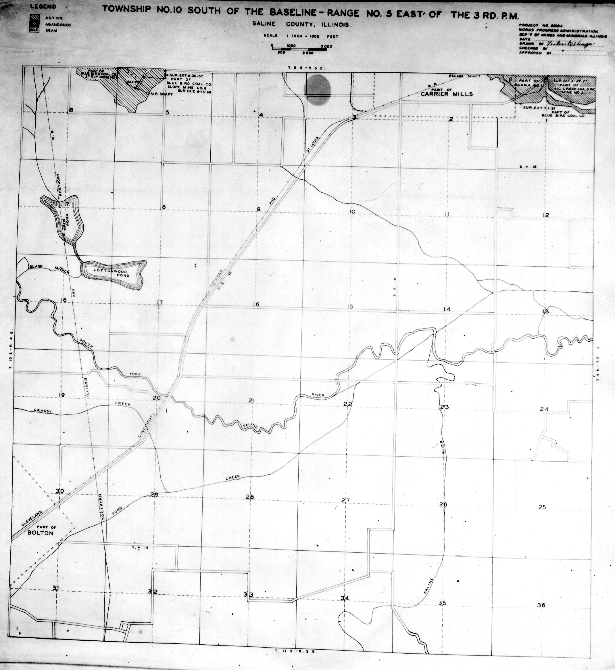
 WPA SALINE 10S5E.jpg 2,140 × 2,330; 1.04 MB
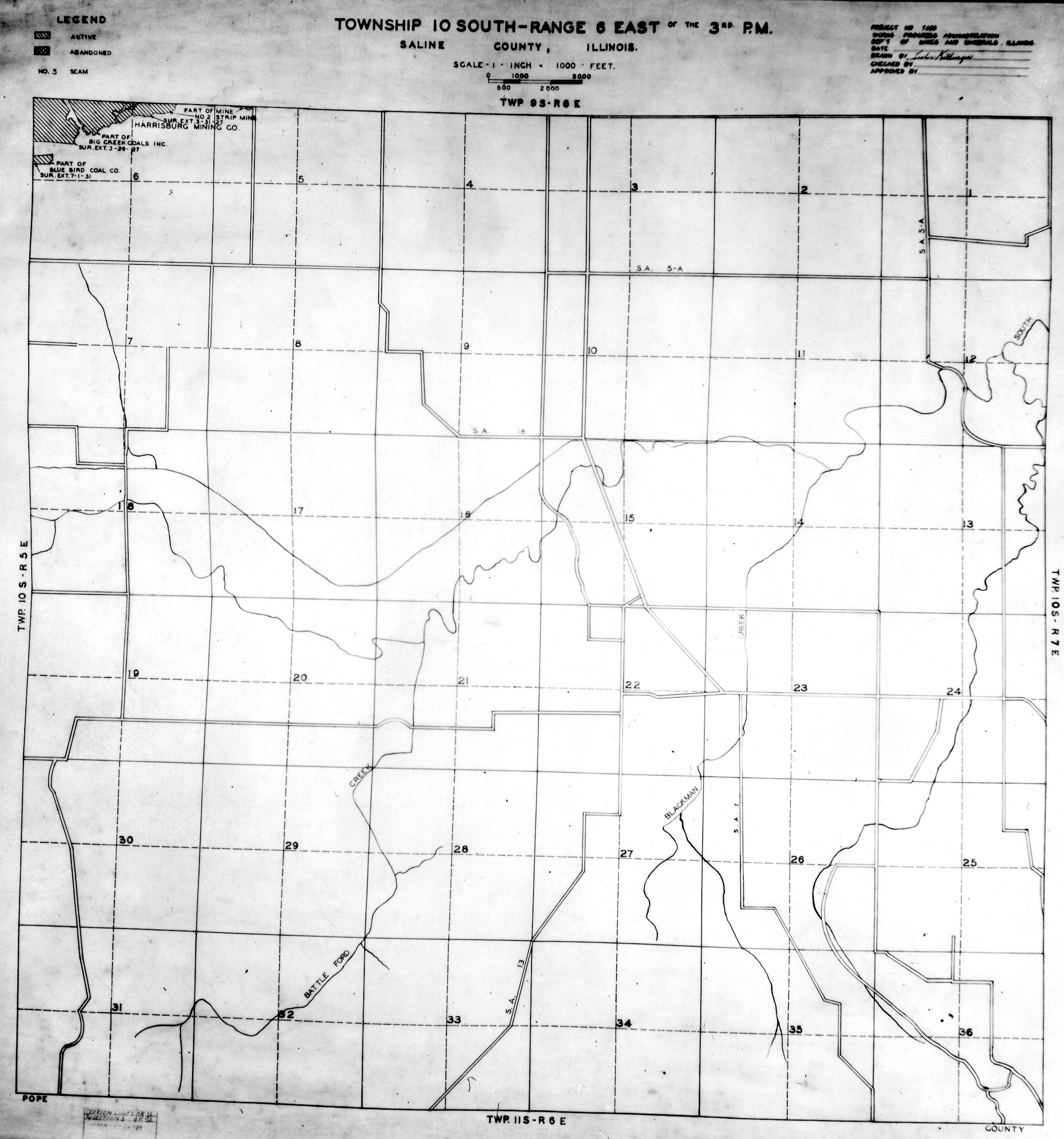
 WPA SALINE 10S6E.jpg 2,150 × 2,300; 1.1 MB
 WPA SALINE 10S7E.jpg 2,170 × 2,320; 1.15 MB
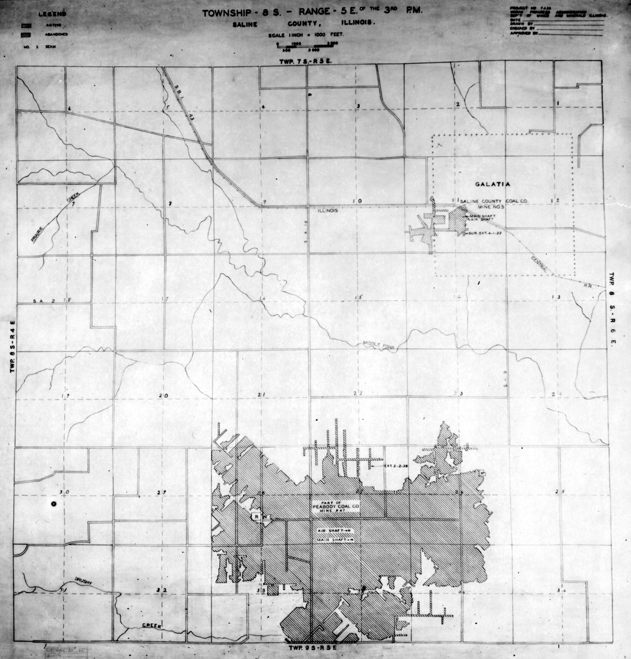
 WPA SALINE 8S5E.jpg 2,179 × 2,275; 1.12 MB
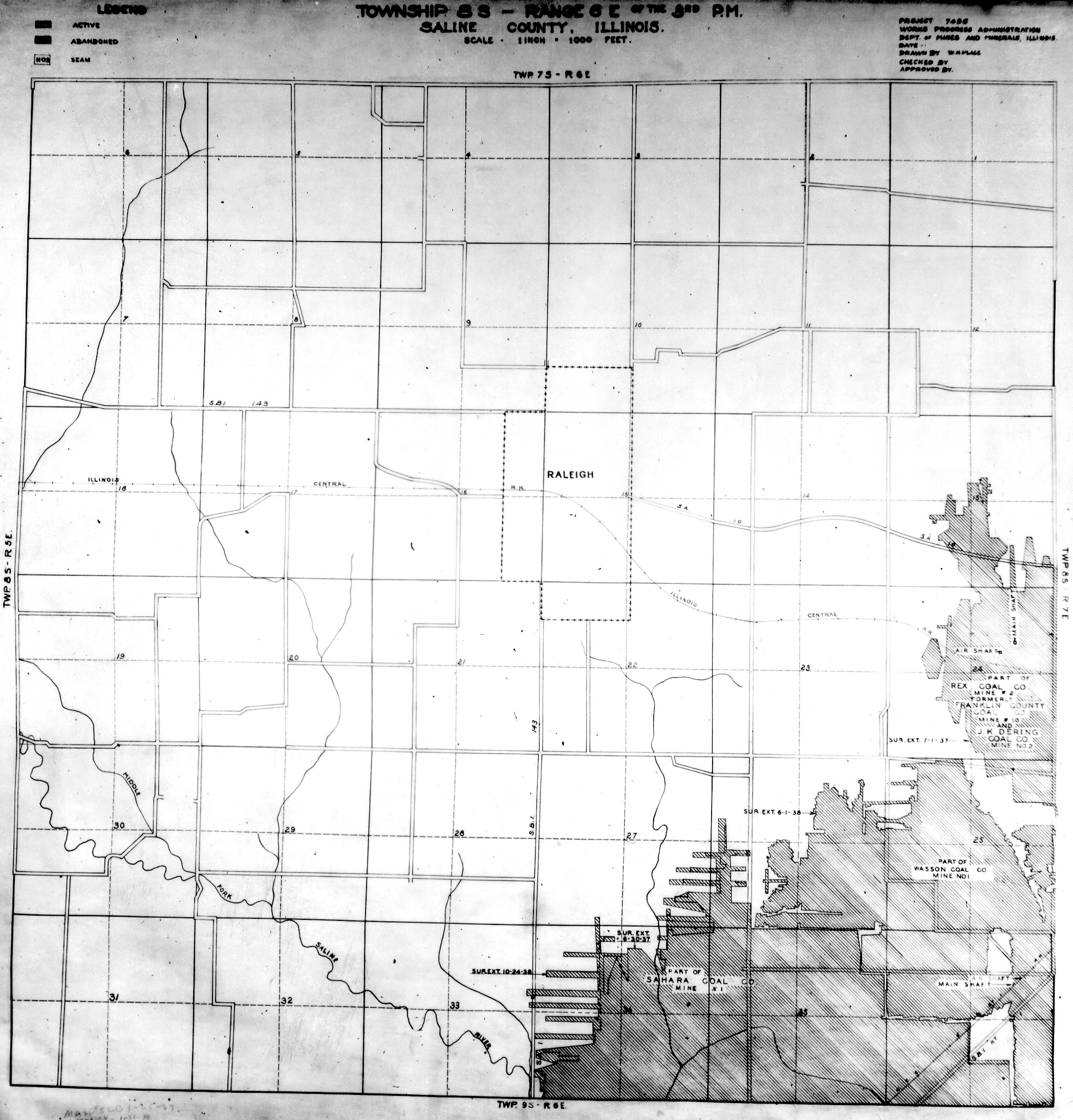
 WPA SALINE 8S6E.jpg 2,096 × 2,188; 1.2 MB
 WPA SALINE 8S7E.jpg 2,120 × 2,340; 1.74 MB
 WPA SALINE 9S5E NO 1.jpg 2,071 × 2,253; 1.27 MB
 WPA SALINE 9S5E NO 2.jpg 2,070 × 2,270; 1.04 MB
 WPA SALINE 9S6E NO 1.jpg 2,184 × 2,310; 1.58 MB
 WPA SALINE 9S6E NO 2.jpg 2,150 × 2,300; 1,020 KB
 WPA SALINE 9S7E.jpg 2,140 × 2,290; 1.17 MB