Mine Index Number: 3290
| Company Name:
|
Saline County Coal Company
|
| Mine Name:
|
Saline County No. 1 Mine
|
| Start Date:
|
1894
|
End Date:
|
1912
|
| Type of Mine:
|
Underground
|
| Total acres shown:
|
102Production also indicates this mine should encompass approximately 300 acres; the area shown on the accompanying map is too small for the reported production. It is likely that part of the outline shown on the accompanying map for Saline County No. 2 (mine index 450) should be included with this mine.
|
| Acres after map date:
|
11
|
General Area of mining acres shown:
|
|
|
|
Shaft, Slope, Drift or Tipple Location(s)
| Type
|
County
|
Township-Range
|
Section
|
Part Section
|
| Main shaft
|
Saline
|
9S 6E
|
31
|
SW NW NE
|
| Air shaft
|
Saline
|
9S 6E
|
31
|
NE NW NE This mine appears to share an air shaft with O’Gara No. 14 Mine (mine index 128).
|
Geology
| Springfield
|
144-150
|
|
8.0
|
6.0
|
MRP
|
Geological Problems Reported
Production
| Company
|
Mine Name
|
Date
|
Production (tons)
|
|
|
|
|
|
| Total Production: 1,744,636
|
Production Notes
Coal Report production (if available)
Sources of Data
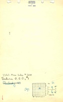
| Microfilm, document 352831This map source was difficult to georegister, since the east-west scale differed from the north-south scale by 800 to 1,000 feet, and did not match other features that were on both the USGS topographic map and source map (railroads, houses). When the north-south scale was used, the topographic features matched reasonably well, but the surrounding mines shown on the source map did not match well. The mine was shifted approximately 250 feet to make a “best fit” between the mines on either side.
|
6-8-1912
|
1:2400
|
1:4469
|
Not final
|
Annotated Bibliography (Data source - brief description of information)
| Coal Reports - Production, ownership, years of operation, seam, depth, thickness.
|
| Directory of Illinois Coal Mines (Saline County) - Mine names, mine index, ownership, years of operation.
|
| Mine notes (Saline County) - Mine type, shaft location, depth, thickness.
|
| Microfilm map, document 352831, reel 03140, frames 400 and 401 - Shaft locations, mine outline, mining method.
|
Mine Notes
Mine Images
Photographs