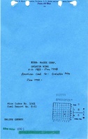
Mine Index Number: 1001
| Company Name:
|
American Coal Company
|
| Mine Name:
|
Galatia Mine
|
| Start Date:
|
1983
|
End Date:
|
2017
|
| Type of Mine:
|
Underground
|
| Total acres shown:
|
17,231 (5,066 in the Herrin Coal, 12,165 in the Springfield Coal)
|
| Acres after map date:
|
|
General Area of mining acres shown:
|
|
|
|
Shaft, Slope, Drift or Tipple Location(s)
| Type
|
County
|
Township-Range
|
Section
|
Part Section
|
| Main shaft
|
Saline
|
8S 6E
|
7
|
SE NW SE
|
| Main slope
|
Saline
|
8S 6E
|
7
|
SW NW SE
|
| Air intake shaft
|
Saline
|
7S 6E
|
29
|
SW SE NE
|
| Air return shaft
|
Saline
|
7S 6E
|
29
|
NW SE NE
|
| Air shaft
|
Saline
|
8S 6E
|
6
|
SW NE NE
|
| Air shaft
|
Saline
|
8S 6E
|
11
|
NE NE SW
|
| Air shaft
|
Saline
|
8S 6E
|
14
|
NE SW SE
|
| Air shaft
|
Saline
|
8S 6E
|
27
|
NE NE NE
|
| Air shaft
|
Saline
|
7S 5E
|
24
|
SW NW SW
|
| Air shaft
|
Saline
|
8S 5E
|
1
|
NW NW NE
|
| Air shaft
|
Saline
|
7S 5E
|
35
|
NE NW NE
|
| Air intake/return shaft
|
Saline
|
7S 6E
|
30
|
SW SE SE
|
| Air shaft
|
Saline
|
7S 5E
|
24
|
SW SW SW
|
| Air shaft
|
Hamilton
|
7S 6E
|
18
|
SE NE NE
|
| Air shaft
|
Hamilton
|
7S 5E
|
13
|
NE NE SE
|
| Air shaft
|
Hamilton
|
7S 5E
|
10
|
SE NE SE
|
| Air shaft
|
Hamilton
|
7S 5E
|
10
|
SW NE NW
|
| Air shaft
|
Hamilton
|
7S 6E
|
7
|
NE NW SE
|
Geology
| Herrin The Herrin seam was inactive from 1995 to 2003.
|
|
|
|
|
CRP, LW
|
Geological Problems Reported
Geologic problems are confidential information and not reported for active mines.
Production
| Company
|
Mine Name
|
Date
|
Production (tons)
|
| American Coal Company
|
GalatiaIn 2006, the portion of the mine in the Herrin seam became known as New Era Mine, and the portion of the mine in the Springfield seam became known as Galatia North Mine.
|
1998-2017
|
133,418,031Production from 2000-2017 includes production for the Millennium Portal (mine index 1032).
|
|
|
|
|
|
|
|
| Total Production: 180,644,663
|
Production Notes
Coal Report production (if available)
Sources of Data
| Company (Herrin)
|
2-6-2012
|
1:24000
|
1:24000
|
Not final
|
| Company (Springfield)
|
2-6-2012
|
1:24000
|
1:24000
|
Not final
|
Annotated Bibliography (Data source - brief description of information)
| Coal Reports - Production, ownership, years of operation.
|
| Directory of Illinois Coal Mines (Saline County) - Mine names, mine index, ownership, years of operation.
|
| Mine notes (Saline County) - Mine type, shaft location, seam.
|
| Company map, Coal Section files (digital file, Herrin Coal) - Mine outline, shaft and slope locations, mining method.
|
| Company map, Coal Section files (digital file, Springfield Coal) - Mine outline, shaft and slope locations, mining method.
|
Mine Notes
Mine Images
![[[:Galatia|Galatia]]](https://wikiimage.isgs.illinois.edu/ilmines/saline/thumbnails/M1001_6-374p_th.jpg) These files may not be true to scale and are not georgistered. These files may not be true to scale and are not georgistered.
|
Map Type:
|
Company
|
| Map ID:
|
6-374p
|
| Company:
|
|
| Mine Name:
|
Galatia
|
| Caption:
|
6-Seam (Herrin) workings 12/31/2009 & 1 Year Projection
|
| Map Date:
|
02/23/2010
|
| Map Status:
|
Not Final
|
| Image Credit:
|
|
| Note:
|
Draw date is give as 02/23/09, but should be 02/23/10
|
| More Info:
|
M1001 6-374p
|
| Full Res Download:These files are true to scale and most are georegistered for gis software. These files may be a very large (>1GB) download!
|
https://wikiimage.isgs.illinois.edu/ilmines/saline/M1001 6-374p.zip
|
![[[:Galatia|Galatia]]](https://wikiimage.isgs.illinois.edu/ilmines/saline/thumbnails/M1001_6-374o_th.jpg) These files may not be true to scale and are not georgistered. These files may not be true to scale and are not georgistered.
|
Map Type:
|
Company
|
| Map ID:
|
6-374o
|
| Company:
|
|
| Mine Name:
|
Galatia
|
| Caption:
|
5-Seam (Springfield) workings 12/31/09 & 1 Year Projections
|
| Map Date:
|
02/23/2010
|
| Map Status:
|
Not Final
|
| Image Credit:
|
|
| Note:
|
Draw date is give as 02/23/09, but should be 02/23/10
|
| More Info:
|
M1001 6-374o
|
| Full Res Download:These files are true to scale and most are georegistered for gis software. These files may be a very large (>1GB) download!
|
https://wikiimage.isgs.illinois.edu/ilmines/saline/M1001 6-374o.zip
|
![[[:Galatia|Galatia]]](https://wikiimage.isgs.illinois.edu/ilmines/saline/thumbnails/M1001_6-374n_th.jpg) These files may not be true to scale and are not georgistered. These files may not be true to scale and are not georgistered.
|
Map Type:
|
Company
|
| Map ID:
|
6-374n
|
| Company:
|
|
| Mine Name:
|
Galatia
|
| Caption:
|
6-Seam (Herrin) workings 12/31/08 & 1 Year Projection
|
| Map Date:
|
02/12/2009
|
| Map Status:
|
Not Final
|
| Image Credit:
|
|
| Note:
|
|
| More Info:
|
M1001 6-374n
|
| Full Res Download:These files are true to scale and most are georegistered for gis software. These files may be a very large (>1GB) download!
|
https://wikiimage.isgs.illinois.edu/ilmines/saline/M1001 6-374n.zip
|
![[[:Galatia|Galatia]]](https://wikiimage.isgs.illinois.edu/ilmines/saline/thumbnails/M1001_6-374m_th.jpg) These files may not be true to scale and are not georgistered. These files may not be true to scale and are not georgistered.
|
Map Type:
|
Company
|
| Map ID:
|
6-374m
|
| Company:
|
|
| Mine Name:
|
Galatia
|
| Caption:
|
5-Seam (Springfield) Workings 12/31/08 & 1 Year Projection
|
| Map Date:
|
02/12/2009
|
| Map Status:
|
Not Final
|
| Image Credit:
|
|
| Note:
|
|
| More Info:
|
M1001 6-374m
|
| Full Res Download:These files are true to scale and most are georegistered for gis software. These files may be a very large (>1GB) download!
|
https://wikiimage.isgs.illinois.edu/ilmines/saline/M1001 6-374m.zip
|
Photographs
![[[:New Future and New Era|New Future and New Era]]](https://wikiimage.isgs.illinois.edu/ilmines/saline/thumbnails/m1001_6_374aa_2018_th.jpg)
![[[:Galatia|Galatia]]](https://wikiimage.isgs.illinois.edu/ilmines/saline/thumbnails/m1001_6_374e_springfield_th.jpg)
![[[:New Future and New Era|New Future and New Era]]](https://wikiimage.isgs.illinois.edu/ilmines/saline/thumbnails/m1001_6_374Y_herrin_th.jpg)