Mine Index Number: 4595
| Company Name:
|
H. and V. Coal Company
|
| Mine Name:
|
H. and V. No. 1 Mine
|
| Start Date:
|
1959
|
End Date:
|
February 1960
|
| Type of Mine:
|
Surface
|
| Total acres shown:
|
None
|
| Acres after map date:
|
5
|
General Area of mining acres shown:
|
|
|
|
Shaft, Slope, Drift or Tipple Location(s)
| Type
|
County
|
Township-Range
|
Section
|
Part Section
|
| Pit
|
Saline
|
10S 7E
|
11
|
NE SW
|
Geology
Geological Problems Reported
Production
| Company
|
Mine Name
|
Date
|
Production (tons)
|
Production Notes
Coal Report production (if available)
Sources of Data
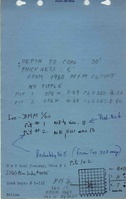
| Mine notes
|
10-7-1981
|
(text only)
|
1:24000
|
Secondary source
|
| Digital ortho-photographic quadrangle
|
2000
|
1:24000
|
1:24000
|
Secondary source
|
Annotated Bibliography (Data source - brief description of information)
| Coal Reports - Production, ownership, years of operation.
|
| Directory of Illinois Coal Mines (Saline County) - Mine names, mine index, ownership, years of operation.
|
| Mine notes (Saline County) - Mine type, mine location, seam, thickness.
|
| USGS digital ortho-photographic Rudement Quadrangle - Mine location.
|
Mine Notes
Mine Images
Photographs