Rudement Quadrangle
Mining in the Rudement Quadrangle
The earliest mining in the Rudement Quadrangle was related to the salt works and took place in 24-T9S-R7E before 1875. The precise location is not known, but would be within the general area of mining shown on the map of the Springfield Coal. The evaporating pans and boilers used about 300 bushels a day.
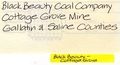
More general underground mining began in 1909, with the Reynolds Mine (mine index 4463), who were the sole operators until 1915, when the Colbert Mine (mine index 133) opened and operated for two years. Surface mining began in 1935, with the Cottage Grove Mine (mine index 3298), but occurred only at a small scale until the mid 1950s, when the Vinyard Mine ([[0804}mine index 804]]), Walnut Grove Mine (mine index 840), and J. & W. No. 1 Mine (mine index 3330) began mining substantial areas. Mining continues today at an underground mine, the I-1 Underground Mine (mine index 1035) in the Davis Coal. Several seams were mined in this quadrangle. The Herrin Coal was mostly surface-mined. The Springfield Coal was shallow enough to surface-mine over much of the quadrangle, but was deep enough to have stable roof conditions for a large underground mine in the northern part of the quadrangle (mine index 1015, Big Ridge Portal No. 1 Mine). The Dekoven Coal was mostly surface-mined in conjunction with the Davis Coal, but was generally too thin to support mining operations on its own. Davis Coal was both surface- and underground-mined.
The southeastern quarter of this quadrangle is a part of the Eagle Valley Syncline, which ends abruptly where the Shawneetown Fault turns southward. The geology of the area is very complex, with many fault zones, including the Shawneetown Fault Zone, Herod Fault Zone, and the Cottage Grove Fault System. These structures are beyond the scope of this introduction, but more information can be found in the Geologic Map of the Rudement Quadrangle, Saline County, Illinois (ISGS IGQ003) and Structural Geology of Southeastern Illinois and Vicinity (ISGS Circular 538).
Map and Directory PDF Download
Coal Mines In Illinois Rudement Quadrangle
Mines that Appear on the Rudement Quadrangle
Unlocated Mines
Saline County
Pages in category "Rudement Quadrangle"
The following 94 pages are in this category, out of 94 total.
2
3
4
Media in category "Rudement Quadrangle"
The following 49 files are in this category, out of 49 total.
 M0126 minenotes.pdf 745 × 1,183, 10 pages; 2.21 MB
 M0127 minenotes.pdf 731 × 1,172, 31 pages; 6.94 MB
 M0131 minenotes.pdf 739 × 1,172, 6 pages; 1.22 MB
 M0132 minenotes.pdf 739 × 1,172, 4 pages; 798 KB
 M0133 minenotes.pdf 731 × 1,160, 3 pages; 445 KB
 M0646 minenotes.pdf 733 × 1,172, 7 pages; 1.39 MB
 M0647 minenotes.pdf 733 × 1,172, 10 pages; 1.13 MB
 M0804 minenotes.pdf 731 × 1,172, 8 pages; 1.75 MB
 M0840 minenotes.pdf 718 × 1,160, 41 pages; 8.27 MB
 M0915 minenotes.pdf 731 × 1,172, 17 pages; 3.37 MB
 M0983 minenotes.pdf 718 × 1,154, 29 pages; 5.78 MB
 M1003 minenotes.pdf 739 × 1,172, 8 pages; 1.51 MB
 M1009 minenotes.pdf 739 × 1,172, 10 pages; 2.21 MB
 M1015 minenotes.pdf 731 × 1,172, 25 pages; 6 MB
 M1044 minenotes.pdf 560 × 302, 11 pages; 4.43 MB
 M2286 minenotes.pdf 731 × 1,172, 4 pages; 786 KB
 M3297 minenotes.pdf 733 × 1,172, 3 pages; 392 KB
 M3298 minenotes.pdf 733 × 1,172, 3 pages; 360 KB
 M3299 minenotes.pdf 731 × 1,172, 3 pages; 535 KB
 M3300 minenotes.pdf 731 × 1,172, 3 pages; 531 KB
 M3301 minenotes.pdf 731 × 1,172, 3 pages; 551 KB
 M3302 minenotes.pdf 731 × 1,172, 4 pages; 618 KB
 M3303 minenotes.pdf 731 × 1,172, 5 pages; 1.01 MB
 M3305 minenotes.pdf 704 × 1,166, 7 pages; 1.6 MB
 M3306 minenotes.pdf 733 × 1,172, 9 pages; 1.66 MB
 M3307 minenotes.pdf 733 × 1,172, 2 pages; 342 KB
 M3308 minenotes.pdf 733 × 1,172, 3 pages; 551 KB
 M3309 minenotes.pdf 733 × 1,172, 3 pages; 538 KB
 M3310 minenotes.pdf 733 × 1,172, 2 pages; 327 KB
 M3312 minenotes.pdf 733 × 1,172, 2 pages; 336 KB
 M3313 minenotes.pdf 733 × 1,172, 3 pages; 539 KB
 M3327 minenotes.pdf 739 × 1,172, 3 pages; 512 KB
 M3328 minenotes.pdf 739 × 1,172, 4 pages; 784 KB
 M3329 minenotes.pdf 739 × 1,172, 3 pages; 608 KB
 M3330 minenotes.pdf 739 × 1,172, 25 pages; 4.85 MB
 M3332 minenotes.pdf 739 × 1,172, 5 pages; 1.05 MB
 M3333 minenotes.pdf 731 × 1,160, 3 pages; 474 KB
 M3334 minenotes.pdf 731 × 1,160, 3 pages; 500 KB
 M3335 minenotes.pdf 731 × 1,160, 3 pages; 503 KB
 M4179 minenotes.pdf 733 × 1,172, 3 pages; 577 KB
 M4180 minenotes.pdf 733 × 1,172, 4 pages; 773 KB
 M4184 minenotes.pdf 739 × 1,172, 6 pages; 1.22 MB
 M4199 minenotes.pdf 750 × 1,183, 4 pages; 716 KB
 M4595 minenotes.pdf 739 × 1,172, 4 pages; 796 KB
 M4597 minenotes.pdf 739 × 1,172, 6 pages; 1.21 MB
 M4598 minenotes.pdf 739 × 1,172, 4 pages; 826 KB
 M4728 minenotes.pdf 733 × 1,172, 2 pages; 315 KB
 M4734 minenotes.pdf 733 × 1,172, 3 pages; 589 KB
 M4764 minenotes.pdf 731 × 1,172, 3 pages; 614 KB