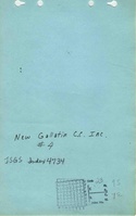
Mine Index Number: 4734
| Company Name:
|
New Gallatin Coal Company
|
| Mine Name:
|
New Gallatin No. 4 Mine
|
| Start Date:
|
1966
|
End Date:
|
May 1966
|
| Type of Mine:
|
Underground
|
| Total acres shown:
|
8
|
| Acres after map date:
|
|
General Area of mining acres shown:
|
|
|
|
Shaft, Slope, Drift or Tipple Location(s)
| Type
|
County
|
Township-Range
|
Section
|
Part Section
|
| Main drift
|
Saline
|
9S 7E
|
23
|
NW NE SW
|
| Air drift
|
Saline
|
9S 7E
|
23
|
NW NE SW
|
| Air drift
|
Saline
|
9S 7E
|
23
|
SE SW NW
|
Geology
Geological Problems Reported
The southern entries are labeled “bad top” on the source map.
Production
| Company
|
Mine Name
|
Date
|
Production (tons)
|
Production Notes
Coal Report production (if available)
Sources of Data
| Microfilm, document 352818
|
5-11-1966
|
1:2400
|
1:2814
|
Final
|
Annotated Bibliography (Data source - brief description of information)
| Coal Reports - Production, ownership, years of operation, mining method.
|
| Directory of Illinois Coal Mines (Saline County) - Mine names, mine index, ownership, years of operation.
|
| Mine notes (Saline County) - Seam.
|
| Microfilm map, document 352818, reel 03140, frame 352 - Drift locations, mine outline, mining method, geologic problems.
|
Mine Notes
Mine Images
Photographs