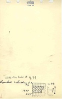
Mine Index Number: 4179
| Company Name:
|
Regenhardt and Southern Construction Company
|
| Mine Name:
|
Regenhardt and Southern No. 4 Mine
|
| Start Date:
|
1951
|
End Date:
|
March 1953
|
| Type of Mine:
|
Surface
|
| Total acres shown:
|
16 Production indicates approximately 22 acres were mined.
|
| Acres after map date:
|
|
General Area of mining acres shown:
|
|
|
|
Shaft, Slope, Drift or Tipple Location(s)
| Type
|
County
|
Township-Range
|
Section
|
Part Section
|
Geology
| Springfield
|
24
|
|
|
4.5
|
Surface
|
Geological Problems Reported
Production
| Company
|
Mine Name
|
Date
|
Production (tons)
|
|
|
|
|
|
| Total Production: 157,040
|
Production Notes
Coal Report production (if available)
Sources of Data
| ISGS map library, 4102 a-7, sheet 2
|
1981-1983
|
1:24000
|
1:24000
|
Secondary source
|
| Microfilm, document 352818
|
5-11-1966
|
1:2400
|
1:2814
|
Secondary source
|
Annotated Bibliography (Data source - brief description of information)
| Coal Reports - Production, ownership, years of operation.
|
| Directory of Illinois Coal Mines (Saline County) - Mine names, mine index, ownership, years of operation.
|
| Mine notes (Saline County) - Pit location, seam.
|
| ISGS map library, 4102 1-7, sheet 2, work map for Rudement Quadrangle Geologic Map - Mine outline.
|
| Microfilm map, document 352818, reel 03140, frame 352 - Mine outline.
|
Mine Notes
Mine Images
Photographs