Mine Index Number: 0664
| Company Name:
|
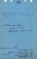
Sahara Coal Company, Inc.
|
| Mine Name:
|
Sahara No. 5 Mine
|
| Start Date:
|
1938
|
End Date:
|
August 1972
|
| Type of Mine:
|
Underground
|
| Total acres shown:
|
4,038
|
| Acres after map date:
|
|
General Area of mining acres shown:
|
|
|
|
Shaft, Slope, Drift or Tipple Location(s)
| Type
|
County
|
Township-Range
|
Section
|
Part Section
|
| Main slope
|
Saline
|
9S 5E
|
29
|
SW SE NW
|
| Slope
|
Saline
|
9S 5E
|
29
|
SE SE NW
|
Geology
| Springfield
|
135
|
|
|
4.5-5.0
|
RPP
|
Geological Problems Reported
The coal contained pyrite in nodules and lenses up to 1.5 inches thick. Pyrite was also present as stringers at the base of the seam and locally as fracture fillings along with some calcite.
Production
| Company
|
Mine Name
|
Date
|
Production (tons)
|
|
|
|
|
|
| Total Production: 17,626,712
|
Production Notes
Coal Report production (if available)
Sources of Data
| Microfilm, document 352839
|
7-11-1972
|
1:2400
|
1:4300
|
Final
|
| Company, 10-5-49
|
6-23-1977
|
1:6600
|
1:6600
|
Secondary source
|
Annotated Bibliography (Data source - brief description of information)
| Coal Reports - Production, ownership, years of operation, thickness.
|
| Directory of Illinois Coal Mines (Saline County) - Mine names, mine index, ownership, years of operation.
|
| Mine notes (Saline County) - Mine type, slope location, seam, depth, thickness.
|
| Microfilm map, document 352839, reel 03140, frames 425-441 - Slope locations, mine outline, mining method.
|
| ISGS Coal Section files, 10-5-49, coal company compilation map - Mine outline (west, 25-T9S-R4E).
|
Mine Notes
Mine Images
 These files may not be true to scale and are not georgistered. These files may not be true to scale and are not georgistered.
|
Map Type:
|
Coal company compilation map
|
| Map ID:
|
10-5-49
|
| Company:
|
|
| Mine Name:
|
|
| Caption:
|
|
| Map Date:
|
6/23/77
|
| Map Status:
|
Secondary
|
| Image Credit:
|
|
| Note:
|
|
| More Info:
|
M0664b.jpg
|
| Full Res Download:These files are true to scale and most are georegistered for gis software. These files may be a very large (>1GB) download!
|
https://wikiimage.isgs.illinois.edu/ilmines/saline/m0664b.zip
|
![[[:Sahara No. 5|Sahara No. 5]]](https://wikiimage.isgs.illinois.edu/ilmines/saline/thumbnails/m0664_th.jpg) These files may not be true to scale and are not georgistered. These files may not be true to scale and are not georgistered.
|
Map Type:
|
Microfilm
|
| Map ID:
|
352839, 3140, 425-441, 26x
|
| Company:
|
Sahara Coal Company, Inc.
|
| Mine Name:
|
Sahara No. 5
|
| Caption:
|
|
| Map Date:
|
07-11-1972
|
| Map Status:
|
Final
|
| Image Credit:
|
|
| Note:
|
|
| More Info:
|
M0664.jpg
|
| Full Res Download:These files are true to scale and most are georegistered for gis software. These files may be a very large (>1GB) download!
|
https://wikiimage.isgs.illinois.edu/ilmines/saline/m0664.zip
|
Photographs