Mine Index Number: 0125
| Company Name:
|
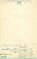
Eldorado Coal Corporation
|
| Mine Name:
|
Eldorado Mine
|
| Start Date:
|
1917
|
End Date:
|
April 1953
|
| Type of Mine:
|
Underground
|
| Total acres shown:
|
2,076
|
| Acres after map date:
|
|
General Area of mining acres shown:
|
|
|
|
Shaft, Slope, Drift or Tipple Location(s)
| Type
|
County
|
Township-Range
|
Section
|
Part Section
|
| Main shaft (11.33x17)
|
Saline
|
8S 6E
|
24
|
NW SE NE
|
| Air shaft (11.33x18)
|
Saline
|
8S 6E
|
24
|
SE SW NE
|
Geology
| Springfield
|
465 (456-465)
|
5.0
|
6.5
|
5.42-6.5
|
MRP
|
Geological Problems Reported
The mine outline shown on the accompanying map indicates the presence of many faults and dikes throughout the mine. Most trend northwest-southeast. The most bothersome dike cut diagonally through 13 and 24-T8S-R6E, and was 25 feet wide in the entry northwest of the hoist shaft, flanked by a total of 12 feet of naturally coked coal. At least two more dikes were noted, both in the northeastern part of the mine. One southwest-northeast trending fault, that had 35 feet of displacement, was noted south of the air shaft. The roof contained many slips, which caused many roof falls. One large area in the northern part of the mine (13-T8S-R6E and 18-T8S-R7E) was unmined because the coal was split. The source map indicates the upper split was 4.0 to 4.5 feet thick, with 1 foot or less of coal in the lower split below 2 feet of rock. Pyrite lenses were common in the coal. The floor had many slips, but no heaving was reported.
Production
| Company
|
Mine Name
|
Date
|
Production (tons)
|
|
|
|
|
|
| Total Production: 11,110,003
|
Production Notes
Coal Report production (if available)
Sources of Data
| Microfilm, document 352805
|
4-18-1953
|
1:2400
|
1:5959
|
Final
|
Annotated Bibliography (Data source - brief description of information)
| Coal Reports - Production, ownership, years of operation.
|
| Directory of Illinois Coal Mines (Saline County) - Mine names, mine index, ownership, years of operation.
|
| Mine notes (Saline County) - Mine type, shaft location, seam, depth, thickness, geologic problems.
|
| Microfilm map, document 352805, reel 03140, frames 352-357 - Shaft locations, mine outline, mining method, geologic problems.
|
| Company map, ISGS map library, 4103.S32 d5.2-1 - Geologic problems (handwritten on map by G. H. Cady, 1919)
|
Mine Notes
Mine Images
Photographs