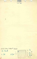
Mine Index Number: 3323
| Company Name:
|
Evert Ward
|
| Mine Name:
|
Ward No. 2 Mine
|
| Start Date:
|
1934
|
End Date:
|
1939
|
| Type of Mine:
|
Underground
|
| Total acres shown:
|
None
|
| Acres after map date:
|
Less than 1
|
General Area of mining acres shown:
|
|
|
Not Shown On Map. The area was later surface-mined by Walnut Grove Mine (mine index 840), so this mine is not shown on the accompanying map.
|
Shaft, Slope, Drift or Tipple Location(s)
| Type
|
County
|
Township-Range
|
Section
|
Part Section
|
| Main slope
|
Saline
|
10S 6E
|
16
|
SW NW NW
|
Geology
Geological Problems Reported
Production
| Company
|
Mine Name
|
Date
|
Production (tons)
|
Production Notes
Coal Report production (if available)
Sources of Data
| ISGS field notes (G. H. Cady)
|
7-16-1925
|
(text only)
|
1:24000Point plotted onto 1:24,000 USGS quadrangle and digitized.
|
Secondary source
|
| Microfilm, document 352764
|
9-25-1942
|
1:1200
|
1:1241
|
Secondary source
|
Annotated Bibliography (Data source - brief description of information)
| Coal Reports - Production, ownership, years of operation.
|
| Directory of Illinois Coal Mines (Saline County) - Mine names, mine index, ownership, years of operation.
|
| Mine notes (Saline County) - Mine type, slope location, depth, thickness.
|
| ISGS field notes (Saline County) - Mine type, slope location, thickness.
|
| Microfilm map, document 352764, reel 03140, frame 285 - Mine location.
|
Mine Notes
Mine Images
Photographs