4197: Difference between revisions
Kate.O'Brien (talk | contribs) (Created page with "{{Sidebar Info Query}} {{Header |checked=1st Entry |unlocated=No |shown_on_map=Yes |Mine-index=4197 |Coal_co=R. and F. Coal Company |Mine Name Header=R. and F. No. 1 Mine |min...") |
No edit summary |
||
| Line 1: | Line 1: | ||
{{Sidebar Info Query}} | {{Sidebar Info Query}} | ||
{{Header | {{Header | ||
|checked= | |checked=Checked OK | ||
|unlocated=No | |unlocated=No | ||
|shown_on_map=Yes | |shown_on_map=Yes | ||
| Line 8: | Line 8: | ||
|Mine Name Header=R. and F. No. 1 Mine | |Mine Name Header=R. and F. No. 1 Mine | ||
|mine_type=Surface | |mine_type=Surface | ||
|mined-out-area=16{{#info:Production indicates approximately 3 acres were mined.|note}} | |mined-out-area=16 {{#info:Production indicates approximately 3 acres were mined.|note}} | ||
|county1=Saline | |county1=Saline | ||
|quad1=Carrier Mills | |quad1=Carrier Mills | ||
Revision as of 10:47, February 9, 2022
Mine Index Number: 4197
| Company Name: | R. and F. Coal Company | ||
|---|---|---|---|
| Mine Name: | R. and F. No. 1 Mine | ||
| Start Date: | 1965 | End Date: | August 1966 |
| Type of Mine: | Surface | ||
| Total acres shown: | 16 Production indicates approximately 3 acres were mined. | ||
| Acres after map date: | General Area of mining acres shown: | ||
Shaft, Slope, Drift or Tipple Location(s)
| Type | County | Township-Range | Section | Part Section |
|---|
| Tipple / pit | Saline | 9S 5E | 34 | SW SW SE |
Geology
| Thickness (ft) | |||||
|---|---|---|---|---|---|
| Seam | Depth (ft) | Min | Max | Ave | Mining Method |
| Springfield | 25-30 | 4.0 | Surface |
Geological Problems Reported
Production
| Company | Mine Name | Date | Production (tons) |
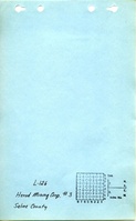
| Herod Mining Corporation | Herod No. 3 | 1965-1965 | 6,466 |
| R. and F. Coal Company | R. and F. No. 1 | 1966-1966 | 14,320 |
Production Notes
Coal Report production (if available)
Sources of Data
| Source Map | Map Date | Original Scale | Digitized Scale | Map Type |
| Coal Section files, 7a-01-38 | 1966 | 1:7870 | 1:7870 | Secondary source |
Annotated Bibliography (Data source - brief description of information)
| Coal Reports - Production, ownership, years of operation, seam, depth, thickness, mining method. |
| Directory of Illinois Coal Mines (Saline County) - Mine names, mine index, ownership, years of operation. |
| Coal Section files, 7a-01-38, DMM surface mine updates on 1959 aerial photo base map - Mine outline. |
Mine Notes
Mine Images

Photographs