0626: Difference between revisions
Alan.Myers (talk | contribs) No edit summary |
No edit summary |
||
| Line 1: | Line 1: | ||
{{Sidebar Info Query}} | {{Sidebar Info Query}} | ||
{{Header | {{Header | ||
|checked=1st Entry | |||
|unlocated=No | |unlocated=No | ||
|shown_on_map=Yes | |shown_on_map=Yes | ||
| Line 52: | Line 53: | ||
|Date=1905-1942 {{#info: |note}} | |Date=1905-1942 {{#info: |note}} | ||
|Production=5,246,968 | |Production=5,246,968 | ||
|Sum=Yes | |||
| | |||
}} | }} | ||
===Production Notes=== | ===Production Notes=== | ||
Revision as of 13:53, June 1, 2022
Mine Index Number: 0626
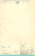
| Company Name: | Prairie Coal Company | ||
|---|---|---|---|
| Mine Name: | Prairie Mine | ||
| Start Date: | 1905 | End Date: | March 1942 |
| Type of Mine: | Underground | ||
| Total acres shown: | 777 | ||
| Acres after map date: | General Area of mining acres shown: | ||
Shaft, Slope, Drift or Tipple Location(s)
| Type | County | Township-Range | Section | Part Section |
|---|
| Main shaft | St. Clair | 2N 8W | 27 | SE SW SW |
| Air shaft | St. Clair | 2N 8W | 27 | SE SW SW |
Geology
| Thickness (ft) | |||||
|---|---|---|---|---|---|
| Seam | Depth (ft) | Min | Max | Ave | Mining Method |
| Herrin | 205 | 7.0 | MRP |
Geological Problems Reported
Production
| Company | Mine Name | Date | Production (tons) |
| Prairie Coal Company | Prairie | 1905-1942 | 5,246,968 |
| Total Production: 5,246,968 | |||
Production Notes
Coal Report production (if available)
Sources of Data
| Source Map | Map Date | Original Scale | Digitized Scale | Map Type |
| Company, 4103.S31i5.1-18 | 10-30-1942 | 1:2400 | 1:2400 | Final |
Annotated Bibliography (Data source - brief description of information)
| Coal Reports - Production, ownership, years of operation. |
| Directory of Illinois Coal Mines (St. Clair County) - Mine names, mine index, ownership, years of operation. |
| Mine notes (St. Clair County) - Shaft location, mine type, seam, depth, thickness. |
| Company map, ISGS map library, 4103.S31 i5.1-18 - Shaft locations, mine outline, mining method. |
Mine Notes
Mine Images

Photographs