0078: Difference between revisions
No edit summary |
No edit summary |
||
| Line 1: | Line 1: | ||
{{Sidebar Info Query}} | {{Sidebar Info Query}} | ||
{{Header | {{Header | ||
|checked= | |checked=Checked OK | ||
|unlocated=No | |unlocated=No | ||
|shown_on_map=Yes | |shown_on_map=Yes | ||
| Line 8: | Line 8: | ||
|Mine Name Header=Superior Mine | |Mine Name Header=Superior Mine | ||
|mine_type=Underground | |mine_type=Underground | ||
|mined-out-area=470 | |mined-out-area=470; production from the Valley Mine (mine index [[3615]]) was hoisted via Superior Mine's shaft. | ||
|after_map=45 | |after_map=45 | ||
|indicated=No | |||
|county1=St. Clair | |county1=St. Clair | ||
|quad1=French Village | |quad1=French Village | ||
| Line 21: | Line 22: | ||
{{Shaft locations header}} | {{Shaft locations header}} | ||
{{Shaft locations | {{Shaft locations | ||
|shaft_type=Main shaft {{#info:Ventilation was provided by underground connection with Crown No. 2 Mine (mine index 3543).|note}} | |shaft_type=Main shaft {{#info:Ventilation was provided by underground connection with Crown No. 2 Mine (mine index [[3543]]).|note}} | ||
|County=St. Clair | |County=St. Clair | ||
|Town-Range=1N 9W | |Town-Range=1N 9W | ||
Revision as of 10:52, September 23, 2022
Mine Index Number: 0078
| Company Name: | Perry Coal Company | ||
|---|---|---|---|
| Mine Name: | Superior Mine | ||
| Start Date: | 1902 | End Date: | 1930 |
| Type of Mine: | Underground | ||
| Total acres shown: | 470; production from the Valley Mine (mine index 3615) was hoisted via Superior Mine's shaft. | ||
| Acres after map date: | 45 | General Area of mining acres shown: | |
Shaft, Slope, Drift or Tipple Location(s)
| Type | County | Township-Range | Section | Part Section |
|---|
| Main shaft Ventilation was provided by underground connection with Crown No. 2 Mine (mine index 3543). | St. Clair | 1N 9W | 1 | NW SE SW |
Geology
| Thickness (ft) | |||||
|---|---|---|---|---|---|
| Seam | Depth (ft) | Min | Max | Ave | Mining Method |
| Herrin | 153-160 | 5.0 | 8.0 | 6.6-7.0 | MRP |
Geological Problems Reported
The roof consisted of black shale, which contained concretions in the lowest 6 inches. Irregular clay veins and minor faults were present in this mine, causing poor roof conditions over small areas. Some faults had 2-foot offsets; a 4-foot offset was noted in one instance. In the western workings, old channels eroded the limestone roof, leaving glacial till directly above the coal. Those areas were unminable. A squeeze was noted in SE SW SE 36-T2N-R9W. Areas of thin rock above the coal were noted in the northern parts of the mine.
Production
| Company | Mine Name | Date | Production (tons) |
| Superior Coal and Mining Company | Superior | 1902-1921 | 2,653,068 |
| Perry Coal Company | Superior | 1921-1923 | 120,423 |
| Perry Coal Company | Superior | 1923-1930 Idle 1925 | 261,724 Production after map date |
| Total Production: 3,035,215 | |||
Production Notes
Coal Report production (if available)
Sources of Data
| Source Map | Map Date | Original Scale | Digitized Scale | Map Type |
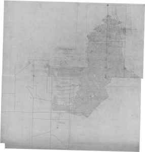
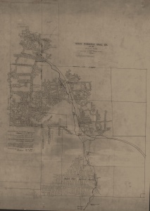
| State archive, PB_96 | 9-15-1923 | 1:2400 | 1:2400 | Not final |
| State archive, IL_221 | 2-2-1930 | 1:2400 | 1:2400 | Final |
Annotated Bibliography (Data source - brief description of information)
| Coal Reports - Production, ownership, years of operation. |
| Directory of Illinois Coal Mines (St. Clair County) - Mine names, mine index, ownership, years of operation. |
| Mine notes (St. Clair County) - Thickness, depth, seam, mine type, geologic problems. |
| State archive, PB_96 - Shaft location, mine outline, mining method, geologic problems. |
| State archive, IL_221 - Mine outline (easternmost portion). |
Mine Notes
Mine Images
Photographs


