0423: Difference between revisions
No edit summary |
No edit summary |
||
| Line 8: | Line 8: | ||
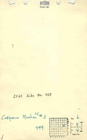
|Mine Name Header=Cosgrove-Meehan No. 3 Mine | |Mine Name Header=Cosgrove-Meehan No. 3 Mine | ||
|mine_type=Underground | |mine_type=Underground | ||
|mined-out-area= | |mined-out-area=623 | ||
|indicated=No | |indicated=No | ||
|county1=Williamson | |county1=Williamson | ||
| Line 87: | Line 87: | ||
{{Source map header}} | {{Source map header}} | ||
{{Source Map | {{Source Map | ||
|Source Map= | |Source Map=State archive, IL_1524 | ||
|Map Date=1-1-1930 | |Map Date=1-1-1930 | ||
|Original Scale=1:2400 | |Original Scale=1:2400 | ||
| Line 111: | Line 111: | ||
}} | }} | ||
{{Annotated bibliography | {{Annotated bibliography | ||
|bibliography= | |bibliography=State archive map, IL_1524 - Shaft locations, mine outline, mining method. | ||
}} | }} | ||
{{Annotated bibliography | {{Annotated bibliography | ||
|bibliography=Company map, Coal Section files (active mines), map of Orient No. 4 Mine (index [[0688]]) - Mine outline | |bibliography=Company map, Coal Section files (active mines), map of Orient No. 4 Mine (index [[0688]]) - Mine outline. | ||
}} | }} | ||
==Mine Notes== | ==Mine Notes== | ||
Revision as of 11:29, June 21, 2023
Mine Index Number: 0423
| Company Name: | Cosgrove-Meehan Coal Company | ||
|---|---|---|---|
| Mine Name: | Cosgrove-Meehan No. 3 Mine | ||
| Start Date: | 1920 | End Date: | February 1933 |
| Type of Mine: | Underground | ||
| Total acres shown: | 623 | ||
| Acres after map date: | General Area of mining acres shown: | ||
Shaft, Slope, Drift or Tipple Location(s)
| Type | County | Township-Range | Section | Part Section |
|---|
| Main shaft | Williamson | 9S 4E | 6 | SE SE NE |
| Air shaft | Williamson | 9S 4E | 6 | SE SE NE |
Geology
| Thickness (ft) | |||||
|---|---|---|---|---|---|
| Seam | Depth (ft) | Min | Max | Ave | Mining Method |
| Herrin | 240-250 | 6.0-6.5 | RPP, HERPillars were pulled in various parts of the mine. |
Geological Problems Reported
The roof was light gray shale. The coal seam undulated, but no information was given on effects to the coal thickness. The top coal was bony and very hard. The coal contained some calcite and pyrite fracture filling.
Production
| Company | Mine Name | Date | Production (tons) |
| Sanford Coal Company | Sanford | 1920-1922 | 263,278 |
| Cosgrove-Meehan Coal Company | Cosgrove-Meehan No. 3 | 1922-1930 | 2,463,588 |
| Cosgrove-Meehan Coal Company | Cosgrove-Meehan No. 3 | 1930-1933 | 623,852 Production after map date. |
| Total Production: 3,350,718 | |||
Production Notes
Coal Report production (if available)
Sources of Data
| Source Map | Map Date | Original Scale | Digitized Scale | Map Type |
| State archive, IL_1524 | 1-1-1930 | 1:2400 | 1:1122 | Not final The mined area shown on the accompanying map is the approximate size expected for the reported production. This suggest that the mine outline is complete. |
| Company | 5-15-1987 | 1:24000 | 1:24000 | Secondary source |
Annotated Bibliography (Data source - brief description of information)
| Coal Reports - Production, ownership, years of operation. |
| Directory of Illinois Coal Mines (Williamson County) - Mine names, mine index, ownership, years of operation. |
| Mine notes (Williamson County) - Mine type, shaft locations, seam, depth, thickness, geologic problems. |
| State archive map, IL_1524 - Shaft locations, mine outline, mining method. |
| Company map, Coal Section files (active mines), map of Orient No. 4 Mine (index 0688) - Mine outline. |
Mine Notes
Mine Images
![[[:Orient No. 4|Orient No. 4]]](https://wikiimage.isgs.illinois.edu/ilmines/williamson/thumbnails/m0688a_th.jpg)
![[[:Cosgrove-Meehan No. 3|Cosgrove-Meehan No. 3]]](https://wikiimage.isgs.illinois.edu/ilmines/williamson/thumbnails/m0423_IL_1524_th.jpg)
Photographs