4146: Difference between revisions
(Created page with "{{Sidebar Info Query}} {{Header |checked=1st Entry |unlocated=No |shown_on_map=Yes |Mine-index=4146 |Coal_co=Amos O. Strobel |Mine Name Header=Strobel Mine |mine_type=Undergro...") |
No edit summary |
||
| (2 intermediate revisions by 2 users not shown) | |||
| Line 1: | Line 1: | ||
{{Sidebar Info Query}} | {{Sidebar Info Query}} | ||
{{Header | {{Header | ||
|checked= | |checked=Checked OK | ||
|unlocated=No | |unlocated=No | ||
|shown_on_map=Yes | |shown_on_map=Yes | ||
| Line 9: | Line 9: | ||
|mine_type=Underground | |mine_type=Underground | ||
|mined-out-area=20 | |mined-out-area=20 | ||
|indicated=No | |||
|county1=Williamson | |county1=Williamson | ||
|quad1=Crab Orchard | |quad1=Crab Orchard | ||
| Line 14: | Line 15: | ||
|year-start=1935 | |year-start=1935 | ||
|year-end=1943 | |year-end=1943 | ||
|Latitude= | |Latitude=37.69577312 | ||
|Longitude= | |Longitude=-88.75307175 | ||
|Zoom=15 | |Zoom=15 | ||
}} | }} | ||
| Line 47: | Line 48: | ||
|Date=1935-1943 | |Date=1935-1943 | ||
|Production=43,205 | |Production=43,205 | ||
|Sum=Yes | |||
| | |||
}} | }} | ||
===Production Notes=== | ===Production Notes=== | ||
| Line 61: | Line 57: | ||
{{Source map header}} | {{Source map header}} | ||
{{Source Map | {{Source Map | ||
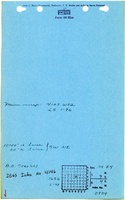
|Source Map= | |Source Map=State archive, IL_1507_01 | ||
|Map Date=3-22-1961 | |Map Date=3-22-1961 | ||
|Original Scale=1:1200 | |Original Scale=1:1200 | ||
|Digitized Scale=1: | |Digitized Scale=1:1200 | ||
|Map Type=Final | |Map Type=Final | ||
}} | }} | ||
| Line 78: | Line 74: | ||
}} | }} | ||
{{Annotated bibliography | {{Annotated bibliography | ||
|bibliography= | |bibliography=State archive map, IL_1507_01 - Slope location, mine outline, mining method. | ||
}} | }} | ||
==Mine Notes== | ==Mine Notes== | ||
Latest revision as of 14:15, June 27, 2023
Mine Index Number: 4146
| Company Name: | Amos O. Strobel | ||
|---|---|---|---|
| Mine Name: | Strobel Mine | ||
| Start Date: | 1935 | End Date: | 1943 |
| Type of Mine: | Underground | ||
| Total acres shown: | 20 | ||
| Acres after map date: | General Area of mining acres shown: | ||
Shaft, Slope, Drift or Tipple Location(s)
| Type | County | Township-Range | Section | Part Section |
|---|
| Main slope | Williamson | 9S 4E | 34 | SW SW NE |
Geology
| Thickness (ft) | |||||
|---|---|---|---|---|---|
| Seam | Depth (ft) | Min | Max | Ave | Mining Method |
| Springfield | 65 | 4.33 | MRP |
Geological Problems Reported
Production
| Company | Mine Name | Date | Production (tons) |
| Amos O. Strobel | Strobel | 1935-1943 | 43,205 |
| Total Production: 43,205 | |||
Production Notes
Coal Report production (if available)
Sources of Data
| Source Map | Map Date | Original Scale | Digitized Scale | Map Type |
| State archive, IL_1507_01 | 3-22-1961 | 1:1200 | 1:1200 | Final |
Annotated Bibliography (Data source - brief description of information)
| Coal Reports - Production, ownership, years of operation. |
| Directory of Illinois Coal Mines (Williamson County) - Mine names, mine index, ownership, years of operation. |
| Mine notes (Williamson County) - Mine type, slope location, seam, depth, thickness. |
| State archive map, IL_1507_01 - Slope location, mine outline, mining method. |
Mine Notes
Mine Images
![[[:Strobel|Strobel]]](https://go.illinois.edu/ILMImages/williamson/thumbnails/m4146_m4147_il_1507_01_th.jpg)
Photographs