Crab Orchard Quadrangle
Mining in the Crab Orchard Quadrangle
Most of the mining in the Crab Orchard Quadrangle occurred in the Herrin and Springfield Coals, but some small mines and large surface mines also mined the Houchin Creek, Dekoven and Davis Coals that are near the surface south of the Herrin and Springfield outcrops. Two small mines also mined the Mt. Rorah Coal in the southern half of the quadrangle. In the northern part of the quadrangle, some Danville Coal was locally mined.
The Herrin Coal was generally mined from the surface, except near the very northernmost part of the quadrangle, where the coal was deep enough to have sufficient roof for safe underground mining. The Herrin was generally from 5 to 6 feet thick, but locally ranged up to 8 feet. The Springfield Coal was slightly thinner over this quadrangle, generally from 4 to 5 feet thick, but was present over a greater area. Because of the thin coal, mines in the Springfield Coal were smaller here than the large mines to the northwest in the Johnston City Quadrangle.
Map and Directory PDF Download
Coal Mines In Illinois Crab Orchard Quadrangle
Mines that Appear on the Crab Orchard Quadrangle
Unlocated Mines
Williamson County
Pages in category "Crab Orchard Quadrangle"
The following 200 pages are in this category, out of 279 total.
(previous page) (next page)1
- 1013
- 199010
- 199017
- 199018
- 199019a
- 199019b
- 199020
- 199022
- 199023
- 199024a
- 199024b
- 199027
- 199028a
- 199028b
- 199033
- 199047
- 199050
- 199051
- 199052
- 199053
- 199054
- 199055
- 199056
- 199057
- 199058
- 199059b
- 199060
- 199062
- 199063
- 199064
- 199067
- 199068
- 199071
- 199074
- 199075
- 199092a
- 199092b
- 199103
- 199117
- 199120
- 199132
- 199139
- 199162
- 199164
- 199185
- 199200
- 199201
- 199207
- 199217
- 199230
- 199241
- 199262
4
- 4041
- 4064
- 4065
- 4066
- 4067
- 4068
- 4069
- 4070
- 4071
- 4072
- 4073
- 4074
- 4075
- 4076
- 4077
- 4078
- 4079
- 4080
- 4081
- 4083
- 4084
- 4085
- 4086
- 4089
- 4090
- 4091
- 4092
- 4093
- 4094
- 4095
- 4096
- 4097
- 4098
- 4104
- 4106
- 4107
- 4109
- 4110
- 4111
- 4112
- 4113
- 4114
- 4115
- 4116
- 4117
- 4118
- 4119
- 4120
- 4121
- 4122
- 4123
- 4124
- 4125
- 4126
- 4128
- 4129
- 4130
- 4131
- 4132
- 4133
- 4134
- 4135
- 4136
- 4137
- 4138
- 4140
- 4141
- 4146
- 4147
- 4148
- 4154
- 4159
- 4160
- 4439
- 4446
- 4450
- 4452
- 4453
- 4454
- 4455
- 4456
- 4457
- 4458
- 4459
- 4460
- 4461
- 4462
- 4464
- 4465
- 4466
- 4467
- 4468
- 4470
- 4471
- 4472
- 4473
- 4474
- 4475
- 4486
- 4487
- 4488
- 4490
- 4504
- 4506
- 4511
- 4514
- 4531
- 4532
- 4535
- 4561
9
Media in category "Crab Orchard Quadrangle"
The following 130 files are in this category, out of 130 total.
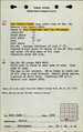
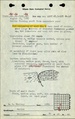
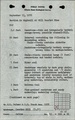 M0697 fieldnotes Saline.pdf 750 × 1,200, 3 pages; 619 KB
 M0697 fieldnotes Williamson.pdf 747 × 1,197, 6 pages; 831 KB
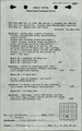
 M0697 minenotes Saline.pdf 718 × 1,160, 5 pages; 699 KB
 M0697 minenotes Williamson.pdf 727 × 1,166, 73 pages; 19.23 MB
 M0700 minenotes.pdf 725 × 1,160, 3 pages; 578 KB
 M0702 minenotes.pdf 725 × 1,156, 126 pages; 33.42 MB
 M0819 minenotes.pdf 725 × 1,160, 5 pages; 826 KB
 M0822 minenotes.pdf 725 × 1,160, 4 pages; 677 KB
 M0949 minenotes.pdf 725 × 1,160, 12 pages; 1.5 MB
 M0987 minenotes.pdf 725 × 1,160, 14 pages; 2.56 MB
 M0988 minenotes.pdf 725 × 1,160, 10 pages; 1.62 MB
 M1013 minenotes.pdf 758 × 1,283, 2 pages; 384 KB
 M3590 fieldnotes.pdf 752 × 1,195; 175 KB
 M3730 minenotes.pdf 739 × 1,187, 3 pages; 760 KB
 M4064 minenotes.pdf 725 × 1,160, 4 pages; 839 KB
 M4065 minenotes.pdf 725 × 1,160, 8 pages; 1.42 MB
 M4066 minenotes.pdf 725 × 1,160, 7 pages; 1.28 MB
 M4067 minenotes.pdf 725 × 1,160, 8 pages; 1.5 MB
 M4068 minenotes.pdf 725 × 1,160, 3 pages; 594 KB
 M4069 minenotes.pdf 725 × 1,160, 6 pages; 1.11 MB
 M4070 minenotes.pdf 725 × 1,160, 3 pages; 494 KB
 M4071 minenotes.pdf 725 × 1,160, 5 pages; 901 KB
 M4072 minenotes.pdf 725 × 1,160, 6 pages; 1.2 MB
 M4073 minenotes.pdf 725 × 1,160, 5 pages; 964 KB
 M4074 minenotes.pdf 725 × 1,160, 4 pages; 705 KB
 M4075 minenotes.pdf 725 × 1,160, 4 pages; 685 KB
 M4076 minenotes.pdf 725 × 1,160, 3 pages; 584 KB
 M4077 minenotes.pdf 725 × 1,160, 2 pages; 264 KB
 M4078 minenotes.pdf 725 × 1,160, 3 pages; 503 KB
 M4079 minenotes.pdf 725 × 1,160, 2 pages; 336 KB
 M4080 minenotes.pdf 725 × 1,160, 3 pages; 476 KB
 M4081 minenotes.pdf 725 × 1,160, 3 pages; 615 KB
 M4083 minenotes.pdf 725 × 1,160, 6 pages; 1.17 MB
 M4084 minenotes.pdf 725 × 1,160, 3 pages; 535 KB
 M4085 minenotes.pdf 725 × 1,156, 3 pages; 572 KB
 M4086 minenotes.pdf 725 × 1,160, 4 pages; 720 KB
 M4089 minenotes.pdf 725 × 1,160, 11 pages; 2.35 MB
 M4090 minenotes.pdf 725 × 1,160, 3 pages; 420 KB
 M4091 minenotes.pdf 725 × 1,160, 2 pages; 255 KB
 M4092 minenotes.pdf 725 × 1,160, 2 pages; 252 KB
 M4093 minenotes.pdf 725 × 1,160, 7 pages; 1.1 MB
 M4094 minenotes.pdf 725 × 1,160, 5 pages; 799 KB
 M4095 minenotes.pdf 725 × 1,160, 4 pages; 614 KB
 M4096 fieldnotes.pdf 750 × 1,200, 2 pages; 368 KB
 M4096 minenotes.pdf 725 × 1,160, 8 pages; 4.37 MB
 M4097 minenotes.pdf 725 × 1,160, 3 pages; 401 KB
 M4098 minenotes.pdf 725 × 1,160, 4 pages; 595 KB
 M4104 minenotes.pdf 725 × 1,160, 5 pages; 815 KB
 M4106 minenotes.pdf 725 × 1,160, 6 pages; 977 KB
 M4107 minenotes.pdf 725 × 1,156, 6 pages; 1.18 MB
 M4109 minenotes.pdf 725 × 1,156, 3 pages; 479 KB
 M4111 minenotes.pdf 725 × 1,156, 3 pages; 470 KB
 M4112 minenotes.pdf 725 × 1,156, 3 pages; 473 KB
 M4113 minenotes.pdf 725 × 1,156, 8 pages; 1.45 MB
 M4114 minenotes.pdf 725 × 1,156, 3 pages; 477 KB
 M4115 minenotes.pdf 725 × 1,156, 3 pages; 508 KB
 M4116 minenotes.pdf 725 × 1,156, 4 pages; 802 KB
 M4117 minenotes.pdf 725 × 1,156, 3 pages; 492 KB
 M4118 minenotes.pdf 725 × 1,156, 3 pages; 509 KB
 M4119 minenotes.pdf 725 × 1,156, 9 pages; 1.44 MB
 M4120 minenotes.pdf 725 × 1,156, 2 pages; 352 KB
 M4121 fieldnotes.pdf 752 × 1,197; 193 KB
 M4121 minenotes.pdf 725 × 1,156, 3 pages; 551 KB
 M4122 minenotes.pdf 725 × 1,156, 4 pages; 677 KB
 M4123 minenotes.pdf 725 × 1,156, 3 pages; 432 KB
 M4124 minenotes.pdf 725 × 1,156, 4 pages; 730 KB
 M4125 minenotes.pdf 725 × 1,156, 3 pages; 589 KB
 M4126 fieldnotes.pdf 752 × 1,197; 193 KB
 M4126 minenotes.pdf 725 × 1,156, 3 pages; 564 KB
 M4128 fieldnotes.pdf 752 × 1,197; 193 KB
 M4128 minenotes.pdf 725 × 1,156, 3 pages; 480 KB
 M4129 minenotes.pdf 725 × 1,156, 4 pages; 747 KB
 M4130 minenotes.pdf 725 × 1,156, 4 pages; 713 KB
 M4131 minenotes.pdf 725 × 1,156, 3 pages; 520 KB
 M4132 minenotes.pdf 725 × 1,156, 6 pages; 5.55 MB
 M4133 minenotes.pdf 725 × 1,156, 5 pages; 861 KB
 M4134 minenotes.pdf 725 × 1,156, 3 pages; 607 KB
 M4135 minenotes.pdf 725 × 1,156, 2 pages; 291 KB
 M4136 minenotes.pdf 725 × 1,156, 2 pages; 378 KB
 M4137 minenotes.pdf 725 × 1,156, 5 pages; 860 KB
 M4138 minenotes.pdf 725 × 1,156, 3 pages; 467 KB
 M4140 minenotes.pdf 725 × 1,156, 2 pages; 340 KB
 M4141 minenotes.pdf 725 × 1,156, 3 pages; 480 KB
 M4146 minenotes.pdf 756 × 1,208, 4 pages; 1.87 MB
 M4147 minenotes.pdf 756 × 1,208, 3 pages; 1.61 MB
 M4148 minenotes.pdf 756 × 1,208, 4 pages; 1.6 MB
 M4154 minenotes.pdf 758 × 1,210, 2 pages; 1.04 MB
 M4159 minenotes.pdf 756 × 1,208, 4 pages; 1.82 MB
 M4160 fieldnotes.pdf 752 × 1,189; 208 KB
 M4160 minenotes.pdf 756 × 1,208, 4 pages; 1.79 MB
 M4446 minenotes.pdf 758 × 1,210, 3 pages; 1.09 MB
 M4450 minenotes.pdf 758 × 1,210, 3 pages; 1.03 MB
 M4452 minenotes.pdf 758 × 1,210, 3 pages; 1.04 MB
 M4453 minenotes.pdf 758 × 1,210, 3 pages; 1.03 MB
 M4454 minenotes.pdf 758 × 1,210, 8 pages; 3.73 MB
 M4455 minenotes.pdf 758 × 1,210, 3 pages; 1.03 MB
 M4456 minenotes.pdf 758 × 1,210, 3 pages; 1.04 MB
 M4457 minenotes.pdf 758 × 1,210, 3 pages; 1.04 MB
 M4458 fieldnotes.pdf 760 × 1,204; 236 KB
 M4458 minenotes.pdf 758 × 1,210, 2 pages; 777 KB
 M4459 fieldnotes.pdf 747 × 1,189, 2 pages; 329 KB
 M4459 minenotes.pdf 758 × 1,210, 3 pages; 1.02 MB
 M4460 minenotes.pdf 758 × 1,210, 3 pages; 1.04 MB
 M4461 minenotes.pdf 758 × 1,210, 3 pages; 1.03 MB
 M4462 minenotes.pdf 758 × 1,210, 3 pages; 1.02 MB
 M4464 minenotes.pdf 758 × 1,210, 3 pages; 1.08 MB
 M4465 minenotes.pdf 758 × 1,210, 3 pages; 1.51 MB
 M4466 minenotes.pdf 758 × 1,210, 3 pages; 1.48 MB
 M4467 fieldnotes.pdf 747 × 1,197; 172 KB
 M4467 minenotes.pdf 758 × 1,210, 3 pages; 1.48 MB
 M4468 minenotes.pdf 758 × 1,210, 3 pages; 1.48 MB
 M4470 minenotes.pdf 758 × 1,210, 3 pages; 1.02 MB
 M4471 minenotes.pdf 758 × 1,210, 3 pages; 1.04 MB
 M4472 minenotes.pdf 758 × 1,210, 3 pages; 1.03 MB
 M4473 minenotes.pdf 758 × 1,210, 3 pages; 1.03 MB
 M4475 minenotes.pdf 756 × 1,208, 3 pages; 1,009 KB
 M4488 fieldnotes.pdf 750 × 1,200; 123 KB
 M4490 fieldnotes.pdf 754 × 1,191, 2 pages; 384 KB
 M4490 minenotes.pdf 756 × 1,208, 2 pages; 1.01 MB
 M4504 fieldnotes.pdf 745 × 1,195; 151 KB
 M4511 fieldnotes.pdf 747 × 1,187; 248 KB
 M4514 minenotes.pdf 758 × 1,210, 3 pages; 1.14 MB
 M4531 minenotes.pdf 758 × 1,210, 4 pages; 2.09 MB
 M4532 minenotes.pdf 756 × 1,208, 3 pages; 1.12 MB
 M4535 minenotes.pdf 758 × 1,210, 4 pages; 1.4 MB
 M4561 minenotes.pdf 758 × 1,210, 5 pages; 2.48 MB
 M6551 minenotes.pdf 758 × 1,210, 4 pages; 1.52 MB
 M6804 minenotes.pdf 725 × 1,156, 3 pages; 557 KB
 M6811 fieldnotes.pdf 747 × 1,187; 231 KB
 M6812 fieldnotes.pdf 747 × 1,187, 2 pages; 299 KB