Mine Index Number: 4119
| Company Name:
|
Big Three Coal Company
|
| Mine Name:
|
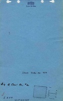
Big Three No. 2 Mine
|
| Start Date:
|
1957
|
End Date:
|
October 1962
|
| Type of Mine:
|
Surface
|
| Total acres shown:
|
None
|
| Production Indicated Acres:
|
12
|
General Area of mining acres shown:
|
|
|
The mine location is in a much larger pit that was probably enlarged by later operators.
|
Shaft, Slope, Drift or Tipple Location(s)
| Type
|
County
|
Township-Range
|
Section
|
Part Section
|
| Tipple / pit
|
Williamson
|
9S 4E
|
30
|
NW NE
|
Geology
| Herrin
|
20-50
|
|
|
4.33-5.75
|
Surface
|
Geological Problems Reported
Production
| Company
|
Mine Name
|
Date
|
Production (tons)
|
Production Notes
Coal Report production (if available)
Sources of Data
| Mine notes
|
Undated
|
(text only)
|
1:24000 Point plotted onto 1:24,000 USGS quadrangle and digitized.
|
Secondary source
|
| USGS topographic map
|
1965, PR 1990
|
1:24000
|
1:24000
|
Secondary source
|
| Department of Mines & Minerals
|
Undated
|
|
|
Secondary source
|
Annotated Bibliography (Data source - brief description of information)
| Coal Reports - Production, ownership, years of operation, seam, depth, thickness.
|
| Directory of Illinois Coal Mines (Williamson County) - Mine names, mine index, ownership, years of operation.
|
| Mine notes (Williamson County) - Mine type, mine location.
|
| USGS topographic map, Crab Orchard Quadrangle, 1965, photorevised 1990 - Mine outline.
|
| Department of Mines & Minerals, 7a-02-13, 7a-02-14 & 7a-02-15, aerial photographic base with surface mines identified - Mine outline.
|
Mine Notes
Mine Images
 These files may not be true to scale and are not georgistered. These files may not be true to scale and are not georgistered.
|
Map Type:
|
Department of Mines & Minerals
|
| Map ID:
|
7a-02-15
|
| Company:
|
|
| Mine Name:
|
|
| Caption:
|
|
| Map Date:
|
Undated
|
| Map Status:
|
Secondary
|
| Image Credit:
|
|
| Note:
|
|
| More Info:
|
7a-02-15 geo
|
| Full Res Download:These files are true to scale and most are georegistered for gis software. These files may be a very large (>1GB) download!
|
https://go.illinois.edu/ILMImages/williamson/7a-02-15 geo.zip
|
 These files may not be true to scale and are not georgistered. These files may not be true to scale and are not georgistered.
|
Map Type:
|
Department of Mines & Minerals
|
| Map ID:
|
7a-02-14
|
| Company:
|
|
| Mine Name:
|
|
| Caption:
|
|
| Map Date:
|
Undated
|
| Map Status:
|
Secondary
|
| Image Credit:
|
|
| Note:
|
|
| More Info:
|
7a-02-14 geo
|
| Full Res Download:These files are true to scale and most are georegistered for gis software. These files may be a very large (>1GB) download!
|
https://go.illinois.edu/ILMImages/williamson/7a-02-14 geo.zip
|
 These files may not be true to scale and are not georgistered. These files may not be true to scale and are not georgistered.
|
Map Type:
|
Department of Mines & Minerals
|
| Map ID:
|
7a-02-13
|
| Company:
|
|
| Mine Name:
|
|
| Caption:
|
|
| Map Date:
|
Undated
|
| Map Status:
|
Secondary
|
| Image Credit:
|
|
| Note:
|
|
| More Info:
|
7a-02-13 geo
|
| Full Res Download:These files are true to scale and most are georegistered for gis software. These files may be a very large (>1GB) download!
|
https://go.illinois.edu/ILMImages/williamson/7a-02-13 geo.zip
|
Photographs