Mine Index Number: 4041
| Company Name:
|
Peabody Coal Company
|
| Mine Name:
|
Utility Mine
|
| Start Date:
|
1958
|
End Date:
|
February 1966
|
| Type of Mine:
|
Surface
|
| Total acres shown:
|
474
|
| Production Indicated Acres:
|
200
|
General Area of mining acres shown:
|
|
|
The remainder of the area was mined by smaller unaffiliated mines.
|
Shaft, Slope, Drift or Tipple Location(s)
| Type
|
County
|
Township-Range
|
Section
|
Part Section
|
| Tipple
|
Williamson
|
9S 3E
|
4
|
SE SW SE
|
| Pits
|
Williamson
|
9S 3E
|
8,9,10,11, 12, 13, 14
|
|
Geology
| Herrin
|
20-57
|
|
|
5.67-8.0
|
Surface
|
| Springfield
|
40-65
|
|
|
3.58
|
Surface
|
Geological Problems Reported
Production
| Company
|
Mine Name
|
Date
|
Production (tons)
|
|
|
|
|
|
| Total Production: 2,026,411
|
Production Notes
Coal Report production (if available)
Sources of Data
| Company, 4103.W52 i5.1-178
|
8-29-1969
|
1:2400
|
1:2400
|
Final
|
Annotated Bibliography (Data source - brief description of information)
| Coal Reports - Production, ownership, years of operation.
|
| Directory of Illinois Coal Mines (Williamson County) - Mine names, mine index, ownership, years of operation.
|
| Mine notes (Williamson County) - Mine type, tipple location.
|
| Company map, ISGS map library, 4103.W52 i5.1-178 - Mine outline.
|
Mine Notes
Mine Images
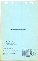
![[[:Utility|Utility]]](https://wikiimage.isgs.illinois.edu/ilmines/williamson/thumbnails/utility4_th.jpg) These files may not be true to scale and are not georgistered. These files may not be true to scale and are not georgistered.
|
Map Type:
|
Company
|
| Map ID:
|
4103.W52 i5.1-178
|
| Company:
|
Peabody Coal Company
|
| Mine Name:
|
Utility
|
| Caption:
|
|
| Map Date:
|
8-29-1969
|
| Map Status:
|
Final
|
| Image Credit:
|
|
| Note:
|
|
| More Info:
|
Utility4
|
| Full Res Download:These files are true to scale and most are georegistered for gis software. These files may be a very large (>1GB) download!
|
https://wikiimage.isgs.illinois.edu/ilmines/williamson/utility4.zip
|
![[[:Utility|Utility]]](https://wikiimage.isgs.illinois.edu/ilmines/williamson/thumbnails/utility3_th.jpg) These files may not be true to scale and are not georgistered. These files may not be true to scale and are not georgistered.
|
Map Type:
|
Company
|
| Map ID:
|
4103.W52 i5.1-178
|
| Company:
|
Peabody Coal Company
|
| Mine Name:
|
Utility
|
| Caption:
|
|
| Map Date:
|
8-29-1969
|
| Map Status:
|
Final
|
| Image Credit:
|
|
| Note:
|
|
| More Info:
|
Utility3
|
| Full Res Download:These files are true to scale and most are georegistered for gis software. These files may be a very large (>1GB) download!
|
https://wikiimage.isgs.illinois.edu/ilmines/williamson/utility3.zip
|
![[[:Utility|Utility]]](https://wikiimage.isgs.illinois.edu/ilmines/williamson/thumbnails/utility1_th.jpg) These files may not be true to scale and are not georgistered. These files may not be true to scale and are not georgistered.
|
Map Type:
|
Company
|
| Map ID:
|
4103.W52 i5.1-178
|
| Company:
|
Peabody Coal Company
|
| Mine Name:
|
Utility
|
| Caption:
|
|
| Map Date:
|
8-29-1969
|
| Map Status:
|
Final
|
| Image Credit:
|
|
| Note:
|
|
| More Info:
|
Utility1
|
| Full Res Download:These files are true to scale and most are georegistered for gis software. These files may be a very large (>1GB) download!
|
https://wikiimage.isgs.illinois.edu/ilmines/williamson/util1.zip
|
![[[:Utility|Utility]]](https://wikiimage.isgs.illinois.edu/ilmines/williamson/thumbnails/utility2_th.jpg) These files may not be true to scale and are not georgistered. These files may not be true to scale and are not georgistered.
|
Map Type:
|
Company
|
| Map ID:
|
4103.W52 i5.1-178
|
| Company:
|
Peabody Coal Company
|
| Mine Name:
|
Utility
|
| Caption:
|
|
| Map Date:
|
8-29-1969
|
| Map Status:
|
Final
|
| Image Credit:
|
|
| Note:
|
|
| More Info:
|
Util2
|
| Full Res Download:These files are true to scale and most are georegistered for gis software. These files may be a very large (>1GB) download!
|
https://wikiimage.isgs.illinois.edu/ilmines/williamson/util2.zip
|
Photographs