Marion Quadrangle
Mining in the Marion Quadrangle
The outcrops of the Herrin and Springfield Coals are very close in the northern part of the Marion Quadrangle, which allowed both seams to be surface-mined. Since both coals were shallow, this enabled many small operators to mine one or both seams. The Herrin Coal is the thicker of the two, reportedly up to 9 feet thick, but more generally around 6 feet. The Springfield Coal ranged between 5 and 6 feet thick.
In the southern part of the Marion Quadrangle, a thin coal correlatable to the Tartar Coal of western Illinois (or Coal 4a of western Kentucky) was drift mined in the many gullies. The names and operating dates of few of these mines are known, but most were quite small in extent. This coal ranged between 3 and 4 feet thick.
Map and Directory PDF Download
Coal Mines In Illinois Marion Quadrangle
Mines that Appear on the Marion Quadrangle
Unlocated Mines
Williamson County
Pages in category "Marion Quadrangle"
The following 200 pages are in this category, out of 212 total.
(previous page) (next page)1
- FileList:1-17-13b
- 199002a
- 199002b
- 199004
- 199006
- 199006b
- 199009
- 199011a
- 199011b
- 199012
- 199015
- 199019a
- 199019b
- 199020
- 199021
- 199022
- 199023
- 199024a
- 199024b
- 199026
- 199030
- 199032
- 199037
- 199039
- 199040
- 199045
- 199048
- 199049a
- 199049b
- 199049c
- 199058
- 199059
- 199060
- 199062
- 199064
- 199065
- 199066
- 199075
- 199076
- 199078
- 199082
- 199083
- 199086
- 199087a
- 199087b
- 199088
- 199089
- 199091
- 199092a
- 199092b
- 199096
- 199097
- 199098b
- 199098c
- 199099
- 199102
- 199103
- 199104
- 199105
- 199108
- 199113
- 199115
- 199117
- 199119
- 199121
- 199122
- 199123
- 199126a
- 199126b
- 199127
- 199128
- 199129
- 199130
- 199131
- 199132
- 199133
- 199135
- 199136
- 199137
- 199138
- 199139
- 199141
- 199142
- 199144a
- 199146
- 199147
- 199148
- 199149
- 199152
- 199154
- 199158a
- 199158b
- 199160
- 199161
- 199162
- 199164
- 199166
- 199168
- 199169
- 199170
- 199171
- 199172
- 199173
- 199175
- 199175b
- 199177
- 199179a
- 199179b
- 199180
- 199182b
- 199185
- 199186
- 199192
- 199193
- 199194
- 199195
- 199196
- 199198
- 199199
- 199200
- 199201
- 199203
- 199205a
- 199205b
- 199207
- 199211
- 199212
- 199214
- 199215
- 199216
- 199217
- 199220
- 199223
- 199224
- 199225
- 199226
- 199229
- 199234
- 199235
- 199238
- 199239
- 199241
- 199243
- 199244
- 199246
- 199248
- 199249
- 199251
- 199252
- 199254
- 199255
- 199256
- 199257
- 199258
- 199259
- 199260
- 199264
- 199265
- 1992763
- 1994115
- 1994265a
- 1994265b
4
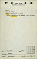
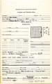
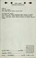
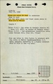
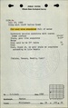
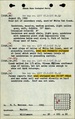
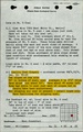
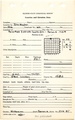
Media in category "Marion Quadrangle"
The following 21 files are in this category, out of 21 total.
 M0173 fieldnotes.pdf 766 × 1,202; 257 KB
 M0173 minenotes.pdf 725 × 1,160, 20 pages; 3.67 MB
 M3187 minenotes.pdf 727 × 1,166, 3 pages; 583 KB
 M4027 minenotes.pdf 727 × 1,166, 3 pages; 575 KB
 M4029 minenotes.pdf 727 × 1,166, 2 pages; 430 KB
 M4040 minenotes.pdf 727 × 1,166, 4 pages; 699 KB
 M4063 minenotes.pdf 727 × 1,166, 5 pages; 855 KB
 M4442 minenotes.pdf 756 × 1,210, 7 pages; 2.93 MB
 M4477 fieldnotes.pdf 750 × 1,197, 2 pages; 309 KB
 M4477 minenotes.pdf 756 × 1,208; 455 KB
 M4478 fieldnotes.pdf 747 × 1,197, 2 pages; 243 KB
 M4479 fieldnotes.pdf 752 × 1,197, 2 pages; 316 KB
 M4479 minenotes.pdf 756 × 1,208; 408 KB
 M4480 fieldnotes.pdf 750 × 1,195; 175 KB
 M4480 minenotes.pdf 756 × 1,208; 494 KB
 M4481 fieldnotes.pdf 747 × 1,187; 213 KB
 M4483 fieldnotes.pdf 752 × 1,197; 152 KB
 M4528 fieldnotes.pdf 747 × 1,187; 237 KB
 M4533 fieldnotes.pdf 750 × 1,197; 202 KB
 M4654 minenotes.pdf 756 × 1,208; 454 KB
 M6794 minenotes.pdf 758 × 1,210, 3 pages; 1.15 MB