Mine Index Number: 0949
| Company Name:
|
Jader Fuel Company
|
| Mine Name:
|
Jader No. 2 Mine
|
| Start Date:
|
1973
|
End Date:
|
August 1980
|
| Type of Mine:
|
Surface
|
| Total acres shown:
|
72
|
| Acres after map date:
|
|
General Area of mining acres shown:
|
|
|
|
Shaft, Slope, Drift or Tipple Location(s)
| Type
|
County
|
Township-Range
|
Section
|
Part Section
|
| Tipple / pit
|
Williamson
|
9S 4E
|
20
|
NW NE SW
|
Geology
| Herrin
|
35-50
|
|
|
5.0-5.83
|
Surface
|
Geological Problems Reported
Pods and lenses of Energy Shale were present above the coal. One lens was over 100 feet long. Rolls were present in the seam, as well as some concretions (near the base of the seam).
Production
| Company
|
Mine Name
|
Date
|
Production (tons)
|
|
|
|
|
|
| Total Production: 486,396
|
Production Notes
Coal Report production (if available)
Sources of Data
| Company, Coal Section files
|
6-15-1983
|
1:7920
|
1:7920
|
Final
|
| Department of Mines & Minerals
|
Undated
|
|
|
Secondary source
|
Annotated Bibliography (Data source - brief description of information)
| Coal Reports - Production, ownership, years of operation, depth, thickness.
|
| Directory of Illinois Coal Mines (Williamson County) - Mine names, mine index, ownership, years of operation.
|
| Mine notes (Williamson County) - Mine type, mine location, seam, geologic problems.
|
| Company map, Coal Section files - Mine outline, mining method.
|
| Department of Mines & Minerals, 7a-02-13, aerial photograph base map with surface mines identified - Mine outline.
|
Mine Notes
Mine Images
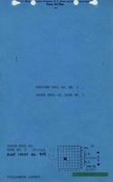
![[[:Jader Fuel No. 2|Jader Fuel No. 2]]](https://wikiimage.isgs.illinois.edu/ilmines/williamson/thumbnails/m0949_th.jpg) These files may not be true to scale and are not georgistered. These files may not be true to scale and are not georgistered.
|
Map Type:
|
Company
|
| Map ID:
|
|
| Company:
|
Jader Fuel Company
|
| Mine Name:
|
Jader Fuel No. 2
|
| Caption:
|
|
| Map Date:
|
06-15-1983
|
| Map Status:
|
Final
|
| Image Credit:
|
|
| Note:
|
|
| More Info:
|
M0949
|
| Full Res Download:These files are true to scale and most are georegistered for gis software. These files may be a very large (>1GB) download!
|
https://wikiimage.isgs.illinois.edu/ilmines/williamson/m0949.zip
|
 These files may not be true to scale and are not georgistered. These files may not be true to scale and are not georgistered.
|
Map Type:
|
Department of Mines & Minerals
|
| Map ID:
|
7a-02-13
|
| Company:
|
|
| Mine Name:
|
|
| Caption:
|
|
| Map Date:
|
Undated
|
| Map Status:
|
Secondary
|
| Image Credit:
|
|
| Note:
|
|
| More Info:
|
7a-02-13 geo
|
| Full Res Download:These files are true to scale and most are georegistered for gis software. These files may be a very large (>1GB) download!
|
https://go.illinois.edu/ILMImages/williamson/7a-02-13 geo.zip
|
Photographs