Mine Index Number: 4137
| Company Name:
|
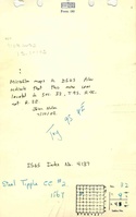
Steel Tipple Coal Company
|
| Mine Name:
|
Steel Tipple No. 2 Mine
|
| Start Date:
|
1934
|
End Date:
|
1946
|
| Type of Mine:
|
Underground
|
| Total acres shown:
|
7
|
| Acres after map date:
|
2
|
General Area of mining acres shown:
|
|
|
This mine was later partially surface mined by Producers No 2 Mine (mine index 3730).
|
Shaft, Slope, Drift or Tipple Location(s)
| Type
|
County
|
Township-Range
|
Section
|
Part Section
|
| Main slope
|
Williamson
|
9S 4E
|
32
|
NE SW NW
|
| Air shaft
|
Williamson
|
9S 4E
|
32
|
SW NE NW * Not shown on accompanying map due to later surface mining. Pulley No. 1 Mine was abandoned 8-1-1937. When the mine was re-opened, a new slope was constructed that entered an old room in the south part of the mine. The source maps for the No. 2 Mine do not show an air shaft, so the old slope may have been used for ventilation.
|
| No. 1 slope
|
Williamson
|
9S 4E
|
32
|
SW NE NW * Not shown on accompanying map due to later surface mining. Pulley No. 1 Mine was abandoned 8-1-1937. When the mine was re-opened, a new slope was constructed that entered an old room in the south part of the mine. The source maps for the No. 2 Mine do not show an air shaft, so the old slope may have been used for ventilation.
|
Geology
| Springfield
|
29
|
|
|
4.0-4.67
|
MRP
|
Geological Problems Reported
Production
| Company
|
Mine Name
|
Date
|
Production (tons)
|
Production Notes
Coal Report production (if available)
Sources of Data
| Microfilm, document 353129
|
11-29-1943
|
1:1200
|
1:1200
|
Not final
|
| Microfilm, document 353129
|
8-1-1937
|
1:1200
|
1:1366
|
Not final
|
Annotated Bibliography (Data source - brief description of information)
| Coal Reports - Production, ownership, years of operation.
|
| Directory of Illinois Coal Mines (Williamson County) - Mine names, mine index, ownership, years of operation.
|
| Mine notes (Williamson County) - Mine type, slope location, seam, depth, thickness.
|
| Microfilm map, document 353129, reel 03142, frame 2 - Slope locations, mine outline, mining method.
|
| Microfilm map, document 353129, reel 03142, frame 1 - Air shaft location.
|
Mine Notes
Mine Images
![[[:Pulley No. 2|Pulley No. 2]]](https://go.illinois.edu/ILMImages/williamson/thumbnails/m4137_th.jpg) These files may not be true to scale and are not georgistered. These files may not be true to scale and are not georgistered.
|
Map Type:
|
Microfilm
|
| Map ID:
|
353129 (Frame 2)
|
| Company:
|
Guy Pulley Coal Company
|
| Mine Name:
|
Pulley No. 2
|
| Caption:
|
|
| Map Date:
|
11-29-1943
|
| Map Status:
|
Not Final
|
| Image Credit:
|
|
| Note:
|
|
| More Info:
|
M4137
|
| Full Res Download:These files are true to scale and most are georegistered for gis software. These files may be a very large (>1GB) download!
|
https://go.illinois.edu/ILMImages/williamson/m4137.zip
|
![[[:Pulley No. 2|Pulley No. 2]]](https://go.illinois.edu/ILMImages/williamson/thumbnails/m4137b_th.jpg) These files may not be true to scale and are not georgistered. These files may not be true to scale and are not georgistered.
|
Map Type:
|
Microfilm
|
| Map ID:
|
353129 (Frame 1)
|
| Company:
|
|
| Mine Name:
|
Pulley No. 2
|
| Caption:
|
|
| Map Date:
|
08-17-1937
|
| Map Status:
|
Not Final
|
| Image Credit:
|
|
| Note:
|
|
| More Info:
|
M4137b
|
| Full Res Download:These files are true to scale and most are georegistered for gis software. These files may be a very large (>1GB) download!
|
https://go.illinois.edu/ILMImages/williamson/m4137b.zip
|
Photographs