6692: Difference between revisions
No edit summary |
No edit summary |
||
| (4 intermediate revisions by 3 users not shown) | |||
| Line 1: | Line 1: | ||
{{Sidebar Info Query}} | {{Sidebar Info Query}} | ||
{{Header | {{Header | ||
|checked= | |checked=Checked OK | ||
|unlocated=No | |unlocated=No | ||
|shown_on_map=Yes | |shown_on_map=Yes | ||
|reason_nsm=The area shown is the general vicinity of the mine. The known production of the mine would encompass about 2 acres and 10 acres was said to have been mined before 1882. | |||
|Mine-index=6692 | |Mine-index=6692 | ||
|Coal_co=D. W. Kelly | |Coal_co=D. W. Kelly | ||
|Mine Name Header=Sievers Mine | |Mine Name Header=Sievers Mine | ||
|mine_type=Underground | |mine_type=Underground | ||
|mined-out-area=24 | |mined-out-area=24 | ||
|indicated=No | |indicated=No | ||
|county1=Macoupin | |county1=Macoupin | ||
|quad1=Gillespie South | |quad1=Gillespie South | ||
|city1=Staunton | |||
|year-start=1876 | |year-start=1876 | ||
|year-end=1885 | |year-end=1885 | ||
|Latitude= | |Latitude=39.00214802 | ||
|Longitude= | |Longitude=-89.76933322 | ||
|Zoom=15 | |Zoom=15 | ||
}} | }} | ||
| Line 22: | Line 24: | ||
{{Shaft locations header}} | {{Shaft locations header}} | ||
{{Shaft locations | {{Shaft locations | ||
|shaft_type=Main shaft {{#info: | |shaft_type=Main shaft {{#info:No other shaft was constructed; the mine was idled due to lack of an escapement shaft in 1884 and never re-opened.|note}} | ||
|County=Macoupin | |County=Macoupin | ||
|Town-Range=7N 6W | |Town-Range=7N 6W | ||
| Line 35: | Line 37: | ||
|depth=220 | |depth=220 | ||
|thick-ave=5.5-6.5 | |thick-ave=5.5-6.5 | ||
|mining-method=RP | |||
}} | }} | ||
===Geological Problems Reported=== | ===Geological Problems Reported=== | ||
| Line 45: | Line 48: | ||
|Mine-Name=Sievers and Maxe | |Mine-Name=Sievers and Maxe | ||
|Date=1876-1880 | |Date=1876-1880 | ||
|Production=unknown {{#info: According to Staunton in Illinois, the shaft was sunk in 1876. Production prior to 1882 is unknown.|note}} | |Production=unknown {{#info: According to ''Staunton in Illinois'', the shaft was sunk in 1876. Production prior to 1882 is unknown.|note}} | ||
|Sum=No | |Sum=No | ||
}} | }} | ||
| Line 52: | Line 55: | ||
|Mine-Name=Sievers and Voge | |Mine-Name=Sievers and Voge | ||
|Date=1880-1881 | |Date=1880-1881 | ||
|Production=unknown {{#info: According to Staunton in Illinois, the shaft was sunk in 1876. Production prior to 1882 is unknown.|note}} | |Production=unknown {{#info: According to ''Staunton in Illinois'', the shaft was sunk in 1876. Production prior to 1882 is unknown.|note}} | ||
|Sum=No | |Sum=No | ||
}} | }} | ||
| Line 115: | Line 118: | ||
}} | }} | ||
{{Annotated bibliography | {{Annotated bibliography | ||
|bibliography=Atlas of Macoupin County and the State of Illinois, | |bibliography=Atlas of Macoupin County and the State of Illinois, 1875, Chicago: Warner and Beers, 89p. - Ownership. | ||
}} | }} | ||
{{Annotated bibliography | {{Annotated bibliography | ||
Latest revision as of 16:38, November 20, 2023
Mine Index Number: 6692
| Company Name: | D. W. Kelly | ||
|---|---|---|---|
| Mine Name: | Sievers Mine | ||
| Start Date: | 1876 | End Date: | 1885 |
| Type of Mine: | Underground | ||
| Total acres shown: | 24 | ||
| Acres after map date: | General Area of mining acres shown: | ||
|
The area shown is the general vicinity of the mine. The known production of the mine would encompass about 2 acres and 10 acres was said to have been mined before 1882. | |||
Shaft, Slope, Drift or Tipple Location(s)
| Type | County | Township-Range | Section | Part Section |
|---|
| Main shaft No other shaft was constructed; the mine was idled due to lack of an escapement shaft in 1884 and never re-opened. | Macoupin | 7N 6W | 33 | SW |
Geology
| Thickness (ft) | |||||
|---|---|---|---|---|---|
| Seam | Depth (ft) | Min | Max | Ave | Mining Method |
| Herrin | 220 | 5.5-6.5 | RP |
Geological Problems Reported
Production
| Company | Mine Name | Date | Production (tons) |
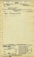
| August Sievers and Fred Maxe | Sievers and Maxe | 1876-1880 | unknown According to Staunton in Illinois, the shaft was sunk in 1876. Production prior to 1882 is unknown. |
| Sievers and Voge | Sievers and Voge | 1880-1881 | unknown According to Staunton in Illinois, the shaft was sunk in 1876. Production prior to 1882 is unknown. |
| August Sievers | Sievers | 1881-1882 | 2,404 |
| Richardson and Company | Sievers | 1882-1883 | 3,000 |
| D. W. Kelly | Sievers | 1883-1884 | 3,520 |
| Sievers | Sievers | 1884-1885 | none |
| Total Production: 8,924 | |||
Production Notes
Coal Report production (if available)
Sources of Data
| Source Map | Map Date | Original Scale | Digitized Scale | Map Type |
| Atlas of Macoupin County | 1875 | 1:46933 | 1:46933 The atlas showed the land ownership; a general area of mining was constructed around the area likely to be mined. | Secondary source |
| Staunton in Illinois | 1988 | (text only) | 1:24000 The atlas showed the land ownership; a general area of mining was constructed around the area likely to be mined. | Secondary source |
Annotated Bibliography (Data source - brief description of information)
| Coal Reports - Production, ownership, years of operation, mine type, depth, thickness, mining method. |
| Directory of Illinois Coal Mines (Macoupin County) - Mine names, mine index, ownership, years of operation. |
| Atlas of Macoupin County and the State of Illinois, 1875, Chicago: Warner and Beers, 89p. - Ownership. |
| Kilduff, Mary Dorrell, 1988, Staunton in Illinois, 273 p. - Ownership prior to 1882, years of operation, location. |
Mine Notes
Mine Images
Photographs