4145: Difference between revisions
No edit summary |
No edit summary |
||
| (One intermediate revision by one other user not shown) | |||
| Line 4: | Line 4: | ||
|unlocated=No | |unlocated=No | ||
|shown_on_map=Yes | |shown_on_map=Yes | ||
|reason_nsm=This mine connected underground to Helm Mine No. 3 (mine index [[4149]]). | |||
|Mine-index=4145 | |Mine-index=4145 | ||
|Coal_co=Towery Brothers | |Coal_co=Towery Brothers | ||
|Mine Name Header=Towery Mine | |Mine Name Header=Towery Mine | ||
|mine_type=Underground | |mine_type=Underground | ||
|mined-out-area=1 | |mined-out-area=1 | ||
|after_map=Less than 1 | |after_map=Less than 1 | ||
|indicated=No | |||
|county1=Williamson | |county1=Williamson | ||
|quad1=Carrier Mills | |quad1=Carrier Mills | ||
|city1=Marion | |||
|year-start=1935 | |year-start=1935 | ||
|year-end=1938 | |year-end=1938 | ||
|Latitude= | |Latitude=37.68844971 | ||
|Longitude= | |Longitude=-88.74031115 | ||
|Zoom=15 | |Zoom=15 | ||
}} | }} | ||
| Line 54: | Line 57: | ||
|Date=1935-1936 | |Date=1935-1936 | ||
|Production=1,742 | |Production=1,742 | ||
|Sum=No | |||
}} | }} | ||
{{Production | {{Production | ||
| Line 60: | Line 64: | ||
|Date=1936-1937 | |Date=1936-1937 | ||
|Production=740 {{#info: Production after map date|note}} | |Production=740 {{#info: Production after map date|note}} | ||
|Sum=No | |||
}} | }} | ||
{{Production | {{Production | ||
| Line 66: | Line 71: | ||
|Date=1937-1938 | |Date=1937-1938 | ||
|Production=1,485 {{#info: Production after map date|note}} | |Production=1,485 {{#info: Production after map date|note}} | ||
|Sum=No | |||
| | |||
}} | }} | ||
{{Production | {{Production | ||
|Production=3,967 | |Production=3,967 | ||
|Sum=Yes | |||
}} | }} | ||
===Production Notes=== | ===Production Notes=== | ||
Latest revision as of 11:33, March 13, 2024
Mine Index Number: 4145
| Company Name: | Towery Brothers | ||
|---|---|---|---|
| Mine Name: | Towery Mine | ||
| Start Date: | 1935 | End Date: | 1938 |
| Type of Mine: | Underground | ||
| Total acres shown: | 1 | ||
| Acres after map date: | Less than 1 | General Area of mining acres shown: | |
|
This mine connected underground to Helm Mine No. 3 (mine index 4149). | |||
Shaft, Slope, Drift or Tipple Location(s)
| Type | County | Township-Range | Section | Part Section |
|---|
| Main slope | Williamson | 9S 4E | 35 | SE SW SW |
| Air shaft | Williamson | 9S 4E | 35 | SE SW SW |
Geology
| Thickness (ft) | |||||
|---|---|---|---|---|---|
| Seam | Depth (ft) | Min | Max | Ave | Mining Method |
| Springfield | 20 | 4.33 | MRP |
Geological Problems Reported
Production
| Company | Mine Name | Date | Production (tons) |
| Prosperity Coal Company | Prosperity | 1935-1936 | 1,742 |
| Prosperity Coal Company | Prosperity | 1936-1937 | 740 Production after map date |
| Towery Brothers | Towery | 1937-1938 | 1,485 Production after map date |
| Total Production: 3,967 | |||
Production Notes
Coal Report production (if available)
Sources of Data
| Source Map | Map Date | Original Scale | Digitized Scale | Map Type |
| Company, 4103.W52 i5.1-37 | 7-1-1936 | 1:1200 | 1:1200 | Not final |
Annotated Bibliography (Data source - brief description of information)
| Coal Reports - Production, ownership, years of operation. |
| Directory of Illinois Coal Mines (Williamson County) - Mine names, mine index, ownership, years of operation. |
| Mine notes (Williamson County) - Mine type, slope location, seam, depth, thickness. |
| Company map, ISGS map library, 4103.W52 i5.1-37 - Slope and shaft location, mine outline, mining method. |
Mine Notes
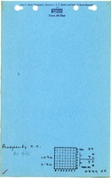
Mine Images
![[[:Prosperity|Prosperity]]](https://go.illinois.edu/ILMImages/williamson/thumbnails/m4145_th.jpg)
Photographs